


Tuesday 8 September 2020
| Distance (km) | 13 kms | |||
| Distance (time) | 7 hrs | |||
| Climb / Descent | 940 / 810m | |||
| Hard / Soft surface | 30% / 70% | |||
| Landscape |
|
|||
| Weather |
|
|||
|
|
||||
|
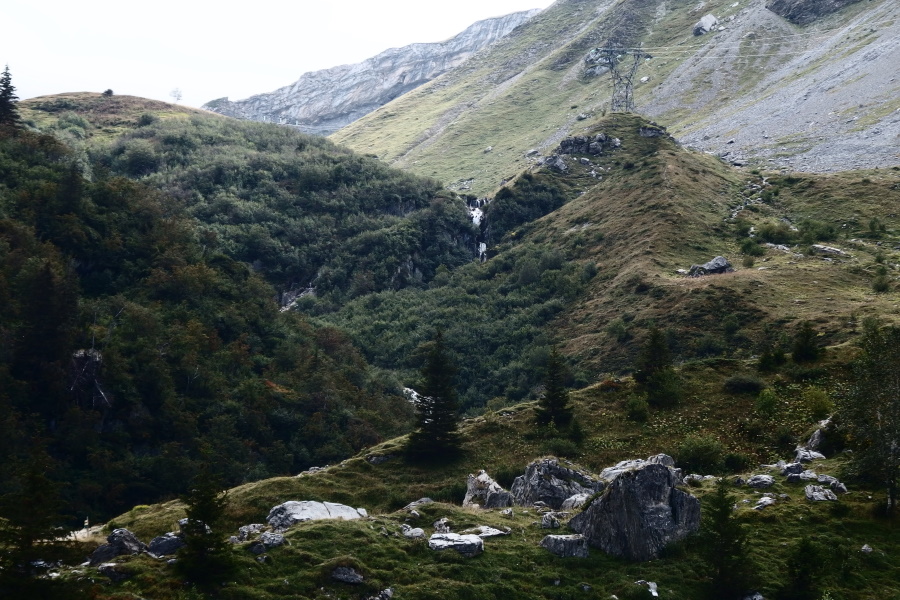
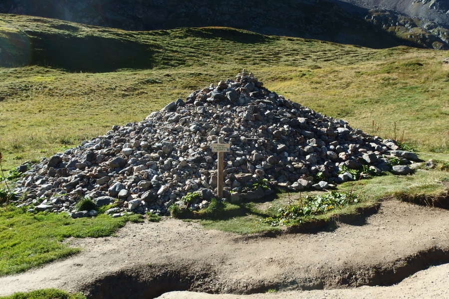
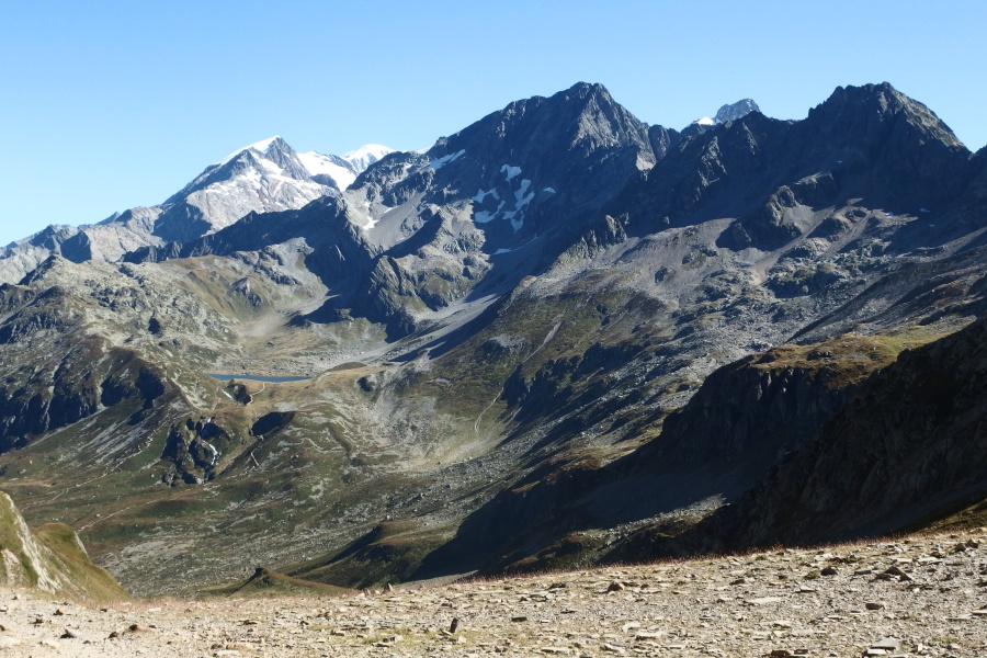
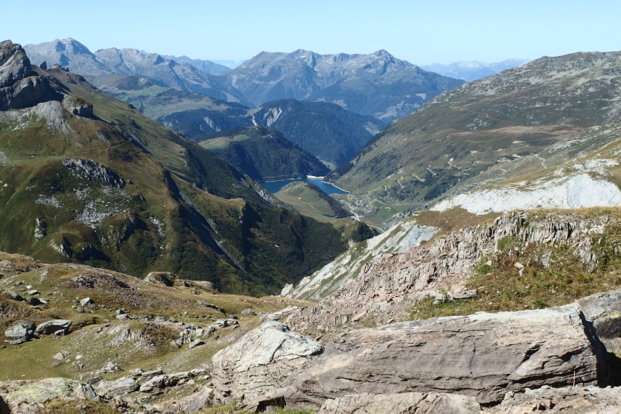
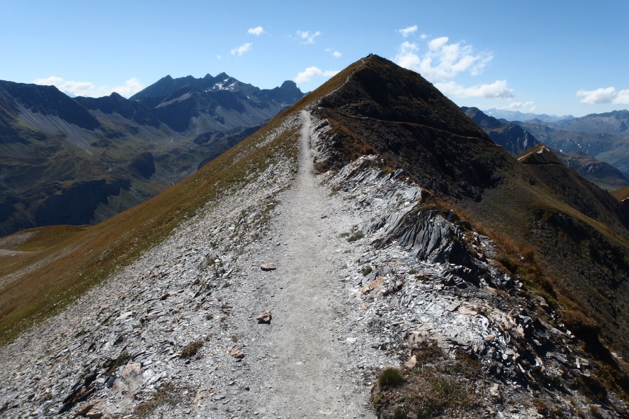
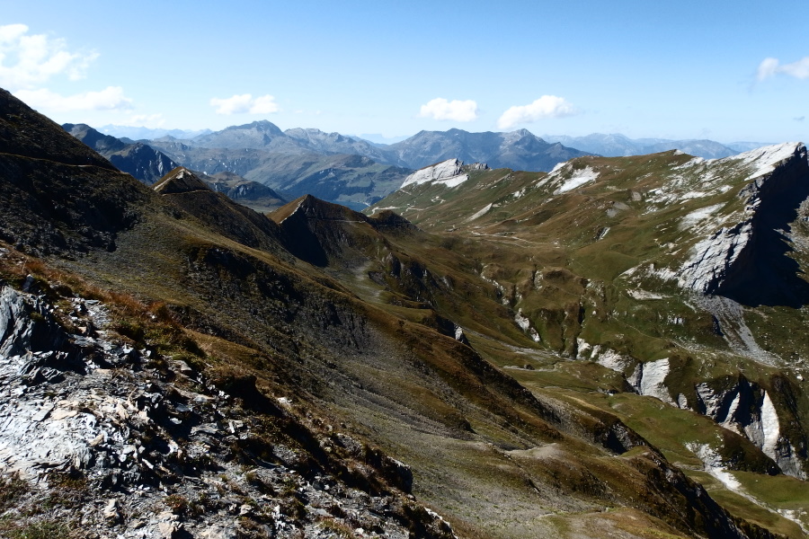
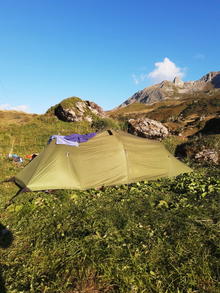
Getting up early, never fun when it is cold in the morning. And cold it is, but breakfast is at 7 and so we have no choice. Breakfast is the usual bread and marmelade, but I walk fine on it and so in spite of the frequent complaints we here from hikers about breakfast in mountain hutts we're fine with it. At the table next to us to ladies are having breakfast too and one of them appears to be Mexican. She's walking the Tour de Mont Blanc together with here Chinese table companion that she met during this trip after which they decided to walk together. We have a chat but since it's close to 8am and we still have to pay and pack we have to move. We have to be packed and gone by 9am, just in case the park rangers will pass again.... We pay to the gard of the hutt and he refers to what happened yesterday. "Well", he says, "it was not so smart to pitch your tent so early since the bivouac zone falls under the reserve rules and they check a lot. Only if it rains they're willing to allow people to pitch a bit earlier." I beg your pardon? That is totally different from what your colleague said yesterday! Could you please make sure you get your stories straight and give the correct information? We are packed (just) on time and before 9 we're on our way. From Les Contamines until here we followed a 4-wheeldrive gravel road, but now we almost immediately leave the road for a narrow path. The climb is not bad though, sometimes steeper and sometimes a bit flatter. What helps is that it's still earlier and we're walking in the shadow. By the time we reach another gravel road we're in the sun so we decide to take the jackets of. Here we have a short flatter piece on the gravel road before it starts climbing again to Plan des Dames; a small pasture with a remarkable pile of stones that supposingly is a grave hill. The story goes that an English lady and her servant got caught here by a snowstorm and didn't survive it. The local population decided to bury them here under a big pile of stones rather than carrying them down the mountain. Is it true? Who know. On the other hand, how hard can it be to make a radar scan of the pile of stones to check if there are any bones underneath? Anyway, the path flattens again and before we start the final ascent we pick a nice big rock to sit on and have something to eat. That final ascent is not so bad though there are a couple of parallel tracks going up and it's not so clear which one is the real track. We pick a high track but that leads to a rather difficult passage later on. In the last 100 meters about 4-5 other hikers pass us and when we reach the Col du Bonhomme there are another 20 hikers or so. It is still busy here. The section between Col du Bonhomme and Col de la Croix du Bonhomme is not so steep .... on average. Practice is that the path is rolling up and so it does have quite some climbing. Only the very last bit is more difficult as there is no real path and one has to scramble over the rocks. A smarty hiker decided to pick exactly that spot that everybody has to pass as his lunch spot and so we're stuck since he's literally on the path. We have to wait until he packs his stuff again before we can continue. Strange fellow. Once at the summit it is only a short descent to the Refuge Col de la Croix du Bonhomme where we decide to have a lunch break with great views. Already at Col du Bonhomme we saw the Crêtes des Gittes, the ridge that we have to follow. Though the descriptions we could find suggest that the path goes over the top of the ridge for 2kms, but from a distance it doesn't look like that. And now we really access the ridge we see it is also not so flat: it's in fact a serious climb along the ridge, but what is a bit disappointing is that most of time the path is either on the north or south side of the ridge but almost never really on top. However, the views on either side are great and so we reach the highest point after which we descend to Col de la Sauce. As soon as the path is on the north side of the ridge it is wet and thus slippery. Lupita is not the biggest fan of descending and on a narrow path with an abyss on one side while being slippery..... But we make it in one piece to Col de la Sauce where we sit in the sun in the grass for a short break. Several other hikers pass; in spite of not being on the Tour de Mont Blanc anymore since the last refuge we passed there are still quite some hikers on the track. One couple draws our attention: a very high maintenance lady acompanied by a man that doesn't seem to socially match. She comes walking fast to the sign indicating the call and starts fast throwing the walking poles, backpack etc on the ground to take of her jacket. In a hurry she gulps in some water, picks up her stuff and walks away fast while the man completeley relaxed follows. We look at each other ... why so stressed? From here it is just one big descent to our overnight stay en we're both curious and slightly worried how that will work out. Until the cabin of Bel-Air we just follow a gravel road and so descending is easy. Occasionally the road splits and though we lack any indication which branch to take with some imagination we manage to pick the right way down. Almost at Bel-Air we spot 3 marmottes next to the road and we gently grab the camera to take a picture. we have seen marmottes before, but never from this close. At Bel-Air we leave the gravel road, that is, instead of following all the switchbacks down the GR5 just shortcuts all curves leading to a rather steep path. We're happy to make it down and only have to cross a pasture to make it to the parking next to Refuge du Plan de la Lai. It's only 4pm so we will first have a drink outside the refuge. We ask were we can pitch the tent - that is behind the yurt that can be found behind the refuge. Should we wait until 7pm before pitching? Nope, we're not in a natural reserve here .... so we pitch the tent, have a nice warm shower and join dinner at 7pm. This was so far the most relaxed full walking day this hoiliday. |
       |
|||
|
|
||||
Download track BalLai.gpx