


Saturday 18 May 2013
| Distance (km) | 18 kms | |||
| Distance (time) | 5 hrs | |||
| Hard / Soft surface | 50% / 50% | |||
| Landscape |
|
|||
| Weather |
|
|||
|
|
||||
|
Determined to make it to the Belgian border before summer we decide to go walking again in spite of the mediocre weather forecast. We park the car at the railway station of Roosendaal to find out we just missed the train to Bergen op Zoom. We have to wait half an hour at a cold windy platform before reaching Bergen op Zoom within a few minutes.
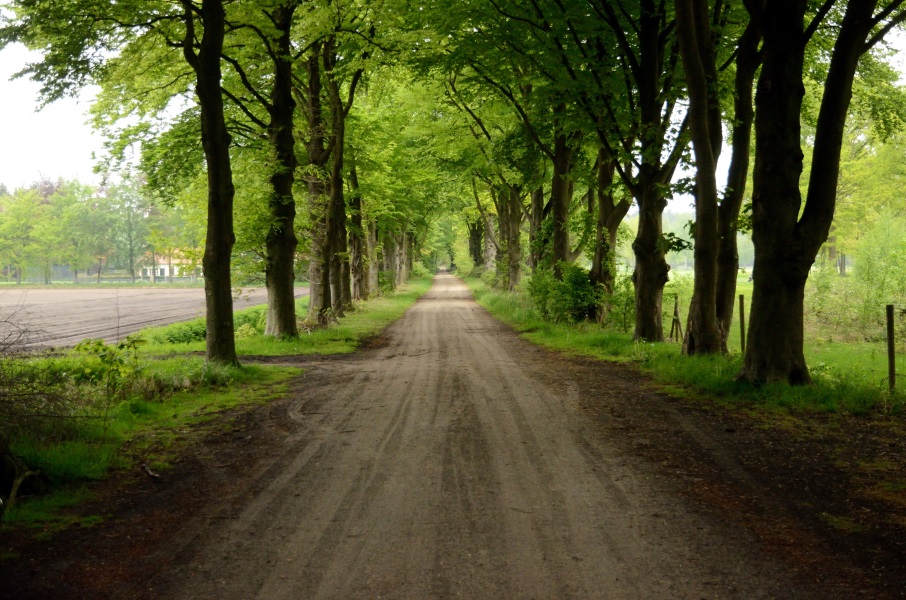
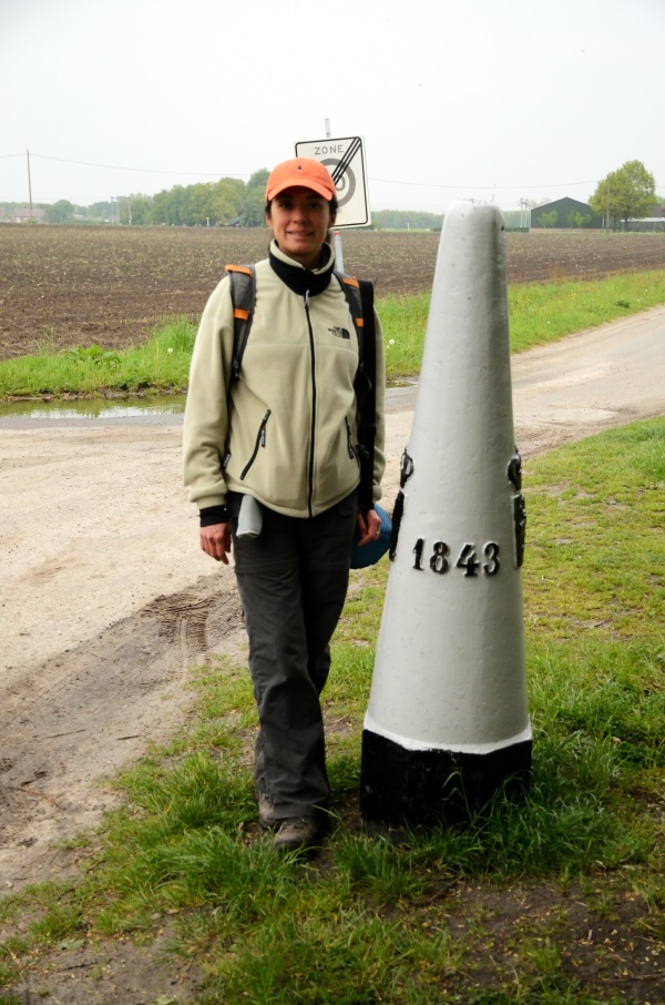
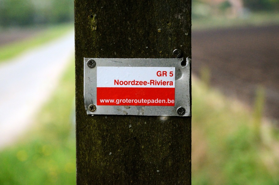
In Bergen op Zoom we pass underneath the railway station and immediately spot the GR markings again. We have to cross some residential area and a park before leaving town along a hospital. At the “famous” walking sign of Klavervelden where several long-distance hiking trails meet we have to stop for a picture and check the distance to Nice. Unfortunately the Bergen op Zoom city council has not very considerately hung a street name sign in front of the GR5 sign so that it's hardly visible that it is still more than 2000 km to go. We continue a bit more over tarmac before walking on a soft trail. The GR markings are mostly absent or reverse on a pole or tree. Handy when you walk from Nice to Hoek van Holland, but not for us. After going wrong a couple of times we somehow do manage to get to Wouwse Plantage. Looking at the map it seems that from Bergen op Zoom to Wouwse Plantage is the same distance as from Wouwse Plantage to Essen, but we hope that is not true otherwise it will be a looong day today. Somehow we're not making much progress today. From the village the GR5 follows a narrow cycle path along the Zoom. A thin stream that is apparently subject of dispute whether it is historically a brook or a canal since it has been partially dug out. We don't care. It's a nice path, in the shadow, beautiful landscape with fields and trees. Too bad it's tarmac, but so be it. The cycle path stops at the border with Belgium where we turn left over a narrow tarmac road that is in fact the border. There are some seriously big houses here, not a bad neighbourhood to live. The tarmac road becomes a muddy dirt road with quite some traffic. Where mud turns back into tarmac we pass an old border marker and a GR5 sign. Time for a photo. It's funny to see that on the left side of the road the street name sign is Dutch while on the right side of the road the street name sign is Belgian. One cannot stop wondering how they handled this before there was a Schengen treaty. But maybe back then this road didn't exist either…? It's only a few 100 m to Essen. The GR5 turns right before the railroad crossing, but we do cross the railroad in order to go to the railway station. We have time before our train back to Roosendaal arrives so we pay the local snackbar a visit. The Algerian owner is very friendly and interested in our walking adventures. His accent, a mixture of Algerian and Flemish, is too much for Lupita's comprehension of Dutch language. But fortunately his English is very good too. The train to Roosendaal takes 10 minutes and we pick up the car. Now railway station parkings have a discount for users of public transport, to be proven by one's public transport card. But a dirty trick is applied in Roosendaal: it only counts for people arriving by train in Roosendaal. We did arrive here by train, but it's not registered on our public transport card because we came from Belgium with a good-old paper ticket. So we have to pay the full amount for the parking. So much for stimulating people to take the train more often… |
   |
|||
|
|
||||
Download track BoZEss.gpx