


Tuesday 12 August 2014
| Distance (km) | 24 kms | |||
| Distance (time) | 6.5 hrs | |||
| Climb / Descent | 759m / 762m | |||
| Hard / Soft surface | 50% / 50% | |||
| Landscape |
|
|||
| Weather |
|
|||
|
|
||||
|
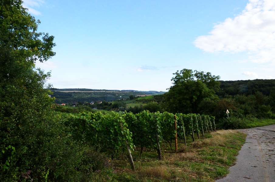
Where for more than 2 years the farthest point at the GR5 was Born, today we will set new boundaries. Furthermore we look forward to walking along the Moselle and pass through vineyards instead of forest.
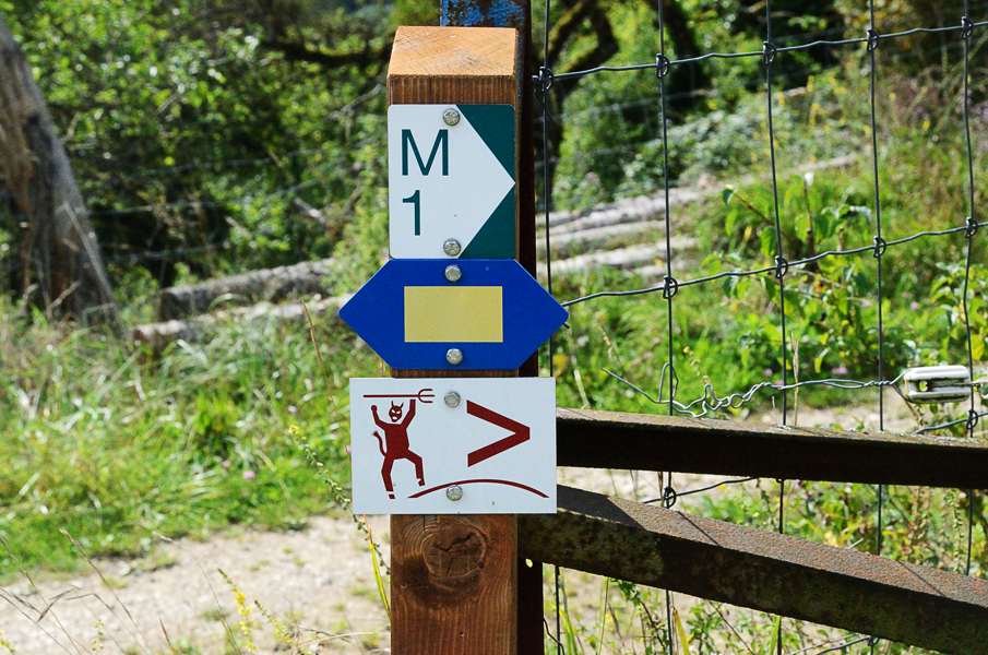
In spite of the fact we can leave from the camping site and we don't have to pack we still don't leave early without a clear reason apart from maybe holiday laziness. We pass through the village and cross the main road and we immediately start climbing over the Neiwee road. Just after the hairpin we join the GR5 again (here yellow squares on a blue background: the Lower Sure trail). It keeps climbing joyfully before we get rid off the tarmac and now walk on a flat track. It's an enjoyable walk here with patches of forest and some meadows with an remarkable amount of bulls. A the first house of Moersdorf the guide and map claim we should go straight ahead into the village but the signposting says we should turn right and steeply up into the forest. Again, signposting is leading so off we go, into the forest. At the highest point at a crossing there is no sign whatsoever and so we go.....straight ahead? The path makes a long curve to the right along a stream and eventually we have to cross the stream and end up on the CR135, the road to Givenich. There are signs here for the hiking trail M1, but not for us. Possibly we did something wrong and check again the not-so-good map in the French GR5 guide and the map suggest that if we turn left here we should get back to the GR5. But to the left is going down and we should be going up. So what if we walk to the right a bit up and then to the left....we should also get back to the GR5. And so that is what we do and indeed close to a large quarry we rejoin the GR5 again. Probably at the crossing at the highest point of the climb close to Moersdorf we should have turned left, but we didn't see a sign. From the quarry to the motorway bridge spanning the Sure valley it is a large but nice and quiet loop through the forest. At the motorway bridge we unfortunately have another problem. Almost directly under the bridge the track splits and every map and guide have their own idea on what todo here. Just to summarize:
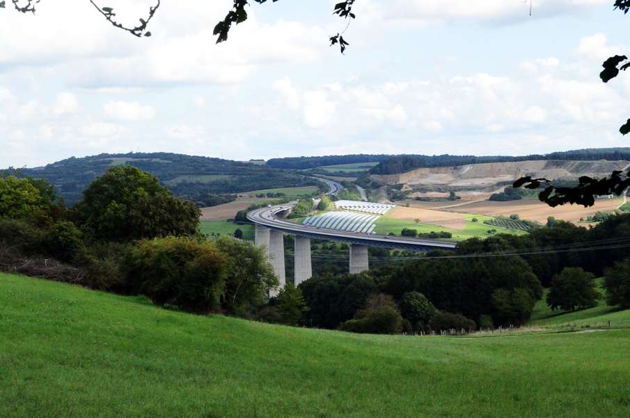
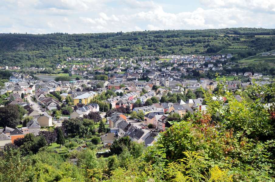
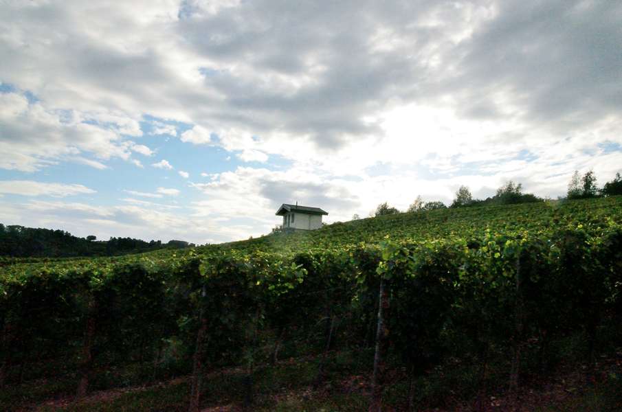
The path turns right and seriously climbs. About at the top the path turns left again and ends at a T-crossing with a gravel road. To the left? To the right? According to the GPS track we should go straight ahead, but that happens to be no option here. We first walk to the right to see if there is any sign making sense, but there isn't. So back to the crossing and then try left. This heads back to the Lower Sure trail and we don't want that. We try another side road here but that is a dead end in a vineyard. So back again to the T-crossing and take the road to the right of which we already know it has no further signs. We gently climb through the forest before the road steeply descends into a winery. Down in the valley we can see Wasserbillig. The gravel road has become a tarmac road by now and we walk this rolling road through the vineyard parallel to the motorway on our right hand side. At some kind of a split we keep left and that little road stops at narrow stairs going all the way down. We decide to take the stairs to get down to the motorway exit close to the Sure. Down there should also be the Lower Sure trail again. It's a tricky descent because the stairs are so long that at some point it feels like you're going to simply trip over your fee. We manage and we're now next to the main road leading to the motorway. But now we have another choice to make: The 2006 guide says we should go to the right, cross the main road and then go up again. But the topografic map says we should turn left and keep following the Lower Sure trail. We don't like the latter option and since there is no signposting proofing our wrong we go right, cross the road and go up. It's a nasty little climb through the woods but at the end we're back in the vineyards with a great panorama over Wasserbillig and the Moselle river. Eventually we end up at the CR141 that comes from Wasserbillig (left) and goes up to Mompach (right). We have lost any signposting long time ago and we are walking purely on map and GPS. Therefore we go to the right and up along the CR141 that passes, after a long curve to the right, over the motorway Trier - Luxembourg. Shortly after the motorway we turn left and walk along the CR141a. However, shortly after that we turn right again and now we are on a quiet little tarmac road. Good! Now we're getting somewhere again. Our road descents with a long S-curve towards the motorway and where it crosses back over the motorway we have to turn right. And guess what: a yellow rectangle, the Moselle trail...that happens to be the GR5 as well. It is a weird thing. The Lower Sure path goes to the downtown of Wasserbillig and ends where the Sure river joins the Moselle river. That is also the point where the Moselle trail starts and goes to Mertert and then up. So much is clear, but does the GR5 follow these national trails or not? According to the guides it does, but apparently between 2006 and 2009 the national trails have changed. But the topografic maps from 2012 says the GR5 does not follow the national trails but in fact short cuts them and thus bypassing Wasserbillig, which is kind of what we did. Anyhow, we're back on track. We follow the tarmac road that after a short climb descends to a stream. It looks like we have to go over the next (considerable) hill but in the end the road goes around the hill and climbing is very limited. When we enter the woods and pass a shelter we make a large loop just to cross the Schlammbaach and 10 minutes later we pass the shelter again, but now on the opposite side of the stream. Looking down we could probably have crossed the stream at the shelter and save ourselves the loop. It keeps looping through the forest before descending over steep and slippery stairs. We hope this descends into Manternach, but after the stairs there is still a long part through the woods until we reach a tarmac road. This is Manternach then? Nope, not yet. We have to turn left and pass underneath the railroad before crossing the river Syr and go back into the forest. A serious climb follows and we are clearly not in the best shape anymore. After a long descent in the forest we're back on the tarmac road and finally we pass the first houses of Manternach. It is warm and rather late and so when we coincidentally pass a bar we cannot just let this opportunity pass. After half a liter of Gatorade for me and 2 cokes for Lupita we feel sufficiently refreshed for the last 4.5 kms to Grevenmacher. We have to, because it is almost 17:30 and we would still like to arrive today. The climb out of Manternach is tarmac and the feet protest. At the highest point we enter the forest again and after a flat part it slowly descends into Grevenmacher. First meadows, then vineyards and finally the houses of Grevenmacher. We made it! Entering Grevenmacher the road is blocked by 2 fire department cars. It seems there is oil or petrol on the road because two firemen are shoveling sand on the road while about 8 other firemen have their hand in their pockets while chitchatting. The GR5 does not completely go to the downtown of Grevenmacher, but we do, because we have to go to the bus station. At the square next to the bus station there is a "fair". That is, there are 4 stands (ball toss, pull-a-prize, one closed and one snacks), indeed! Since we just missed the 19:00 bus we have 1 hour to eat some chips and grilled sausage with a can of coke. You got to do something... The bus back to Born is a depressing 20 minutes, for which we had to walk the whole day... |
     |
|||
|
|
||||
Download track BorGre.gpx