


Monday 6 August 2019
| Distance (km) | 17 kms | |||
| Distance (time) | 8 hrs | |||
| Climb / Descent | 1460m / 560m | |||
| Hard / Soft surface | 15% / 85% | |||
| Landscape |
|
|||
| Weather |
|
|||
|
|
||||
|
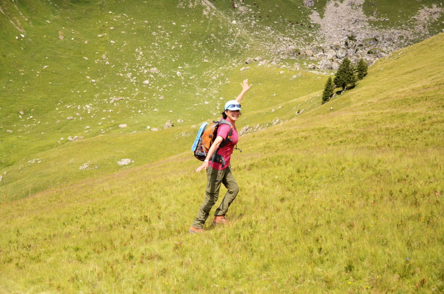
A couple of days relaxing and my toe seems to recover: I can at least walk again without pain. For the next stage there is nowadays the problem that the mountain hut at Col de Bassachaux has ceased to exist and so there is no longer the possibility to stay overnight up there. But fortunately they invented the ski lift and the summer ski pass. The passes we bought for a week for just 2 Euro per person per day to make sure that we can walk without heavy backpacks.
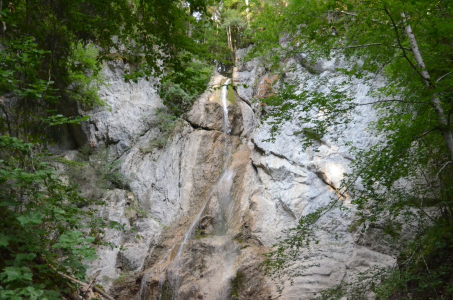
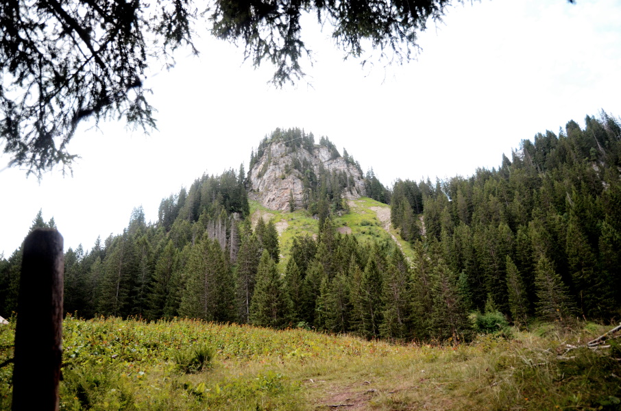
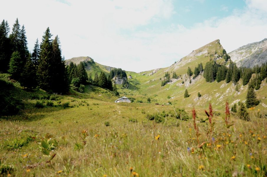
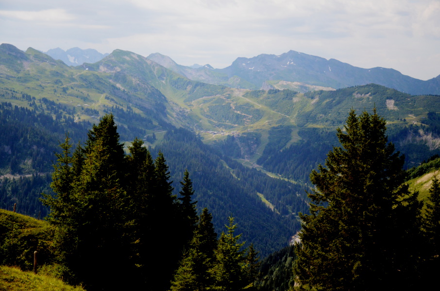
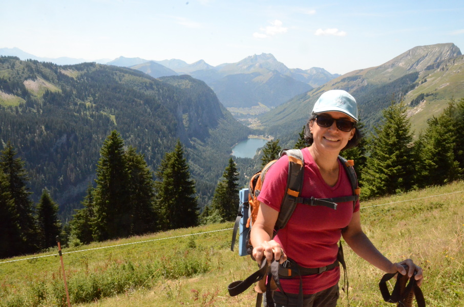
Yesterday we took the car and drove from Châtel up to Col de Bassachaux in order to park the car there. We found a nice spot so that it will survice the night and then we walked the GR5 for a 20 minutes or so until just below the Crêtes des Rochassons where 2 skilifts have their upper stations. A short climb up to the stations and then we took the ski lift down to Plaine Dranse where we had to change to the next ski lift further down to Pré la Joux. That also happens to be the end point of the shuttle bus to our camping and further into Châtel. And so about 2 hours later we're back at the camping, but now without the car. So today we start with our 25 minutes walk to the town centre to catch the bus (again it's to early for the shuttle bus) to La Chapelle d'Abondance from where we continue our walk. The first part of the walk is still flat which is always nice to start, better than going straight up from the very beginning. A few hundred meters we walk along the main road before heading right towards the river. The next kilometers more feel like a walk in the park on a gravel path along the river until we reach a group of houses called Le Moulin. Here we have to go right and indeed it starts climbing here. At the edge of the forest we briefly stop to take of our jackets as we will without a doubt sweat going up, and also to have a quick bite. The climb starts fierce but we get an excuse for a break when passing the waterfall since we want to take a photo. Then it goes up again to Sur Bayard (not more than a barn) were we briefly are out of the forest. It's also a bit flatter here before we again enter the forest and also again climb steeply. We just keep climbing through the forest until we again reach an open spot, this time not so big: Les Crottes. Again it's just a barn, but these are the only milestones we have. After Les Crottes the landscape is becoming steep and the path has to zigzag up. The vegetation is very lush here and it more feels like a walk through the jungle. Then it gets a bit flatter and suddenly we're in the open again. Straight ahead we can now see the pass Col des Mattes, which we have to cross. The perfect moment for a break with some cereal bars and a sip of lemonade. It feels good to be out of the forest and so we cross the pasture towards the barn that is about halfway. With a loop we then climb to the rather flat and wide mountain pass. The view to the south is magnificent and in the far distance we can see Col de Bassachaux. The first part of the descend is easy crossing a typical mountain pasture and Lupita is spontaneously getting a Sound of Music moment. Only the short stretch before Le Pron is a bit steeper. It is here that a Dutch family walks towards us and they ask me in their best French whether it will stay this steep further up or not, after which I answer in my best Dutch that that is not the case. In the end we get to the lowest point (after concurring some cows on the path) and head right on the gravel road to Chalet de l'Etrye that is still quite a bit above us. After that we keep following the gravel path that slowly gets more rocky but keeps climbing. The view to the left is great. Half behind us we see Châtel and below us Pré de la Joux that we passed yesterday. We have to walk half aroun Mont de Grange and with a couple of hairpins we reach the nameless highest point of the road after which it descends again to the farmhouse of Lenlevay. Here are some cows on the road again and it needs some persuasion to make them understand we want to pass. We see more and more hikers here, probably from the parking at Col de Bassachaux. That is not so suprising, because the gravel road in that direction is flat as can be and we make a lot of meters here. Unfortunately we are about 100m too low, so where the gravel road ends at a crossing of several tracks and paths (a rather busy crossing with lots of hiking groups) we have to go straight ahead onto the final climb to the car. We find out we're not that fresh and fruity anymore because it's a bit of a struggle to get to the road just below the restaurant at Col de Bassachaux. A final little climb to the parking where our car awaits us. All together a pleasant walking day; no painful toes or knees, or back or neck. Just a nice walk. |
      |
|||
|
|
||||
Download track ChaBas.gpx