


Wednesday 12 August 2015
| Distance (km) | 8 kms | |||
| Distance (time) | 2 hrs | |||
| Climb / Descent | 100m / 440m | |||
| Hard / Soft surface | 35% / 65% | |||
| Landscape |
|
|||
| Weather |
|
|||
|
|
||||
|
It's a very relaxed way to wake up knowing we only have a short piece to walk today. We have breakfast at ease, gather our stuff and walk away from the hotel at 10 o'clock. It's mostly descending and it cannot be much than 2 hours to Schirmeck.
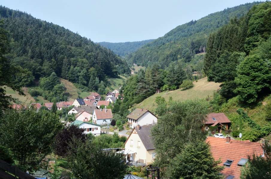
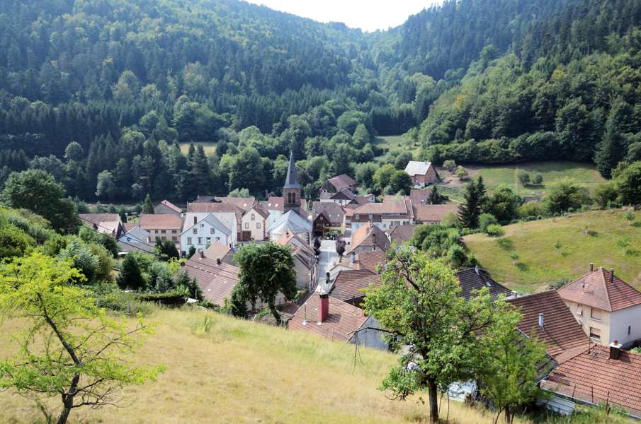
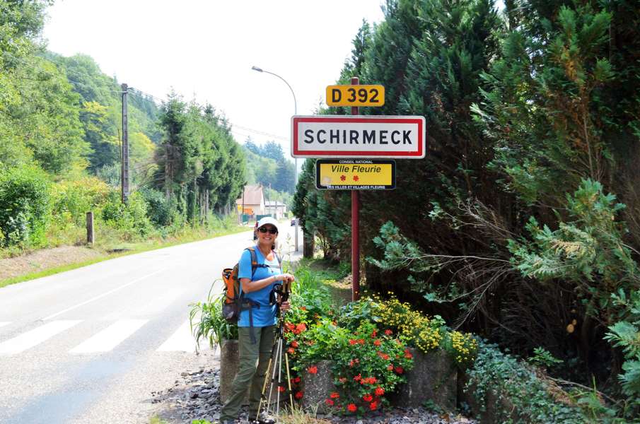
Nevertheless we manage to loose track again. We quietly walk down a forest track and arrive at the crossing with a tarmac road. Straight ahead through the trees we see the houses of Grandfontainem, but we shouldn't. So again we grab the map and with all the signs of all the walking trails that we see here we figure out where we are. Apparently somewhat back we should have turned left off the track, possibly slightly climbing. But nothing happened, if we turn left here and follow the tarmac road we will rejoin the GR5 again. And indeed, only 200m further that is the case. After a little bit more tarmac we turn right again into a narrow path going down. Especially the last part to Grandfontaine is very very steep. They tried to make steps here with wood boards and rebar, but the steps are half gone and naked pieces of rebar now just stick out of the ground. That is so dangerous: if you fall here you're skewered and won't live to tell the story. Very carefully downhill! Downstairs at the tarmac road....we immediately have to go up again to the main road just to follow it downhill before we go left again to re-enter the forest. From here it remains a narrow path, sometimes inclining considerably to the right which is very tiring for the ankles. When we hear church bells we think we're in Schirmeck, but we find out there is another village: Wackenbach. Here we pass houses high above the village and go back into the forest. Eventually we arrive just before the sign with the town name back on the D392 and we walk into Schirmeck along the road. Now we only have to find the railway station to get back to the camping. It is noon and the train leaves at 13:00 so we have time. After scaring off wasps for an hour at the platform we take the slooooow train to Strasbourg where we have to wait 20 minutes for the train to Nancy. At 15:00 we're back in Sarrebourg. From here leaves only once a week on Wednesday (which is today) bus 142 to St.Quirin, at 17:00. Or so we have been told by the lady of the tourist info in St.Quirin. Fine with us, we have 2 hours for lunch at the local pizza guy. At 16:45 we're back at the platform of the bus station waiting for the bus....that doesn't arrive. It is 17:00, then 17:15. Busses come and busses go, but not ours. We could take the bus to Abreschviller and then walk to St.Quirin but that is a walk of over 1 hour. Better not. Taxi maybe? And then a familiar face....the bus driver that drove us last week from Gondrexange to Sarrebourg. He recognizes us and asks what we're looking for. We explain and he checks the schedule and doesn't understand either why there is no bus. He grabs his telephone and makes a call. After a minute or so he hangs up and explains that he has to drive his route to Gondrexange and further to Avricourt, but that he has permission to drive us to St.Quirin after that since the bus has to get back to Sarrebourg anyway. We do have to join him on the entire route and it will cost us 15 euro together. We don't need much time to consider it: we do it! And so we're in the bus to Avricourt with 6-7 others after which we drive half the distance back to St.Quirin. By now it is 18:45 but who cares? The driver is nice enough to drive us all the way to the camping site and literally drop us at our tent. We pay the 15 euros and we're back "home". The camping caretaker is watching it from a distance and approaches us. "Isn't that a SNCF bus? I thought they have no service to the village?". Er, today they do...long story. And now we can do nothing at all for 3 more days before this year's holiday is over. In 2016 we will continue from Schirmeck to conquer the Vosges... |
   |
|||
|
|
||||
Download track DonSch.gpx