


Thursday 9 May 2013
| Distance (km) | 17 kms | |||
| Distance (time) | 4 hrs | |||
| Hard / Soft surface | 20% / 80% | |||
| Landscape |
|
|||
| Weather |
|
|||
|
|
||||
|
Starting from here we can't handle it anymore with just public transport and so we decide to park the car in Middelharnis from where we take the bus to Goedereede. The weather forecast for this Ascension Day weekend is not great, but for now it's at least dry. With a cold wind, though.
Leaving the bus stop in Goedereede we cross the N57 main road to enter the polder over a narrow tarmac road. The wind is straight in the face here so that we have tears in our eyes in spite of wearing sun glasses. At the end of the narrow road we have to get onto the dike to the left and annoyingly there is quite a bit of car traffic on that dike. We suspect this is because of the slow moving traffic on the N57 due to everybody heading for the beaches. Anyway, we'll just have to endure this before our path enters the Flakkee mud flats.
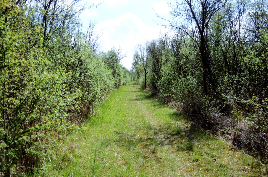
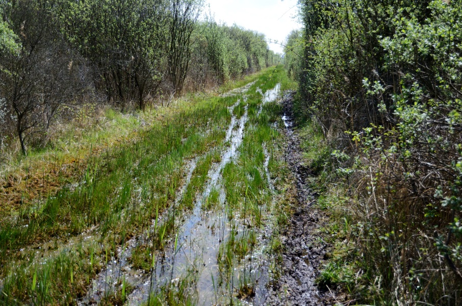
We have to search for the entrance because from the dike one shouldn't follow the brand new cycle path but take the stairs down the dike and climb over the fence there. But then you do get a nice sheltered path with soft ground for the feet. However, progressing through the mud flats the ground gets really soft and even really really soft and even swampy until it's impassable because there is 10cm of water in places. We're not making much progress like this, but hey, the sun is out. It's a miracle though that none of us got wet feet here.
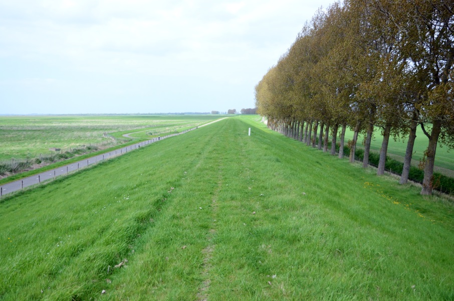
At the very end we leave the mud flats arriving at a tarmac road at the foot of a dike. We briefly admire the mud being knee high on our trousers before we continue. It's just a short piece of tarmac until the road ends at a parking area. Officially we should go left here up the dike but we wouldn't know how to. The barb wire fence clearly has been replaced recently and maybe there used to be something to climb over the fence but there isn't any more right now. So we decide to follow the gravel cycle path that goes in more or less the same direction as the dike. At the T-crossing we then turn left to re-join the dike. And here we can get up the dike in order to follow it all the way to Herkingen (7 kms).
It's a gorgeous walk over the dike with a view to both sides. Just before reaching the Grevelingen lake we have to zigzag in between the sheep (and sheep dun). Though we can't see the village of Herkingen yet we estimate it's another 30 minutes walking and so it's time to call for transport. In the weekend and on public holidays Herkingen can only be reached by an on-demand bus that should be called at least 1 hour in advance, so that's what we're going to do. A bit in the shelter of the dike we call and it should be fine. In the end it's only a 20 minutes' walk to Herkingen and so we have plenty of time. We go up and down the main street (100m) and then head for the marina to get an ice cream. Indeed, nicely on time a taxi van arrives that appears to be ours. The driver says we're the only ones so she can bring us straight to Middelharnis without having to follow the official bus route. At Middelharnis she's nice enough to drop us off where we left the car instead of at the bus stop. And that all for free, because being a taxi she doesn't have equipment to charge our public transport card, so it's on the account of the bus company. |
    |
|||
|
|
||||
Download track GoeHer.gpx