


Tuesday 15 August 2017
| Distance (km) | 21 kms | |||
| Distance (time) | 6 hrs | |||
| Climb / Descent | 680m / 600m | |||
| Hard / Soft surface | 15% / 85% | |||
| Landscape |
|
|||
| Weather |
|
|||
|
|
||||
|
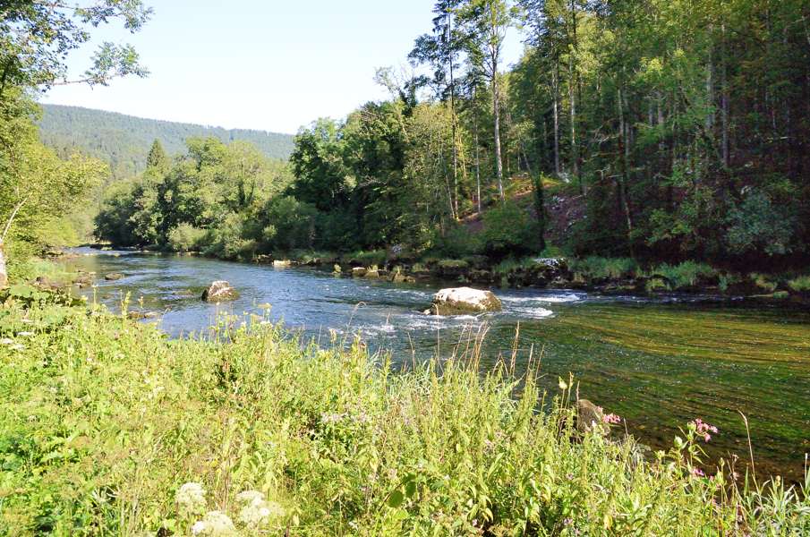
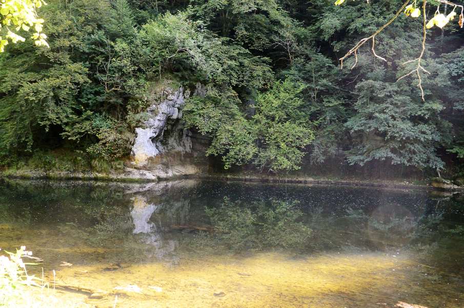
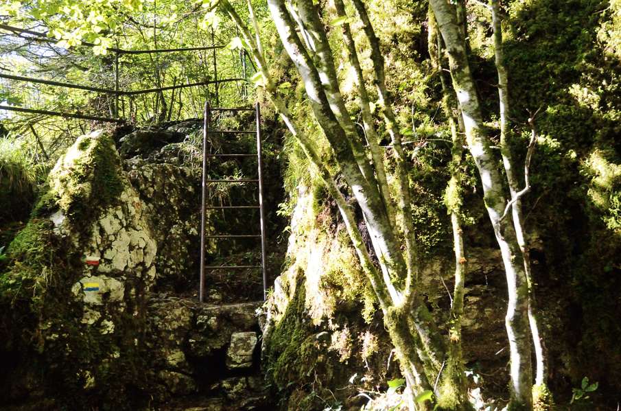
Again I took some rest, but we can't just sit and do nothing: we have to walk. Besides, today is supposingly an easier day as we stay in the valley of the Doubs. It does take some effort to reach the starting point though: we park the car in La-Chaux-de-Fonds behind the station in some street and we take the train to Saignelegier. Well, that train that doesn't go because of railroad maintenance works, so we take the replacement bus to La Cibourg and from there we continue by train. But I have to admit: it's well organized. There is a separate bus stop for the shuttle buses of the Chemins de Fer du Jura and it is well indicated where this bus stop is. Ah, and at Saignelegier we have again 2 minutes to transfer to bus 32 to Goumois. Were are the only passengers in the bus... At 9 we start knowing there is only 1 bus returning from La Rasse, at 16:30. Sufficient time, 7.5 hours for a walk that according to the guide should take under 5.5 hours. So we have a coffee in Goumois and hit the road. Directly outside the village we leave the main road and after we passed the canoe centre and a picknick site we're on a forest track along the river. All very nice, but by the time we're starting to really appreciate the track it starts climbing, and climbing, and climbing and at some point we're 100m above the river? If for sure feels like that. Done climbing the path rolls up and down before descending all they way down to river again. Was that really necessary? And that is not all, because soon the track goes up again to climb to the La Goule chapel after which it remains more or less level until the dam. A third climb follows to the La Charbonniere du Haut hutt. Here we have to make an interesting choice. Originally the GR5 went on from here to the Echelles de Mort, a series of long steel stairs going back down into the valley. As an alternative there was a normal track going down and then pass underneath the stairs along the river. Recently this was flipped: the regular GR5 now uses the normal track and the one over the stairs is considered an alternative route.....According to the guide at least, because the signs still reflect the old situation. Anyway, we're not going to descend the stairs so we take the steep track down to the ruins of an historic mill along the river and from there just follow the river. In the end we get to a parking site of the electricity plant Refrain at the bottom of the Echelles de Mort. The parking is busy with daytrippers so we move along the access road to the parking. The river has a considerable descent here and since we're walking upstream this means climbing. And it keeps climbing until the dam, which we could have seen coming of course. At the Refrain electricity plant one can see the water pipes coming out of the mountain at considerable height above the plant, so it is clear how high the lake is. A lot higher than the plant for sure! At the dam we really now walk next to the lake on a small strip of dry land between the water and the rock face. We wonder how they're going to squeeze the path through here. Well, they don't: we have to climb a ladder of 4-5 meters high to get on top of the rocks. Ladders are not Lupita's favourite and she doesn't climb fully enthusiastic. For me a ladder is just a ladder and though a severely suffer from vertigo I just climb it, not looking down. After the ladder the path climbs a bit more and then descends again to the lake. From here it just undulates all the way to the bridge of Biaufond. From here it is another 35 minutes to La Rasse and for a moment we consider taking the road on the Swiss side of the river but we decide not to. A good choice because the road appears to be very busy and with a lot of crazy motorbikers that think they're Valentino Rossi or so. But ok, we quietly walk to La Rasse where we arrive at 15:45. Sufficient time left for a panaché in hotel La Rasse before heading to the bus stop. The bus is fast and on time, straight to La-Chaux-de-Fonds where we pick up the car again. |
   |
|||
|
|
||||