


Sunday 30 June 2013
| Distance (km) | 16 kms | |||
| Distance (time) | 5 hrs | |||
| Hard / Soft surface | 50% / 50% | |||
| Landscape |
|
|||
| Weather |
|
|||
|
|
||||
|
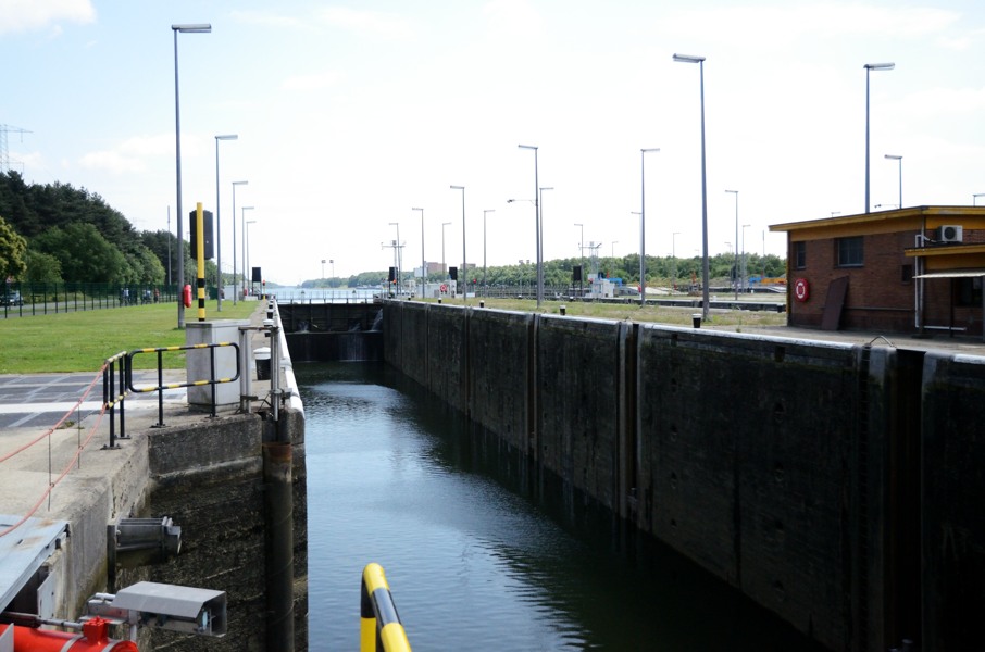
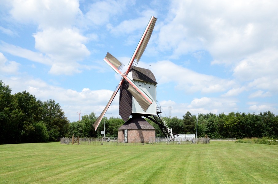
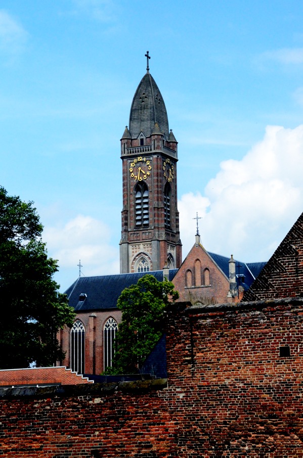
The great part of camping site Dennewoud is thet we're practically at the end point of today. However, how to get to the starting point, the railway station of Herentals, is a whole different ball game. We can choose between walking 1.5 kms to Zoerle-Parwijs and take the direct bus from there that only goes once per 2 hours. This bus ride is about 25 minutes. The alternative is to take the bus to Geel from straight across the camping entrance (once an hour) and from Geel take the train to Herentals which gives a 50 minutes travelling time. We decide to go for the latter option, not because we're too lazy to walk but we just don't like walking 1.5 kms along a main road. \
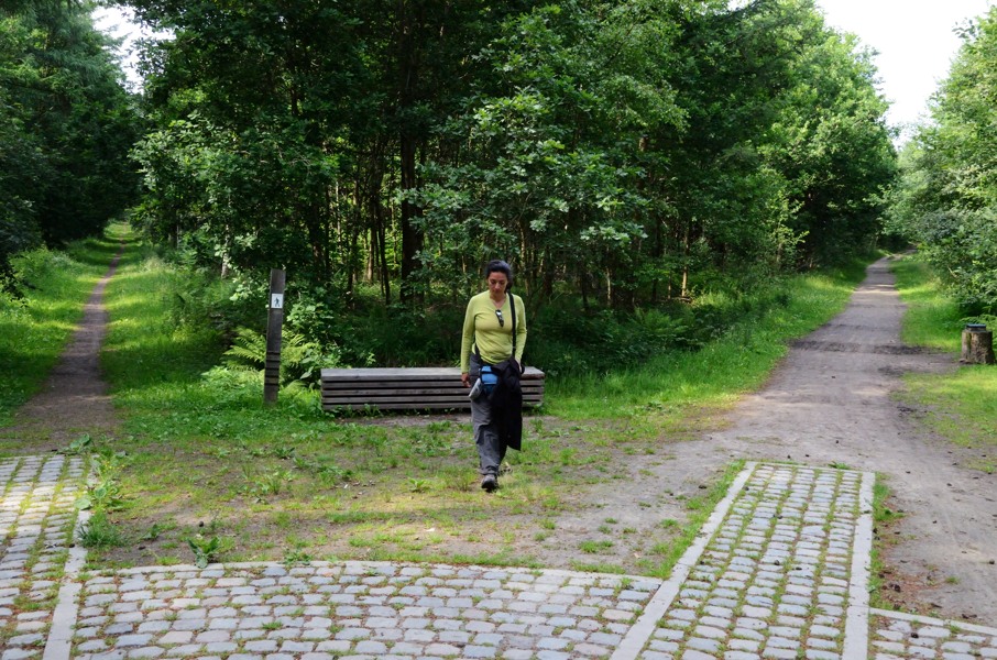
So we leave the camping site by car just to park it 200m to the left at the parking area of forest reserve "De Beeltjens". There is a bus stop at the parking area and we hop in the bus to Geel. The railway station in Geel is heavily under construction and so it takes a while to discover the entrance to the platform but then we're in 15 minutes in Herentals. We have to start walking through the town and we already noticed on the map: the GR5 takes anything but the shortest way to do so. However, one can exaggerate: going zigzag through a park just to end up at the same main road but 100m further is our humble opinion ridiculous. The Grote Markt (central market square) is beautiful and it's good the route passes here. Usually the GR5 goes around towns but once in a while it doesn't and so we see places that we only know as motorway exits whilst passing with high speed. The track loops further through Herentals and ends up at the large bypass road that we have to cross. Immediately after we cross the canal Bocholt-Herentals after which the GR5 follows the canal. One could consider this nature, but somehow there is a nasty smell of garbage, either from illegal dumping or some garbage processing industry nearby, we don't know. What we do know is that the sun has seriously came through and we have to take the jackets off. After going underneath a main road the route leaves the canal and turns right. We cross the N13 main road to Geel and go straight ahead on a gravel road in between the corn fields with an occasional patch of forest. We're hardly out of Herentals and the landscape is great again. However, quite sudden we're in front of the Albert canal and by means of a large set of ship locks with an impressive height difference we cross the canal to a busy road on the other side. Signposting is seriously failing here, but we figure out we have to go a very short distance to the left along the road before entering the terrain of the Mill of Olen: a beautifully maintained and restored wind mill. At the other side of the terrain we go down the embankment. There is a warning sign for Oak processionary caterpillers: something to take into account. The GR5 sign we see here will be the last one for quite a while. It's a narrow path and where it takes a 90 degrees turn to the left the GPS track claims we should go straight ahead. Well, with a bit of phantasy one could consider straight ahead a wildly overgrown path....or maybe it's just forest. We're not planning to go there, especially not with the warning for the caterpillars in our minds. So we keep following the trail and see where we end up. A bit further the trail turns right again so we're now parallel to the GPS track. At the end of the track we arrive at a gravel road: the Rijtestraat. This is supposed to be the GR5 (according to the GPS track) but there is no sign whatsoever. At the first houses of Olen we pass a large farmhouse named Keunigshof and they claim to have home made ice cream. Hard to resist, so we have an unplanned stop for a chocolade-and-lemon ice cream (Lupita) and a chocolate-and-passion fruit ice cream (yours truly). The owner is rather talkative and complains to us that the clear blue sky we had so far is getting slowly more and more cloudes. That is too bad indeed but as long as it doesn't rain we're fine with it. It's a hard decision but we have to move on and we walk in the direction of the centre of Olen. We see no GR5 signs anywhere and blindly follow the GPS track. Only in the centre of Olen we see GR signs and we pass the restaurant where we had dinner yesterday. Next to an italian restaurant we leave the small central plaza.....and that was the end of the GR5 signs again. We loop through Olen, pass a forest called "Teunenberg" and even a larger private domain without any GR5 indication and just based on the GPS track. Only on the gravel road Olense Heide we suddenly see GR5 indications again. No idea how the GR5 is supposed to get here but clearly not the same way as the GPS track or otherwise it's extremely poorly signposted. From here a long and rather dull section along tarmac roads start. The first part is kind of ok, but the dead straight (gravel) road Stenen Heide and the equally straight Torendreef are plain boring. Our only luck is that they're narrow concrete roads with a gravel shoulder so that at least we don't have to walk the concrete. Disadvantage is that there are a lot of cars that need that shoulder to pass. Along the Oevelse Dreef passing the abbey of Tongerlo there is no more shoulder and after having to jump for our lifes 3 times we decide to walk over the cycle path considering there are far less cyclists here than cars. At the main road we go straight ahead and slowly walk out of Tongerlo again. At more or less that last houses we have to turn left into the forest. Ah...soft trail again. The track is dead straight through forest reserve the Beeltjens. Halfway there is a peculiar crossing of 8 tracks. If you stand in the middle and spin around a few times you have no idea anymore from which track you came as they all look very alike. Funny. Fortunately the GR signs help out here and we continue trough the forest. Just before arriving at the main road from Zoerle-Parwijs to Westerlo the route crosses the Beeltjensdreef. We leave the GR5 for now and turn right as on the parking area at the end of the Beeltjensdreef is where our car is. With a big sigh of relief we arrive at the car. Today's distance was not too big, but the combination of not being recovered from yesterday and large sections of tarmac/concrete in the end have worn us out. We take the last sip of drink and drive home....Until the next walking weekend. |
    |
|||
|
|
||||
Download track HerWes.gpx