


Sunday 25 July 2021
| Distance (km) | 13 kms | |||
| Distance (time) | 5 hrs | |||
| Climb / Descent | 440m / 1000m | |||
| Hard / Soft surface | 20% / 80% | |||
| Landscape |
|
|||
| Weather |
|
|||
|
|
||||
|
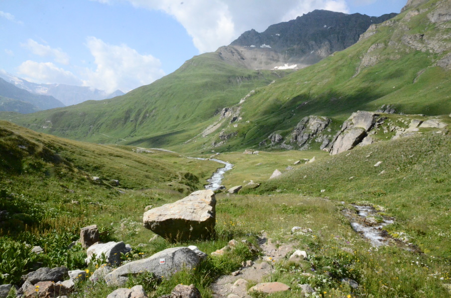
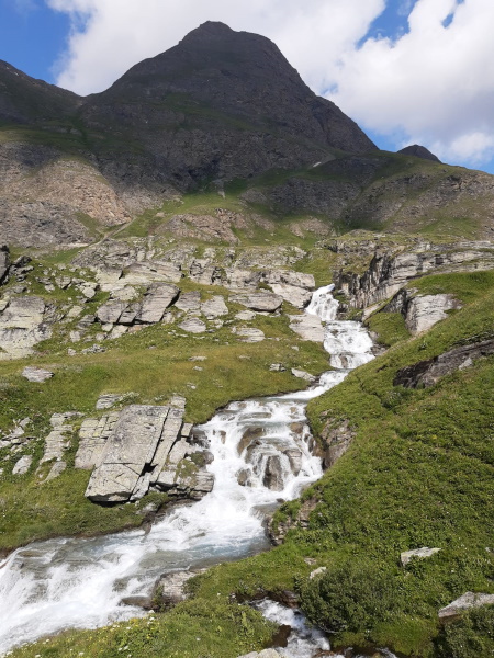
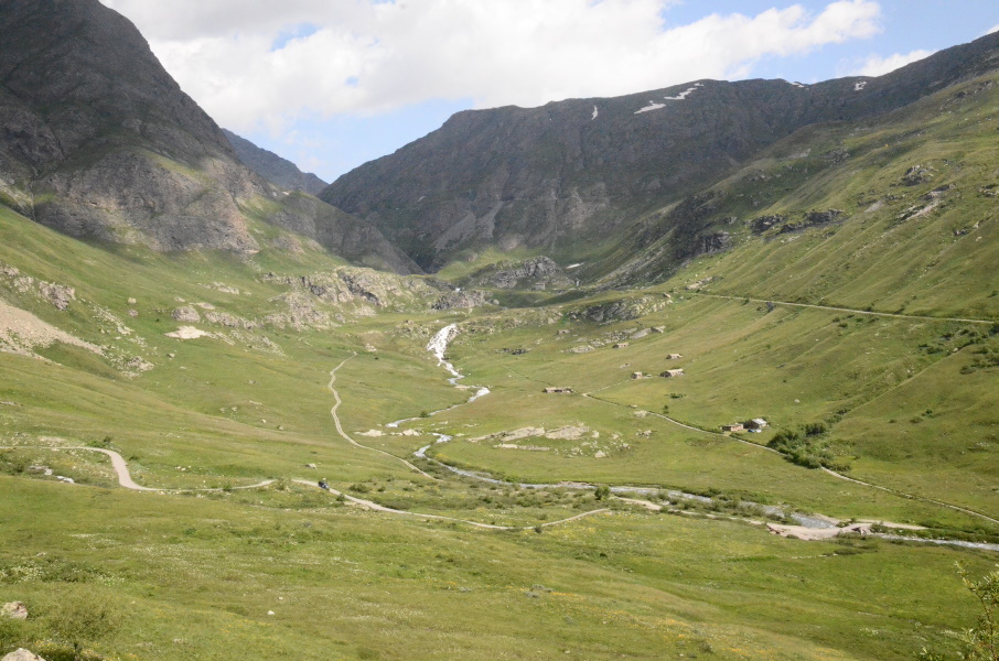
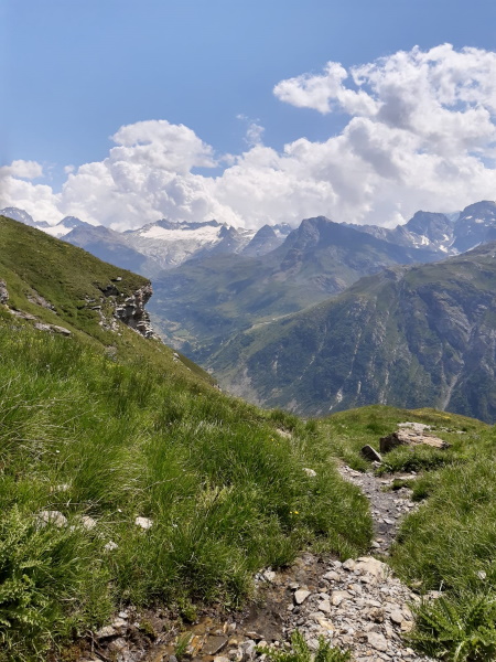
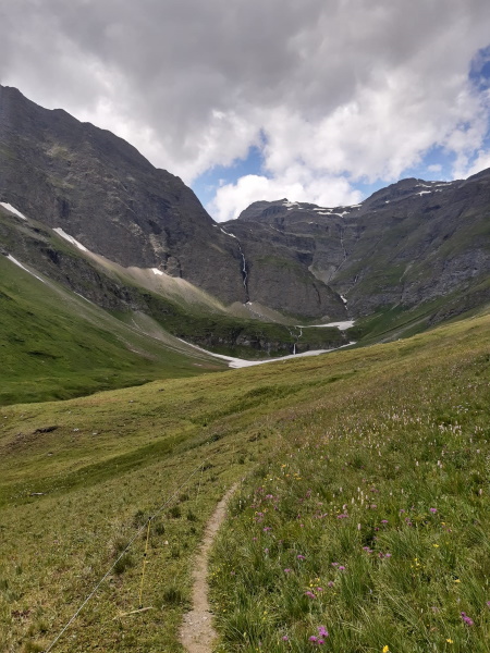
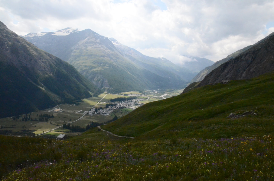
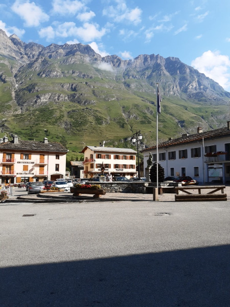
Yesterday we moved the whole shebang from Nancroix to Termignon. Packing and reinstalling the tent took more time then the drive itself, but now we're more practical located with respect to public transport and GR5. We passed the Iseran pass again, but now by car, and during the decent we investigated already. The original idea was to take a taxi from Bonneval-sur-Arc to the Col de l'Iseran and then decent on foot again, but Lupita can't handle altitude very well and did suffer from headaches the day before yesterday when we arrived at the pass. So we decided to pick up the GR5 a bit lower. From Bonneval there is a shuttle bus going to Pont de l'Oulietta along the D902 at just over 2400m altitude and that looks like a nice point to start. This point is not along the GR5 that passes a bit lower along the Ruisseau de la Lenta, but there should be a path connecting Pont de l'Oulietta with the GR5. And since we pass there by car we just briefly step out to check. Well, we don't see a path. There is a big information panel with a map that actually has the connection path drawn and the path is mentioned in the official FFRP GR5 guide but it's really not there. It drops steeply from the road and there is no way to tell from the road if it is safe to decent or that there is somewhere an unpassable ridge that we can get stuck on. So this is not an option. The alternative is to walk down along the road to Pied Montet - an abandonned building that looks like it once was a refuge or so - where the GR5 does briefly touch the D902 road. That would imply walking 2.5kms along the road, but if it's the only way ...? So in Bonneval at the tourist info we reserve the shuttle for the next day (hence, today) as we pass there anyway. And then we check out Bessans where we want to park the car and take the bus to Bonneval; just to check where the bus stop is and where we can park. Again, we pass there anyway. And then we drive to Termignon where we install our base camp for the next 2 weeks on camping Les Mélèzes. And now an early morning again, on a Sunday, to drive to Bessans, park the car and take the bus to Bonneval. In Bonneval we step out and we have to wait 10-15 minutes for the shuttle to Pont de l'Oulietta. A small volkswagen van arrives ... that wouldn't be? Let's ask, and yes it is our shuttle. We are also the only passengers so why not ask if he can drop us at Pied Montet rather than Pont de l'Oulietta and save ourselves a 2.5kms walk along the road? And that is fine, no problem...so we head up and we are dropped nicely next to the GR5 at an altitude of 2300m. This will leave us a gap in the GR5 that we then didn't walk, but after today (spoiler alert!) that is not going to be an issue. We descend along the GR5, nice and quiet along a serious size stream. At the waterfall it's a bit steeper but nothing that can spoil this pleasant walk. At the bridge the GR5 goes to the right and up and thus so do we. Following a 4x4 track we gain another 120m to some nameless little mountain pass where we exchange the 4x4 track for a narrow single track. That single track passes some pastures and then changes into a balcony track. Balcony tracks are not our favourite though it heavily depends on how well maintained, flat and wide the track is. Well, this path is none of these three: it's heavily inclined towards the valley, it's in places so steep we need hands and feet and it has some seriously deep crossings of streams that are difficult to pass. The biggest have some wooden beams to serve as a rather unstable bridge to make them marginally better to cross. But does the view make up for all that? Well, no, not really: the whole way one's looking into the valley of the Arc river and as walking is not that fast the view is pretty much the same the whole day and thus not very suprising. After Pont du Vallon (the bridge over the Vallon stream) the single track becomes a 4x4 track again, which is at least more pleasant to walk on. One can follow this 4x4 track for a long time though the GR5 regularly shortcuts the hairpins. This reduces the distance to walk, but the shortcuts are narrow and steep and timewise there is little advantage over just following the 4x4 track. But in the end there is no choice then to leave the 4x4 track since it goes to Le Villaron and the GR5 goes to Bessans, one village further downstream the river Arc. So there is quite a distance of stoney single track to go, but fortunately not to steep nor difficult. At the bottom we end up at the river and after a short part along the river we enter Bessans over a bridge that needs some serious maintenance (some of the wooden deck boards are completely rotten). We pick up the car again and we're not sure what to think of today. We had high expectations on beautiful views and so, but we're a bit disappointed. |
       |
|||
|
|
||||
Download track IseBes.gpx