


Wednesday 9 September 2020
| Distance (km) | 13 kms | |||
| Distance (time) | 7 hrs | |||
| Climb / Descent | 1000 / 810m | |||
| Hard / Soft surface | 30% / 70% | |||
| Landscape |
|
|||
| Weather |
|
|||
|
|
||||
|
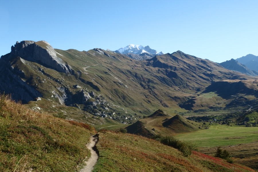
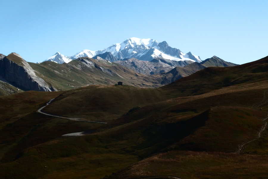
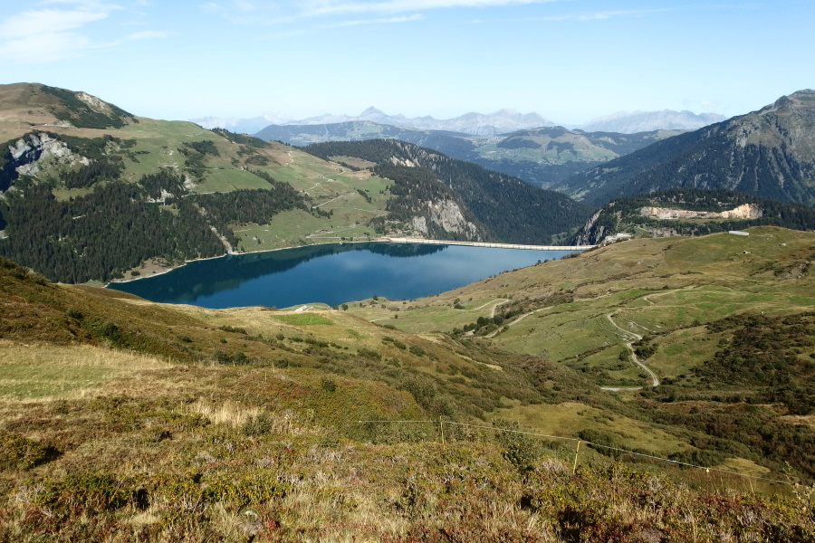
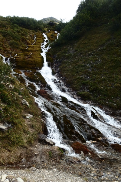
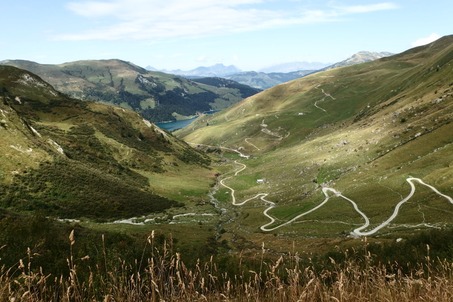
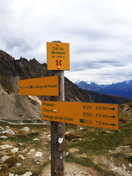
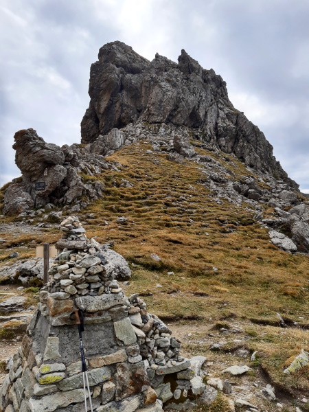
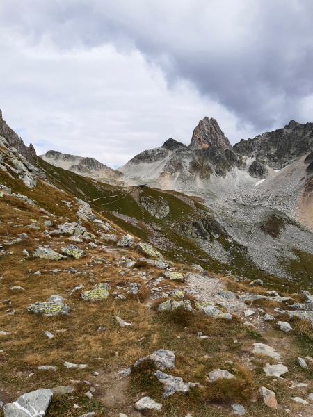
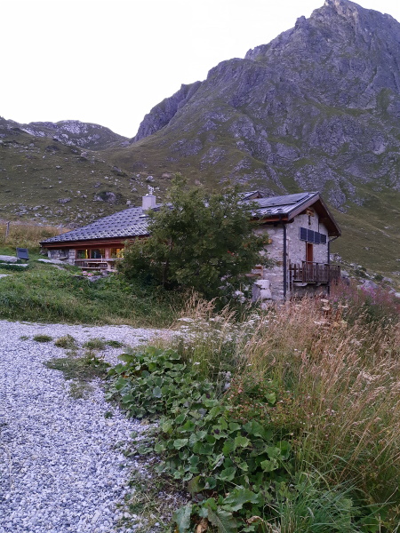
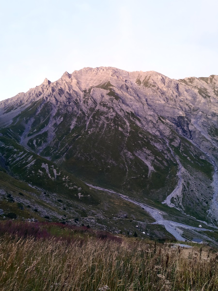
Today is supposed to be about the same as yesterday with respect to altitude gain and distance, but with the only difference that yesterday the main climb was at the start of the day and today it will be at the end. Therefore we doubt we can walk today's stage in 7 hours again, but we'll see. Just like yesterday we have breakfast at 7 and we leave before 9. We cross the road and head for Plan Mya, the refuge that is just 10 minutes further up the mountain. It is again a gravel road and that's always nice for a quiet start. Next to Plan Mya there is a huge dome tent where somebody is just dragging out big matrasses....I don't believe they're hikers. After Chalet Le Mora the GR5 shortcuts a big loop in the gravel road but we're not so happy with this shortcut: it's steep, slippery, warm, through dense bushes and thus with stinging flies. And in the end we just end up on the same gravel road again and not even at the summit. Until the chalet Petit Berger the road keeps climbing. What is a bit of a disappointment is that at this part of the route we cannot see the Roselend lake that is below us while we had hoped to have nice views. After Petir Berger the gravel road turns into a track that seriously descends. The path is heavily eroded so descending goes slow. At the lowest point we cross a stream and then we have to get all that up again to Grand Berger that is at about the same altitude as Petit Berger. Just before Grand Berger there are some cows on the road, and where in the Jura cows could easily be chased away here in the Alps they're not so easily impressed. So we make a loop around them, just to find 3 more on the track just after the highest point. Actually, now coming closer, the 3 cows are in fact bulls. They don't flinch with my attempts to chase them away so we decide to carefully pass the first, then the second, and then .... well, the third is on the middle of the path, legs spread looking at me and snorting. Ok....so another big loop around this fellow then through the rather high vegetation next to the path. And considering the state of the vegetation we're not the first one today doing this. From here on it goes rolling down and the path is very wed and muddy. Some parts we're more sliding down than walking. Only until we literally walk around the corner the quality of the path improves and we end up on another gravel road. High above Treicol we decide to have our lunch stop. We have a great view over the mountains and now also over lake Roselend on our right. The signs earlier today suggested that the GR5 passes by Treicol, a parking at the bottom of the valley, and indeed it used to do so. Nowadays the GR5 follows a higher track that safes you from descending in the valley just to climb out of it again towards Presset. And indeed, here it's signposted that the gravelroad goes to Treicol whereas the GR5 goes straight ahead onto a track. Signposting here is a bit dodgy, it also frequently uses yellow/red (which is for regional walking trails) instead of white/red (for national walking trails). Anyway, we walk the trail higher up the valley and cross two streams to end up on the gravel road from Treicol to Presset. The GR5 again shortcuts some of the hairpins resulting in a steep rocky path in between two waterfalls. A tough and mostly wet climb brings us back to the gravel road just before Presset, a the foot of another impressive waterfall. We now keep following this gravel road passing Presset, not much more than the ruin of some kind of building. Just after Presset we will have to turn left where the gravel road goes straight ahead to Col du Coin. We have to turn left onto a steep path to Col de Bresson. Where the path splits 3 young guys are discussing and by the time we arrive they start walking in the direction of Col de Bresson. We already did some hours of walking and so we're not that fast anymore but with the thought in our minds that even the slowest diesel makes it to the top we head for Col de Bresson. The path is steep and regularly we need hands and feet to get across some rocks. The 3 young guys stop a couple of times and everytime we reach them they move on agaon. Somehow we don't like and trust that. Maybe we're suffering from city paranoia, but do they want something from us? Are they looking for a good spot to rob us? But there is little we can do about it apart from returning to where we came from, which is not what we really want. So we push on and the 3 now move further ahead. The path climbs over the grassy slope of the mountain and far above us it looks like it turns over some ridge. Just below that ridge the 3 again stopped and we hesitate for a few seconds what to do. We decided to walk on and they appeared to be eating something sitting on some rocks. A bit higher the path leaves the grassy slope and turns onto a small flatter area with some impressive boulders. We decide to have something to eat here ourselves. While chewing three walkers come down the pass and when they're closer we recognize them as the three French that we shared the table with in the refuge for both dinner and breakfast. They are just doing a tour and came up an alternative way and will now return to the refuge the way we went up. After this short encounter we climb further. It's a very rocky path, but it's not difficult, dangerous or scary - just steep. A couple of times we see the 3 young guys below us but they don't seem to come closer. It seems they were a bit too enthusiastic in the beginning and are now running out of steam. A couple of times the path twists in a different direction then we thought it would but finally we can see the path, which is by then very close. We had planned to have a short break at the top, but once there there is a cold wind blowing and so we decide to go straight for the descent. According to the guide the descent to the refuge is 1 hour, which usally means it will takes us considerably longer. On the other hand we arrived at the pass at 3pm and that was a lot faster than we thought was possible. At the path there is only a sign pointing to Refuge de Presset, about 20 minutes further on and already visible from here. Straight ahead is the GR5 going down, but there is no sign saying so. Strange. The first part of the descent is the usual steep and eroded and so we take it easy. The 3 young guys by now arrived at the pass as well and they head for Presset. By now we have reached the small stream that passes the refuge so we only have to follow it. The path descends seriously but it is never really difficult and that is quite a relieve. When we can already see the refuge we are taken over by 2 French that started in the refuge at Col de la Croix du Bonhomme this morning. Close to the refuge they've created some nice flat spots for tent. The shower is warm and the food is good. The temperature outside drops considerably and for the first time we actually find it cold, not in the least because of the strong wind. |
          |
|||
|
|
||||
Download track LaiTar.gpx