


Thursday 2 August 2018
| Distance (km) | 23 kms | |||
| Distance (time) | 6.5 hrs | |||
| Climb / Descent | 650m / 530m | |||
| Hard / Soft surface | 30% / 70% | |||
| Landscape |
|
|||
| Weather |
|
|||
|
|
||||
|
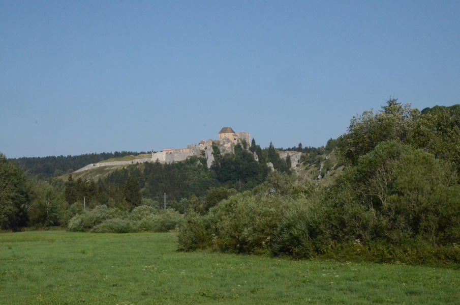
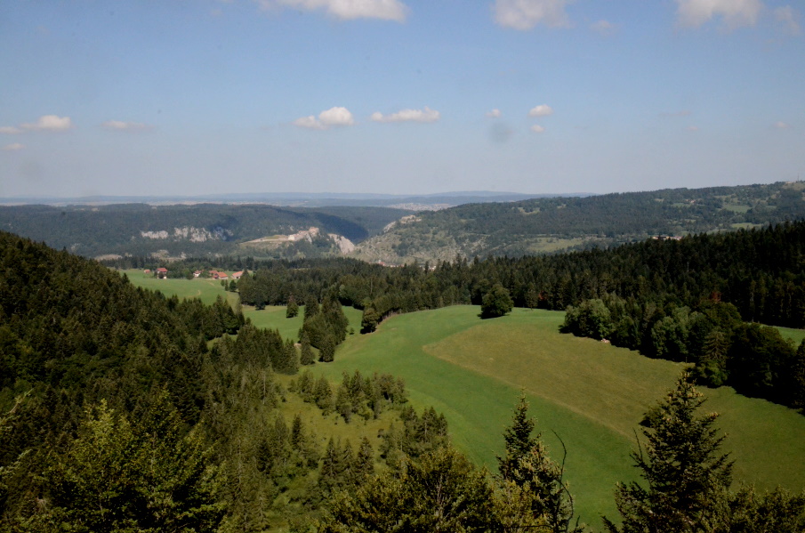
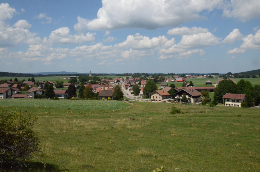
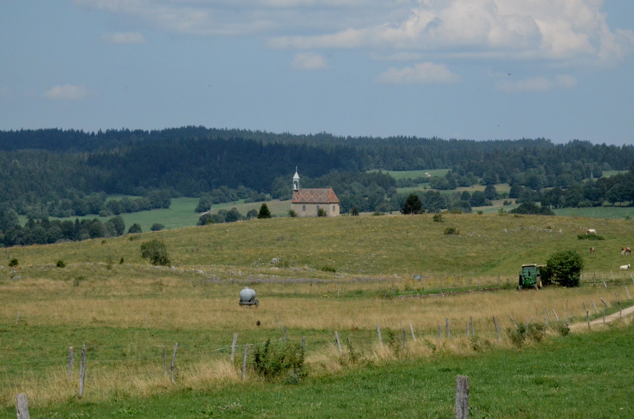
After a day of rest meant to observe whether my ankle is doing fine or not (and it is) we continue in good spirits. Normally we try to park the car somehwere and arrange transport to start and end point by public transport, but today that is going to be too time consuming. It is in fact possible: the bus from Les Hôpitaux-Neufs to Frasne, from there the train to Pontarlier and then the bus again to Le Frambourg. The only downside....this round trip will take 1.5 hours while Le Frambourg is at max 10 kms as the bird flies from Les Hôpitaux-Neufs where we are at the camping site. So, different from other stages, we are picked up by taxi from the camping site to bring us to the libary in Le Frambourg. That takes only 20 minutes....and 36 euro. Ok, that's a bummer. Before we hit the trail have to briefly go in the wrong direction to visit the bakery, but then we really are on our way. The first part through the village is just to stretch the legs but as soon as we passed under the railroad track it goes up. Not too bad, but markings are hard to find here. We really think we properly follow them but in the end our track is a dead end on a pasture so we clearly did miss a side path (or two). Should we go back? Well...to our right supposingly is the route (according to the GPS) and so we cross the pasture to the right were we indeed see a path, but quite far below us. So we decide to walk to the far end of the pasture parallel to what is supposed to be the real route and fortunately there is an open fence at that far end leading onto the next pasture, this time with cows, just to end up on at an electric cattle fence. It's just a single wire and quite high so we can pass underneath and with a little bit of cross country we arrive at the path that should be the GR5. But again we don't see any markers so we walk up and down the path a bit without success. Ok, enough time wasted: we can see the chapel of Montpetot and we know we have to pass it. Does it really matter whether we get to the chapel over the GR5 or some other path? So back to the pasture where by now the cows have approached out of curiosity. So we speed up, cross the pasture and we're back on the tarmac close to the chapel while the cows behind us hang over the fence, chewing on...whatever. Lupita felt a bit chased and needs a sip of water, but apart from that we're good. And we see markings again! At the chapel we have a short snack break, just sitting on the tarmac in the shadow, before we continue climbing. The first part out of Montpetot is seriously steep crossing another (cow-free) pasture just to continue as a forest track all the way to the top of the ridge. From here we follow the ridge over a double trail slowly climbing to the highest point of the ridge, the viewpoint Belvedere de la Roche Sarazine. We enjoy the view for a while until a French family joins us, with sigarets and their hands polluting our air. The descent to Les Fourgs is very gently following a tarmac road and soon we can see the village. It feels though whether we don't get any closer and a zig-zag in the road just before the village doesn't make that feeling any better. But we obviously get there and now have to look for a bar or restaurant....because we need a toilet. Since we have to walk quite a distance along the main street we gamble we'll pass something, and indeed we do. High time for 2 panaché and a sanitary stop. Yesterday Lupita asked me if there is a lot of climbing today and with half a glance on the map I estimated that there would be a considerable climb just out of Le Frambourg (and there was) and a minor climb after Les Fourgs. Now I'm confronted with that remark because leaving Les Fourgs behind we have to get up a serious hill to a chapel. We're soaking wet from sweating by the time we get to the chapel so we take a break in the shadow but in the cooling wind. After the chapel we follow a gravel road just to cross another pasture. There is no clear path but we see a passage out on the far end so that is probably where we have to go. Well, no, in the end we don't: we just follow the electric fence towards to woods while cows stare at us from the other side of the fence...chewing, of course. The forest track is, as usual, seriously deteriorated due to logging equipment and so we shuffle over the holes and ditches until we arrive at another small tarmac road where we turn right. We pass a small parking area at the Sapin President; a 41m high pine tree with the face of a former president carved in. Apart from a family having a barbecue there is nobody here....Hence we continue over the long open area in the bos follow some fence over a rather bumpy track. Just before the Farmhouse-Inn Le Vourbey we suddenly see that an electric cattle fence has been lead over the path. Apparently a farmer needed to fence of a piece of pasture, but using a thin red wire over a through-passing hiking trail is just not so friendly. With a stick I find on the ground I push the wire to the ground so that we can pass. Lupita steps over but kind of trips and the wire jumps up against my hand. ZZZapp...yep, it has electricity indeed! But ok, we passed the fence and we pass the farmhouse following a gravel road. Then we cross another pasture and go back into the woods follow a track that slowly becomes a narrow tarmac road. Finally we reach a real tarmac road (with cars!), rapidly descending. We can see the roofs of houses, so that must be Les Hôpitaux-Vieux. Nope, it isn't, it is the roofs of a hamlet called La Béridole and Les Hôpitaux-Vieux is still a bit further. We assume to gently walk into that village but at the biathlon traiing facility just before the village we have to turn left climbing towards the edge of the forest. Now we were already looking for a while for a place to sit and eat something but we hadn't found a proper spot yet. Well, on this little climb I get hunger struck and I drag myself to the forest where we sit on the ground in the shadow to munch away some granola bars. After this short stop the path appears to be rather level along the village before reaching the N57 main road. Using a narrow tarmac road we bridge the main road and rather sudden we're in Les Hópitaux-Neufs, our end point of today. It's another 300m to the camping site where we spend the rest of the afternoon barefoot with our legs up. |
    |
|||
|
|
||||