


Tuesday 31 July 2018
| Distance (km) | 26 kms | |||
| Distance (time) | 8 hrs | |||
| Climb / Descent | 860m / 730m | |||
| Hard / Soft surface | 35% / 65% | |||
| Landscape |
|
|||
| Weather |
|
|||
|
|
||||
|
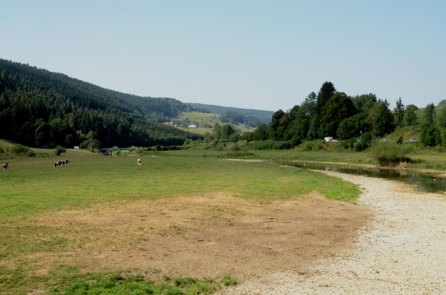
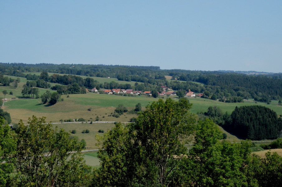
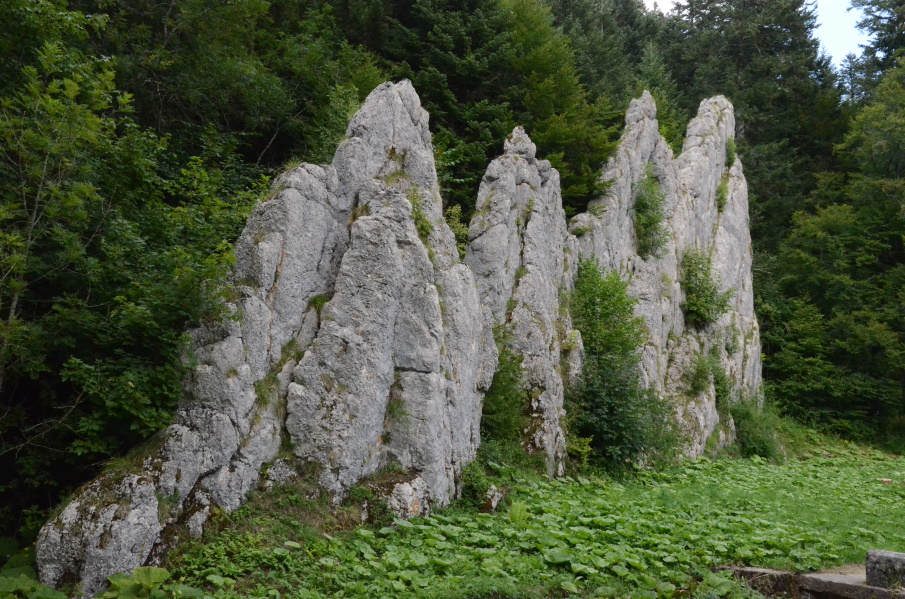
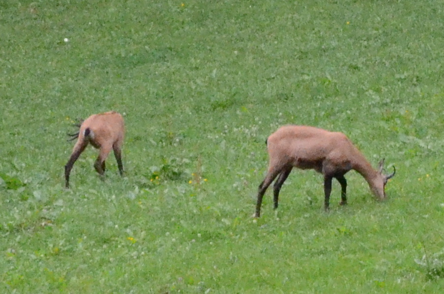
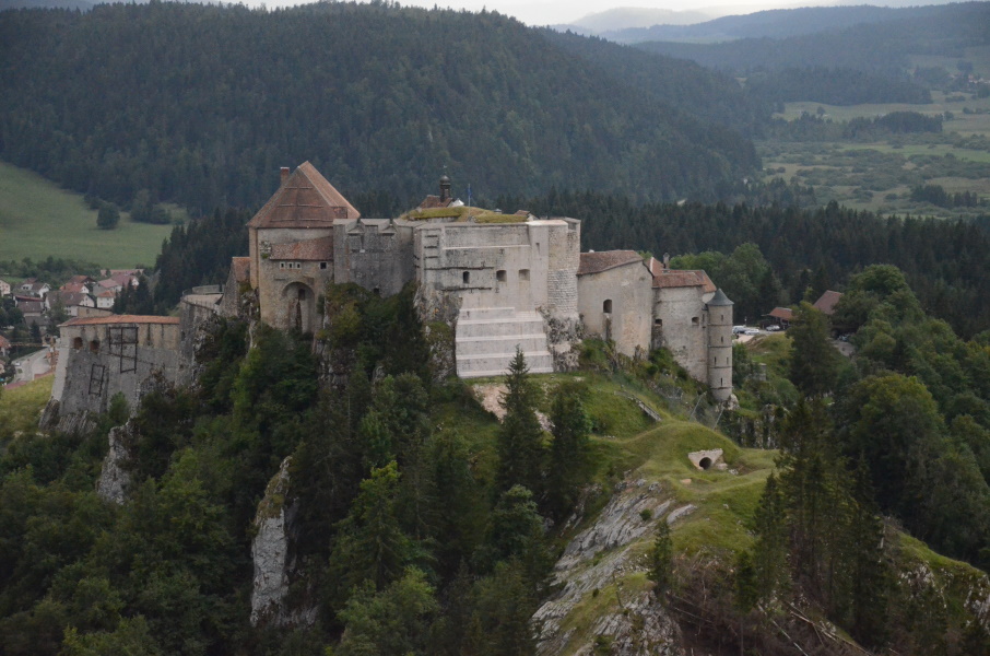
The first real walking day of the year after the short 9 kms trial walk we did yesterday. Normally we also walk for a week in May, but this year that was not an option as we were up to our necks in the boxes resulting from moving to our new house. Additional complications are that we hardly got any training this year as a result of the moving and that around 6 weeks before this trip I seriously overstretched my left ankle ligaments leading to a swollen foot for a couple of days. So we'll just have to wait and see how it will work out. We park the car in Le Frambourg in the morning and take the bus (a Swiss bus) to the railway station of Pontarlier where we have to wait just over half an hour for the bus to Morteau. I have a chat with the bus driver in the latter bus and before we know it we're dropped at the bus stop in Montbenoît. It's really going to happen now.... We get ourselves some croissants from the bakery next to the bus and start walking; it's 10:30, a bit later than we would have liked to. After the first few 100 meters over the tarmac we turn left crossing the Doubs and to our surprise it's completely dry. We knew that it's a warm and very dry summer this year but seeing the Doubs without water is something almost unheared of. It's also a sad sight as the dry or slightly muddy river bed is full of dead fish, mostly trout. Not exactly a happy start of the holiday. After crossing the river we immediately enter Lupita's favourite territory: cows! Already last year she discovered that though cows are pretty much harmless, they are very curious and quite big and intimidating. Therefore crossing pastures with cows on the loose is not her cup of tea. But this pasture is only small and the cows are far enough to the left to pass them unnoticed. We know we have to follow the Doubs somewhat before crossing over to Les Allies in the next value, but we had the hope that the route would either be rather flat until the final crossing over is made close to Maison-du-Bois, or that we already climb out of the valley before crossing over. Of course none of the two is the case: the route goes up and down a lot before finally turning southbound to Les Allies. It looked like we were already quite high above Maison-du-Bois, but nevertheless the track keeps going up and up through the forest and we really start wondering where on earth is the highest point. Well, it is where the track leaves the forest again. From here it's only 1.5 kms down to Les Allies; a tiny village without any facilities. We walked 9 kms now in half an hour longer than our hiking guide indicates so we're clearly not at our best. But late or not, we do need to stop and have something to eat here and by absence of a decent picknick table we sit ourselves on the ground in the shadow on the disabled parking spot next to the municipality house. Here in Les Allies we also join the main route of the GR5 again. Since Saut du Doubs we followed one of the official alternatives passing Morteau, but here in the village we're back on the main route. It starts with an easy part over tarmac, but soon we'll have to climb again. The weather is rather sticky with little wind so the rather steep tarmac road is quite hot and we're happy to have some trees for shadow. We walk at the same altitude for a while with quite some shadow, but then unfortunately we descent everything again (over a rather nasty stesp gravel path) and we're back at the road. From here it's a rather easy part until the narrow passage Defile d'Entreportes to bring us to the next valley once more. At the rock formation on the other side of the Defile we have a short break and there we see a sign to our final destination of today: Le Frambourg, still 10 kms to go. That is really a shock and disappointment because we were counting on 5-6 kms from here. Since it is 16 o'clock now we will probably be at the car around 18:30 or so. Lupita gets a mental breakdown but also realizes that there is not much we can do but going on.... We already saw at the map there there is another climb coming up and indeed. Fortunately it's actually not so bad: the first part on a gently climbinb tarmac road and but the time we get to a trail in the forest it is not that much higher anymore. And the good part is: once we're at the summit we arrive at a nice almost flat gravel road that brings us all the way to the Mahler fortress that is located high abouve Le Frambourg. And so we walk to the fortress while the originally blue sky slowly turns white and later even grey. We spot some deer and take a break to watch and take some picture. At the fortress we're really tired but decided to stop for some sightseeing. After a couple of minutes it suddenly starts to rain but we find it more refreshing than actually bothersome and after 10 minutes or so it stops again. The descent to Le Frambourg is nice and gently, which is very nice. We had bad memories of the steep final descents of several stages in the Vosges, but here it is nothing like that. At 18:30 sharp we arrive at the car that we parked next to the library. We still need to get to a supermarket so we're not completely done yet, but we can conclude it was a little bit too tough today for a first stage. |
     |
|||
|
|
||||