


Thursday 30 July 2015
| Distance (km) | 31 kms | |||
| Distance (time) | 7 hrs | |||
| Climb / Descent | 500m / 540m | |||
| Hard / Soft surface | 30% / 70% | |||
| Landscape |
|
|||
| Weather |
|
|||
|
|
||||
|
A long day ahead that starts with a short walk to the railway station in Liverdun. We have never walked more than 26 kms on a day and today we should break that record. At the railway station we find out there is no ticket machine and so we board the train without a ticket at just after 8 o'clock to go to Nancy. No check is done and so we arrive for free in Nancy where wo do buy tickets to Pont-a-Mousson. We have to wait half an hour for the train and that leaves me time to tape my feet. In Pont-a-Mousson we then have to wait 15 minutes for the bus to Montauville. And hey, we have the same driver as 2 days ago from Montauville to Pont-a-Mousson. We step out at the end point next to the monument and we're directly on the GR5 again.
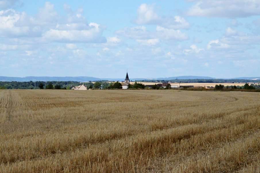
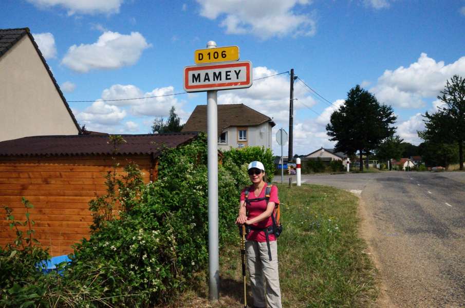
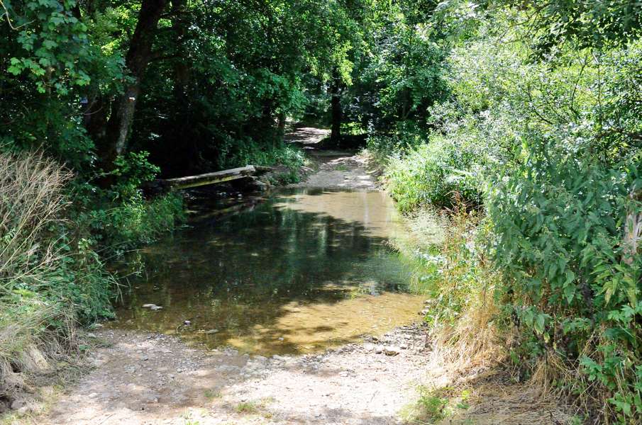
A long and straight climbing track leads us west. It is very warm when walking in the sun but then on the other hand rather chilly in the shadow. At the farmhouse St.Pierre we should go straight ahead but somebody decided to use the path as storage of 4 stacks of broken tarmac and so we have to walk on the side of it through the stinging nettles just to end up at the busy D958 main road. We follow the main road about 100m and then turn left into a narrow path that is heavily overgrown with bushes. A mountain biker in the other direction came to the same discovery and decided to walk taking the bicycle by the hand. Once in the forest the path becomes a real forest track and when we turn right at the crossing onto the Tranchée de Mamey we're on a gravel road. Mamey as a village is not worth mentioning: just a large group of houses without a centre. The name makes Lupita raise the eyebrows: mamey is a tropical fruit in South America and it's a bit strange to find a village called like that. After the village we descend into the forest until we cross a stream at the lowest point of the gravel track. Here we have to turn left onto a forest path and now we walk for kilometers very nice through the forest along the stream. If the whole day is like this the 30 kms is going to be a piece of cake! We leave the forest at the hamlet St.Jean and cross the Esch stream, by now a small river, twice before reaching Martincourt. Again a village without much going on (there is a pub but it looks like it has been closed indefinitely) but beautifully located in the valley. We decide to have a serious lunch break here and so we dig up the cheese and sandwiches from our backpacks. We rest over half an hour here before moving on. We have to cross the Esch again at a ford with also a very narrow little bridge. There is nothing wrong with the bridge, but to get to the bridge we have to do some clambering to get onto it. Probably just crossing the ford is easier but Lupita has leaking shoes and is not in the mood for wet socks. After the bridge the path follows the river for quite a while before we steeply climb through the forest to Rogéville where we leave the forest again. After crossing the busy D10 we walk over a cart track through the fields to Rosières-en-Haye. Again there is little to do here but we do find a bench in the shadow close to the church to have something to drink. We have to cross another busy road after which we slowly descend into the forest again. It loops through the forest for a while until we suddenly have to turn left and up. It is not even a very steep or long climb but it is very warm and the distance starts adding up. We now pass La Champagne, a suburb of Liverdun one could say. The forest track turns into a tarmac road and the feet are not amused. From here it is still a few kilometers tarmac along the main road and through the downtown of Liverdun to get to the railway station. We limp and stumble and continue to the camping site. The last part along the road was really a killer but we broke our record of "longest stage". |
    |
|||
|
|
||||
Download track MonLiv.gpx