


Saturday 19 August 2017
| Distance (km) | 19 kms | |||
| Distance (time) | 5 hrs | |||
| Climb / Descent | 520m / 500m | |||
| Hard / Soft surface | 55% / 45% | |||
| Landscape |
|
|||
| Weather |
|
|||
|
|
||||
|
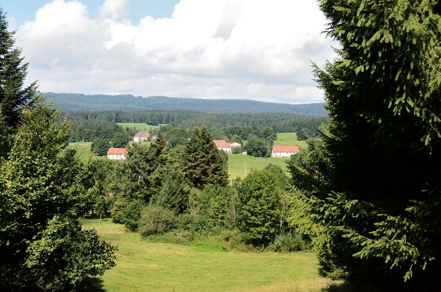
Today is Lupita's birthday, so what are we going to do? Indeed.....hiking. Not on my request, she really wanted it herself. We drive off the camping site at 8 to park the car in Montbenoît and take the bus back to Morteau at 8:39. It's overcast and while waiting at the bus stop it starts to rain. Why did we want to walk again? So back in Morteau we decide to hop on the camping site again to pick up our rain coats, you never know. And since we're there we might as well have breakfast 2.0 before leaving at around 9:30. We don't really feel like climbing all the way through Morteau to get to the point where we left the GR5, at almost the highest point of the town, knowing that the GR5 will come down to almost the bottom of the valley. So wat we do instead is to shortcut the route. We just climb until the church where we encounter yellow/blue signs leading to Pont-de-la-Roche and we decide to follow those signs. Even before reaching the last houses of the town we have to veer right onto a trail that climbs a bit before levelling. Until some canopy zip-line we remain level, but then it climbs rather steeply until we reach the GR5 trail. Great, we're back on track!. We get another (short) flattish section but just above Pont de la Roche the trail climbs straight and steeply. At first we think it's just another little climb, but it just keeps going up and up. After already quite some climbing we encounter a deer about 50m ahead on the track. We sneak closer to make a picture, but of course it hears us and jumps into the forest. Too bad, let's move on then. By now we see more and more open patches in the forest which is usually a sign we're almost at the summit. But no, the track just keeps climbing until we finally reach a farmhouse where we really reach the highest point. And the good part is that the landscape opens up here. We like the forest, but sometimes one wants a bit of a view as well. And getting closer to Combe d'Abondance the views over this small valley with farmhouses is only getting better. Combe d'Abondance it self is hardly a village. Officially the horse riding centre also has a restaurant and since it's Lupita's birthday we would like to see if we can get a cup of coffee and some cake. But whether there actually is a restaurant and if it is open we can't figure out as we can't even find the entrance. So let's forget about it.... From here it is tarmac and more tarmac to Remonot and further. After Remonot we cross the railroad and we decide to have a short break. During our break the train to Besançon passes and we wave to the train driver who waves back. Then we move on again following a long climbing stretch of tarmac to the farmhouse Le Crêt l'Agneau and the hamlet Les Auberges. Here we cross the old railroad line from Pontarlier to Gilley, that nowadays is a cycle path. And yes, it's tar sealed. We follow the cycle path until we have to turn left into a pasture. We now get an unsealed part to a viewpoint where we are supposed to admire the rock formations of the é d'Entre Roches. But in the end the track just leads to the parking along the D437 and the view is just wat we had already seen from the car. Furthermore one can't really shoot a nice photo here without having a motorised fridge or large of tarmac on it. Hence, we feel cheated: the descent was not worth it, let alone the climb that is still to come. And so we climb out of the valley again towards Les Travers where we join the old railroad track again to lead us around Ville-du-Pont. Slightly limping from the sour feet we enter Montbenoîum;t and get to our car. It's 15:00 now and we've not finished that early yet this holiday! So way before 16:00 we're showered and sitting in front of our tent. Nice and relaxed! In the evening we find a local restaurant and enjoy a far to large tartiflette with a glass of wine. To celebrate Lupita's birthday in style and to celebrate our last walking day of 2017. Next year we'll continue to Lake Geneva. |
 |
|||
|
|
||||