


Tuesday 7 August 2018
| Distance (km) | 22 kms | |||
| Distance (time) | 5 hrs | |||
| Climb / Descent | 470m / 300m | |||
| Hard / Soft surface | 35% / 65% | |||
| Landscape |
|
|||
| Weather |
|
|||
|
|
||||
|
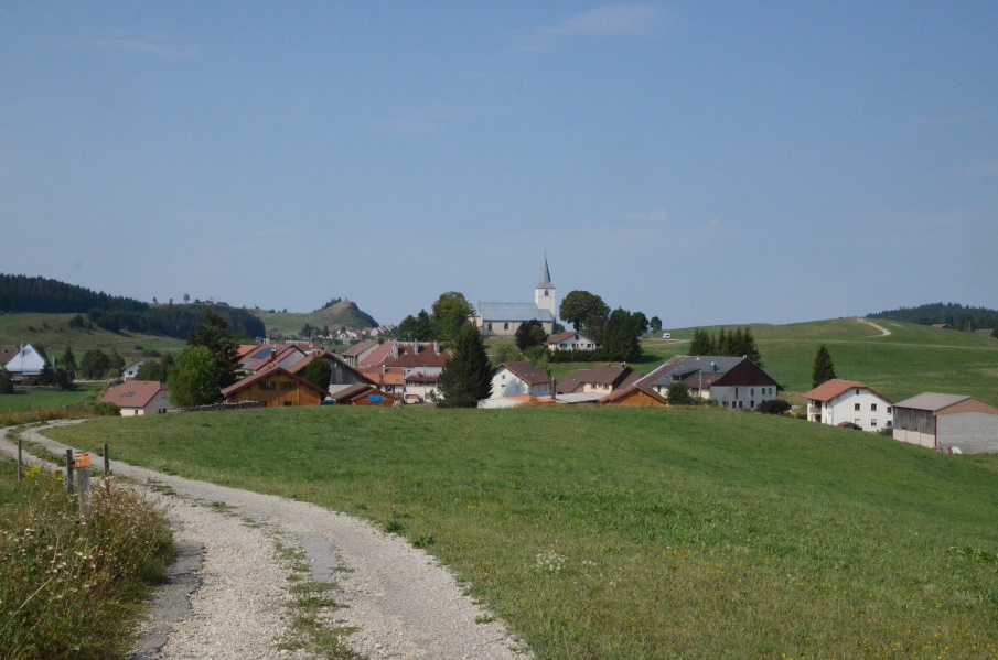
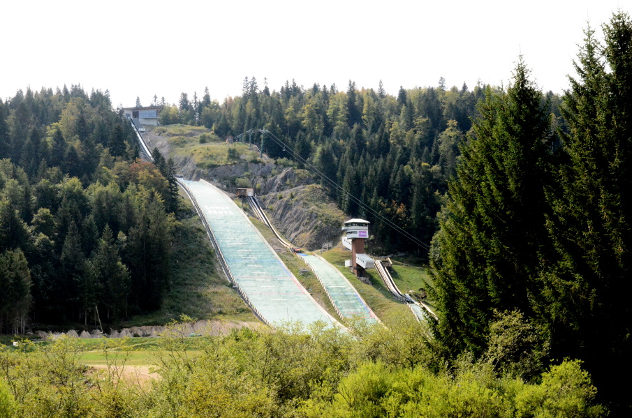
After some serious thunder and rain during the night it is suprisingly sunny again in the morning. We have breakfast, again at half past 7; it seems impossible to get breakfast any earlier, and we gather our stuff. Today is supposed to be the easiest day of our three-days-in-a-row walk but we have said that before in the past a reality was not always accordingly. It takes a bit of effort to actually leave because our land lady finds out Lupita is from Mexico and so she shows up with a photo book of a trip to Mexico she made like 30 years ago and of course out of politeness we have to have a quick look. But ok, by 9 we are really on the way. We pass through the village and walk along a straight road towards the edge of the forest. We have already walked this part in 2011 and it is interesting to do it again now 7 years later. Some things I recognize immediately, like the wood board bridge over the small stream Cul du Bief. But what I didn't remember was that the track goes up and down; in my memory it was flat until Chaux-Neuve. So that is what they mean with "selective memory"...? What we do both remember very well is the last kms to Chaux-Neuve when walking along the stream Cébriot because in 2011 they were mowing the grass here so that Lupita had very teary eyes (she's allergic to grass) and we entered the village sniffing and crying. That is not a problem this year. In Chaux-Neuve we sit at the corner of the only crossing in the village at the gas station and grocery store to have a bite. We wlll leave the path we walked in 2011 here; back then we went to Chatelblanc and Foncines-le-Haut. This time we head for the edge of the valley knowing that at some point we have to leave the valley so we will get a serious climb. We first pass a ski jump site and then we pass through a quiet open area in between two hill sides just to arrive at another gravel road. At this point I'm molested by a lady on a mountainbike that excuses hereself by stating she doesn't have a bell on her bike. Well, then buy one, or shout "ring-ring" or so. But just hit my left walking pole under the excuse of lacking a bell is complete nonsense. Anyway....we are again entering the forest on a narrow track and we are still not climbing out of the valley. That changes though when we arrive at a narrow tarmac road. We turn left here and the road starts to climb....and climb, and climb. It seems without end! It's not steep, or at least most of it isn't, but every time we think we reached the highest point because the road flattens there is another curve and another climbing bit. In the end the climb is about 2.5-3 kms until we reach the high point where we take a break. We strecth ourselves in the soft layer of leaves along the road and have a muesli bar, which turns into a 30 minutes break. But we have time. From here on it's a matter of descending to Chapelle. The tarmac road has turned into a track since we reached the highest point and we just keep following it. It is pretty much level and so we slowly leave the forest where the track turns into a tarmac road. We can see the tip of the church tower of Chapelle in the distance and so we enter the village around 4pm. It's a tiny village but it does have 2 hotels. We made reservations in "Les Clochettes du Risoux" run by an enthusiastic French/English couple. A hot shower and a very nice dinner was just what we needed... |
    |
|||
|
|
||||