


Thursday 7 August 2014
| Distance (km) | 21 kms | |||
| Distance (time) | 7.5 hrs | |||
| Climb / Descent | 939m / 980m | |||
| Hard / Soft surface | 50% / 50% | |||
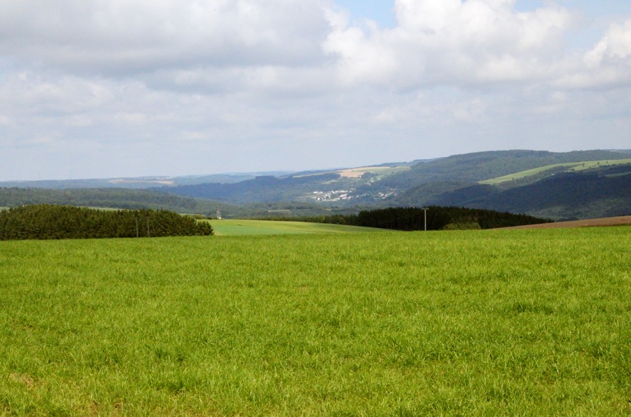
| Landscape |
|
|||
| Weather |
|
|||
|
|
||||
|
The next morning we have to reorganise. We decide to take the car to Vianden and from there take the bus to Obereisenbach and walk back to Vianden with just a daypack. There aren't that many buses from Vianden to Obereisenbach and so we can choose beteen 8:45 or 10:45. Since the hotel serves breakfast starting from 7:30 it seems unlikely we can make it to the 8:45 bus and so 10:45 it is. We pay the hotel (with bank card this time) and leave for Vianden. We are right on time at the bus stop and we arrive around 11 o'clock in Obereisenbach on what appears to become a nice sunny day. We have to pass by the camping site to return the key of the shower and so we walk into the reception and find the same lady as yesterday, but clearly in better mood today. She had noticed we had left and I apologize for not letting her know. Not a problem and she wants to pay us back our money. Well, that is not strictly necessary: we had paid for the camping and it was our decision to leave. But no, no discussion possible, we didn't use that camping site so we shouldn't have to pay. Wow, very friendly!
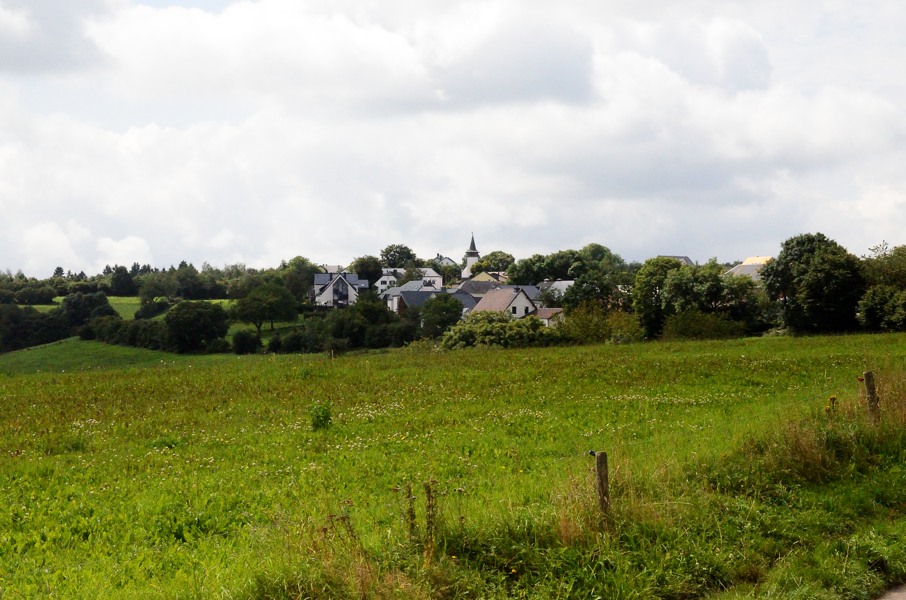
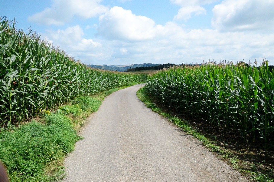
And then we leave! A short piece along the N10 to Untereisenbach before taking a tarmac side road going up to Wahlhausen. We catching up with a Belgian family that would like to walk a round tour but they have neither map nor GPS. We explain that they could go to Wahlhausen just like us, then descend to Gemund and return along the main road (on foot or by bus) to Untereisenbach. They seem to like the idea and they follow us. Now the GR5 shortcuts a large hairpin in the road to Wahlhausen and the shortcut is really steep. Both sons of the family can follow, but the parents fall behind. Back onto the tarmac road we just have to keep following it to Wahlhausen. It's a pretty long climb and we're being pestered by stinging flies. Finally one manages to bore himself into my elbow, the bastard. We're so happy to be up in the fields and catch some wind. In Wahlhausen the route sharply turns left but we decide to enter the village to have a drink in the only bar as it is quite warm. After a short stop we move on and everything we have climbed we can now descend again to rejoin the N10 at Gemund, only a few kilometers from Untereisenbach. Not very efficient. At Gemund we catch up with the Belgian family again who's having lunch. We wish each other a great walk and continue along the maind road. Only a short distance further we leave the N10 again over a narrow climbing tarmac forest road. Only just a bit further we also leave this little road and go onto a forest track. It climbs a bit more before flattening and we have an enjoyable walk high above the N10. That fun doesn't last very long. The path goes all the way down to cross a stream and then goes back up to become flat again. And then again we get a long descent to cross a stream. At the other side of the stream the climb is \bloody steep in hairpins up the hillside. This is really disappointing and it takes a while to get up the hillside before having a flat path again. In the end we descend to Stolzembourg but the last part took us considerably longer than expected. It is just after 15:00 now and we hadn't expected that. Furthermore it is warm (26-27 degrees centigrade), no wind and humid. Not the best weather for a walk. During our short stop with cold coke in Stolzembourg we decide to walk on in spite of a long climb to Niklosbierg ahead of us. So...off we go! We leave Stolzembourg following a climbing tarmac road and exchange it for a forest path. The path climbs not too steep. Later we get back to a tarmac road that changes to gravel road further on. All of this is climbing, but not te strenuous. We can see we're approaching the basin of Niklosberg quite fast and conclude that it is all not so bad. Right...until we leave the gravel track and descend and descend over a narrow trail. Why of why? The gravel track, according to the map, loops around and ends up just west from Niklosbierg. Nothing wrong with that. But no, we have to descend all the way to a small stream and then have to climb all that again over a narrow, steep, muddy and above all very slippery trail. Finally we cross a wider trail with a bench. There is a sign here indicating Vianden to the left and Niklosbierg another 700m further up. Lupita sits down on the bench and sighs "we made it". Nope...we're not going to Vianden from here but we have to get the 700m up. An instant depression is the result and we struggle and slide another 700m to reach the Niklosbierg basin. Apart from a great panorama there is nothing here, so we enjoy the view and take our last sip of drink. The next kilometer we walk along the rather busy road that passes along the basin. Not very pleasant, but at least flat and we can appreciate that right now. Then we turn left into a small descending tarmac road that goes to Bivels. But before actually getting there we have to turn right into a forest track. This track keeps descending until we're above the Vianden reservoir. We now have to loop around the power plant and that is a long loop with some climbing. Behind the power plant it really starts climbing and the trail splits at a high voltage mast. There is a sign pointing straight ahead in the middle of the split and attached at the left side of the pole. So one can only see the sign when taking the left trail at the split, hence we conclude we have to go left. This is reasonably flat and even starts descending to the lake. That is not what we want because we have to go up to the castle of Vianden. Maybe we should have taken the right trail at the split, though that would have been unlogic. We look up through the forest and see another track high above us. Hmmm, maybe we should just cut across? And so we traverse through the forest with ankle deep leafs towards the track above us. And indeed, yellow circles again..! So the sign at the split is just wrong. Now walking over the correct path we pass a small chapel and follow the access road to the chapel. A bit further the GR5 turns right and goes almost vertically up. I check the map and see that a few hundred meters further it rejoins the road again. We look at the steep track again and decide to go on strike. No more useless climbs! We are tired and it's late so we just walk the access road and indeed the GR5 rejoins the access road just before the castle of Vianden. Maybe we missed a great view, but too bad. From the castle the GR5 continues at that altitude but our car is down by the river. So we leave the GR5 and walk along the cobble stone road down. Close to the bridge over the river we can't resist the temptation of an ice cream store and buy a large ball of limoncello ice cream each. We had already decided to pitch the tent at the camping site of Born (close to Wasserbillig) since we have to continue from there 2 days from now anyway. That is a 45 minutes drive however, and so it is 20:30 when our tent is finally pitched. Just on time to order a large schnitzelf from the restaurant at the camping site. |
   |
|||
|
|
||||
Download track ObeVia.gpx