


Tuesday 28 July 2015
| Distance (km) | 21 kms | |||
| Distance (time) | 5 hrs | |||
| Climb / Descent | 600m / 530m | |||
| Hard / Soft surface | 45% / 55% | |||
| Landscape |
|
|||
| Weather |
|
|||
|
|
||||
|
After all emotion of yesterday we decide to just go on today again. We drive to Montauville and park the car in the far west of the village at the monument for victims of both world wars. From here there is bus 3 going to the railway station in Pont-a-Mousson from where we can take the train to Pagny.
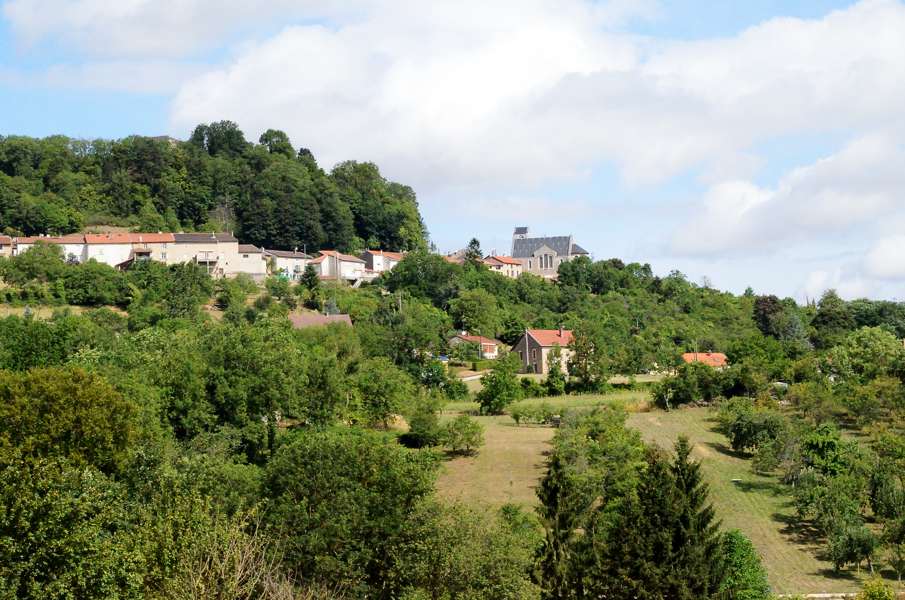
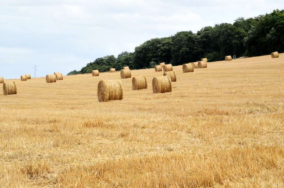
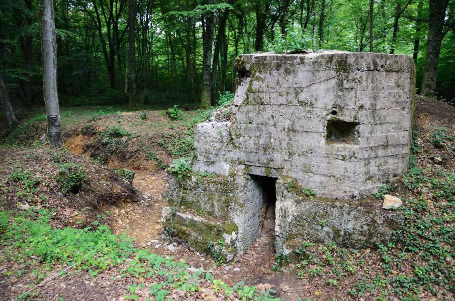
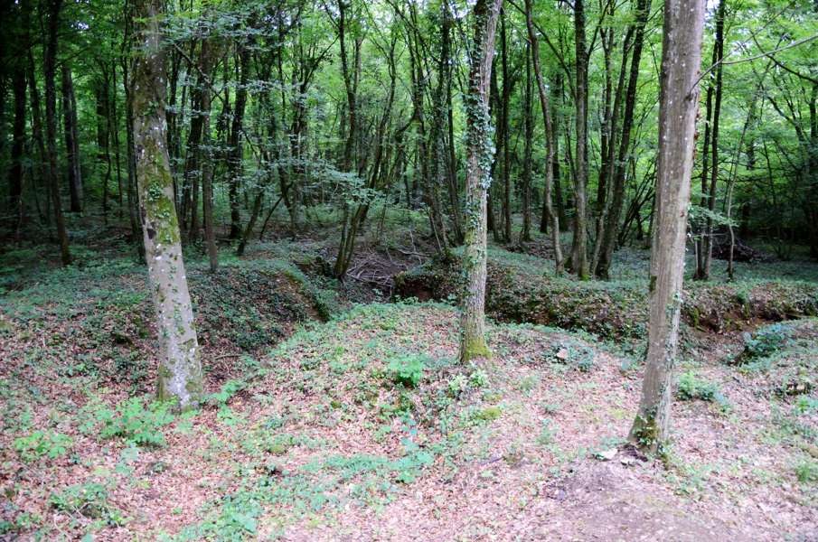
I Pagny we first have to walk a kilometer back to the GR5 before walking through the vineyards around Pagny. The road climbs gently into the forest before turning right after which a steep climb follows to the edge of the village Prény. Here the GR5 takes steep stairs up to the old castle ruin above the village, and the descends again to the other side of the village. It is possible to just follow the road through the village and save yourself the climb. We now follow a narrow path going steeply down while leaving Prény and we reach the lowest point at a mill next to a pond. And immediately the road goes up again to the TGV (high speed railroad) track and beyond. We're doing quite some climbing here in only the first part of today's stage. A long section through the forest now follows and actually this part is not so interesting. First we walk over and overgrown and straight cart track with dense woods on either side, completely blocking the view. Then we walk through what is almost a tunnel of branches. Suddenly we arrive on a non-paved road and we are now at Les Quatre Chemins: not much more than a crossing of non-paved roads in the forest. We have a short break here for a bite and continue into the forest. The road now descends, first gently and then steeper and ends at a large farm house. The map and the guide don't agree on how the GR5 proceeds from here: into the forest (the guide) or around the forest (the map). The map wins: the signposting is around the forest and actually a sign says this is a new route. Good! That saves us a steep climb as mentioned in the guide and it is also a kilometer shorter to Vilcey-sur-Trey. In the village we shortly stop for a sip of water and walk out of the village and into the forest again. It's climbing a lot here and in the damp forest that means sweating. Left and right we see ditches and other things that resemble a lot trenches from the 1st world war. Going further into the forest we know for sure: the forest is really full of trenches. We pass an old bunker that we have a closer look at. I have seen trenches in the forest before close to Verdun but Lupita sees this for the first time in her life and seriously impressed. Eventually we arrive at the Croix des Carmes: a monument for the battle that was here between the Germans and the French when the Germans tried to force a way to get to Paris but where stopped by a local French regiment. It is hard to imagine that it took an 18 months battle just to conquer this single hill (Bois de Prêtre). When we descend to Montauville we stop at an information panel when a forest ranger pops up asking if we have questions. Ehm, no, not really? He beckons us and start explaining about the trenches. We follow him into the forest and he shows us positions for shooters, the remains of a guard post and an underground shelter. Here the forest is littered with steel crosses and barb wire, very impressive. He points out where the front line was and tells hime we're actually walking through a German trench now and he points out where the French trenches were, about 100m further in the forest. And so we get a 30 minutes tour and learn a lot about how and why there was so much battle on this hill. We thank the ranger for all his explanation and when we walk on we see trenches everywhere. The forest that looked so peacefull with singing birds suddenly lost a lot of its innocence. And that is not improving when we pass the militairy cementary of Pétant. Before we realise it we're back at the car and our walking is done for today. Again a special day though for completely different reasons than yesterday. |
    |
|||
|
|
||||
Download track PagMon.gpx