


Tuesday 3 August 2021
| Distance (km) | 16 kms | |||
| Distance (time) | 8 hrs | |||
| Climb / Descent | 1100m / 1000m | |||
| Hard / Soft surface | 10% / 90% | |||
| Landscape |
|
|||
| Weather |
|
|||
|
|
||||
|
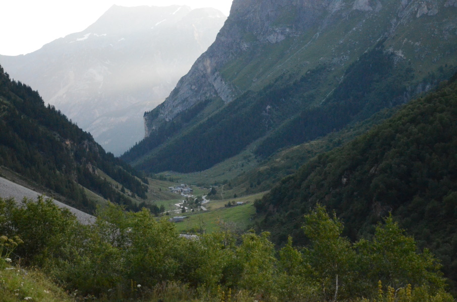
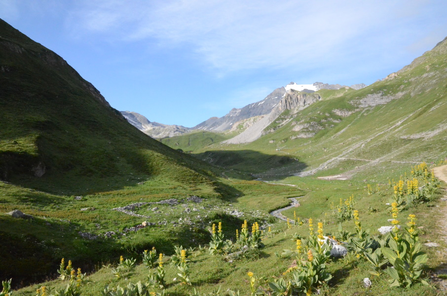
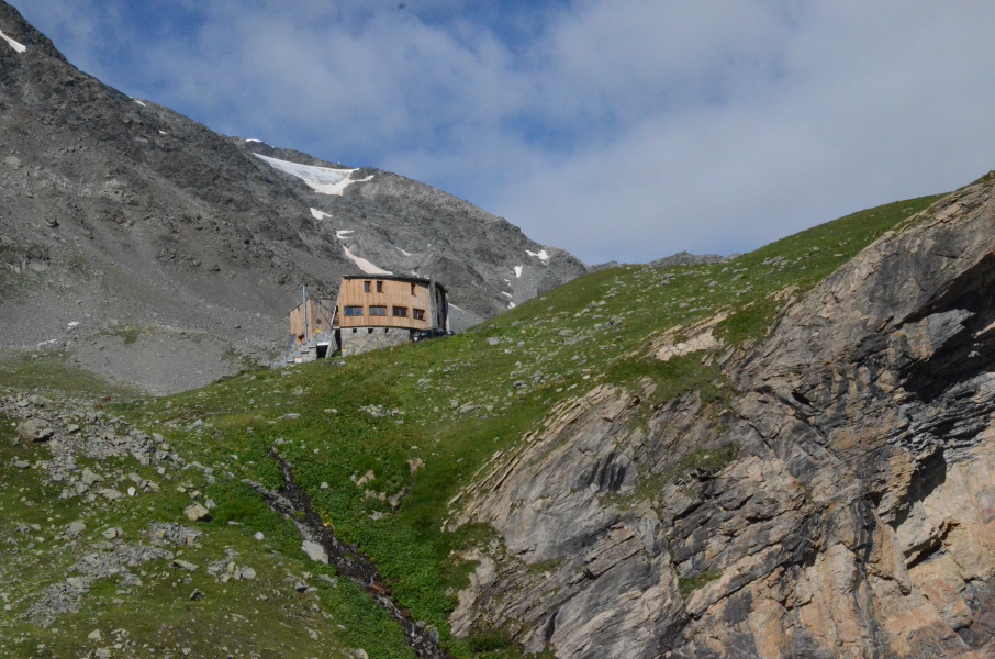
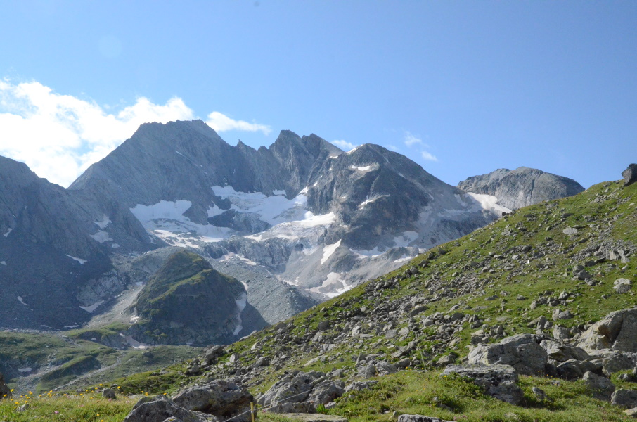
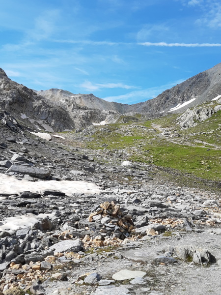
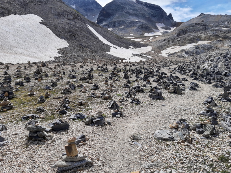
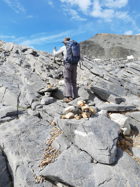
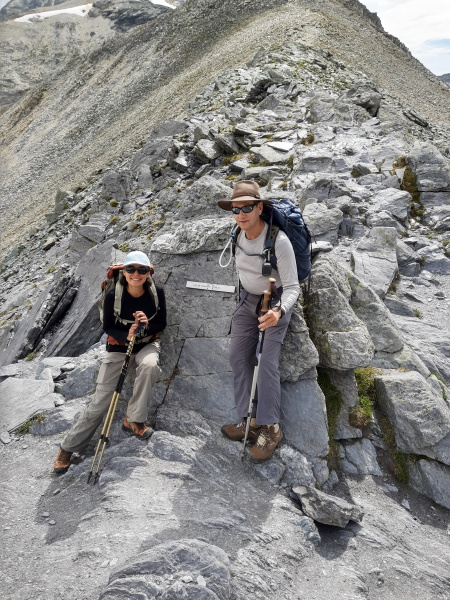
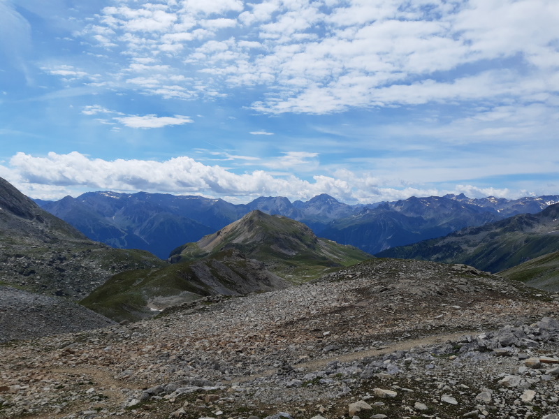
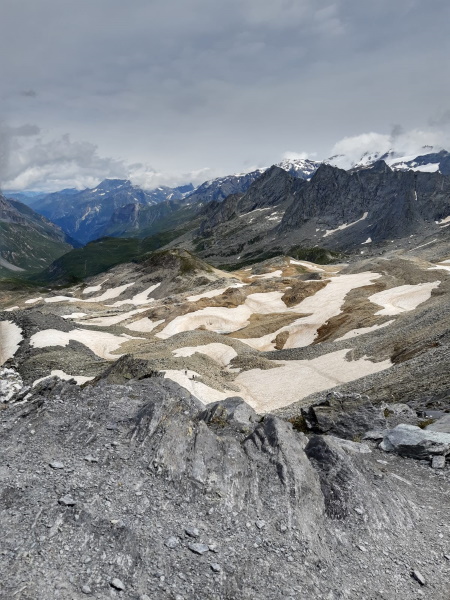
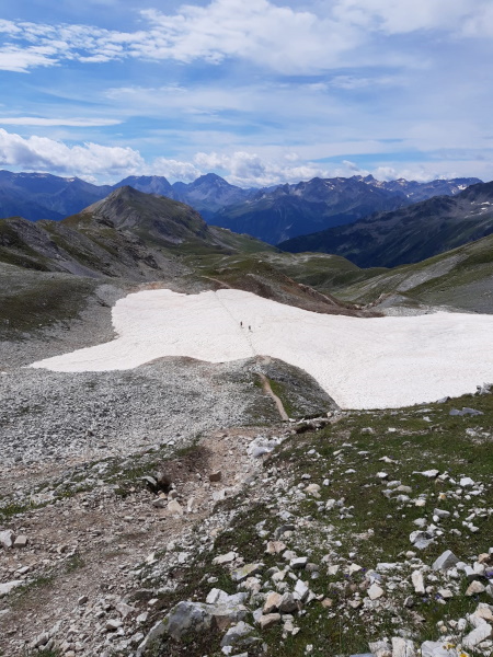
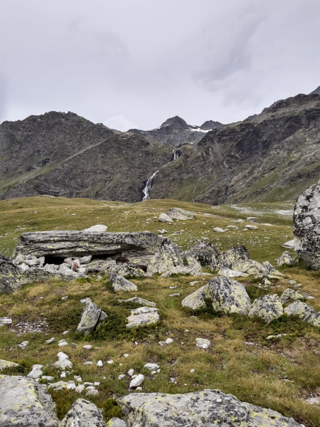
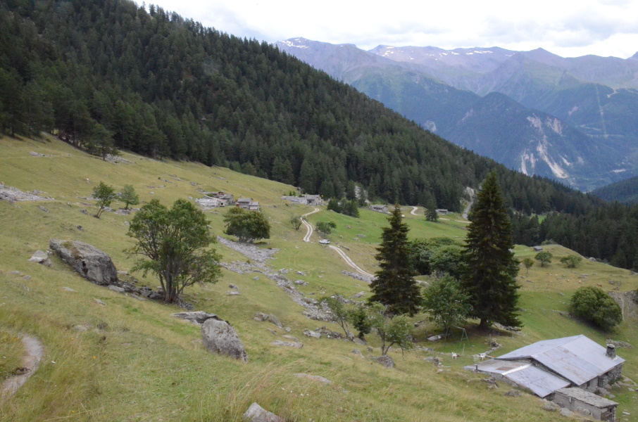
Once more we have to get up early, and too early for breakfast in the hotel. So yesterday we visited the local supermarket for some chocolate breads that we now have for breakfast while seated on the edge of the bed. When we go downstairs just before 7 Stefan is already waiting for us and only 10 minutes later we're at the parking just beyond Les Prioux. We say goodbye and we're on our way again. According to the guide the path gently rises in the valley. Well....from where we started it goes up steeply on an unpaved road and it keeps doing so until Refuge du Roc de la Perche. From there indeed it become a 4x4 track that gently climbs upstream. The road is long, very long. One can see the path in the far distance and indeed it gains altitude only very slowly. Until about 2200m altitude that path mostly is about making distance rather than altitude (though you're now 400m higher than Les Prioux). At the first hairpins it gets steeper and the 4x4 track deteriorates. There are some straight angles in the road and at 2400m the track turns right to Refuge de Péclet-Polset. We turn left here, a narrow walking path to Col de Chavière. The first part climbs to approximately 2500m after which there is a mostly undulating part with an occasional steeper little climb. The first climb is a debris slope with an impressively large cairn at the top. So that is where we have to go, but the path to do so is not so clear.It starts with a few switchbacks and then there is just rock. We try to find the best way up and then suddenly there is a path again. Out of breath we arrive at the cairn, we're now at 2600m altitude. Another flatter piece and here some people got wild: there are hundreds of cairns here aligned on a flat field. The combination of the silence, the moon-like landscape and the cairns is eerie. After this strange part we're now facing a rocky wall where again the path is unclear. There are some cairns here and there and we trial-and-find the best way up again. It takes some scrambling with hands and feet to get to the top. It's not dangerous, but at least adventurous. Another piece of "normal" path with a small snow field brings us at the foot of the final ridge. It is a very steep debris slop with a very narrow little track going up to a pass that is about 100m above us. Well, let's hope for the best... The first bit is hands and feet as it's just too steep. After that it eases somewhat but the track is the ultimate balcony track but then as wide as the width of my shoe. So we have to literally catwalk up with hands and feet and only the last dozen meters is easier. Lupita is pushing on, but I know she really really doesn't like this at all. But the problem is...we're here now and returning to Pralognan is not really an option. The pass itself is a small nodge in a narrow ridge. There is a tiny sign mentioning we're at 2792m altitude: higher than the Col de l'Iseran and thus our new altitude record on the GR5(5) to the south. From the other side some hikers make it to the top and so we take pictures of each other. The descent on the other side is a lot better than the climb we did, but still very very steep and now also some more walkers are coming up while passing each other is a challenge here. We're kind of shuffling down until the path becomes less steep and slightly wider. At 2640m we cross a large snow field and since it is indeed somewhat flatter here we decide to have a break and something to eat. In the meantime the wind has picked up considerably and we need to put jackets on. The sky is also slowly changing from blue to white and there are some clouds around the highest peaks. We had some hope that the weather forecast would be totally wrong, but now it does seem the weather is going to change. And so we push on down to some plane at 2500m altitude around Partie lake (with a lot of people having a picknick). This is where the path splits: straight ahead goes to Refuge de l'Orgère and connects to the GR5 there and to the right is the GR55 (though the signpost doesn't mention it) to Polset. So we go right.... The question is, did we already pass the worst part of the climb or is that still to come? For now we descend in short bits over the plain in the direction of the edge of the plain, after which the path goes over the edge. That might be a nasty part....and it is. Very eroded, lots of stones and many high (or deep) steps down. My right ankle that was fine yesterday is now playing up again. Every time I take a deep step down with my left foot first, my right foot hurts because it has to bend quite a bit relative to my lower leg. Of course the solution is to then always step down with my right foot first, but the thing is that I'm very lefthanded (leftfooted) and I automatically take large steps always with my left foot first and just try to force yourself not to do so... Anyway, the descent is an effort, but more because of my foot than because of the path itself. Finaly we end up high above the stream and there the path remains pretty much at the same altitude. We enter the woods now and with the flat path the stream is deeper and deeper below us since we walk in downstream direction. Only just before Polset it descends again, but thankfully not so steep and not so stoney. At 3pm we enter Polset (that is quite pretentious for 5 houses and a restaurant) and though the wind is getting stronger and stronger and the sky is now completely grey, it still doesn't rain. We have over 1.5 hours to kill before the bus comes and so we hit the terrace of the restaurant for a chocolate and raspberry pancake and an ice tea....we got to do something in 1.5 hours. The owner brings binoculars because on the slope in front of the terrace there is a deer family. And indeed, the male (with big antlers), female and 2 bambis are just lying on the slope in between rocks and grass. A nice picture. At 4:15pm we walk to the bus stop that is a bit further down along the tarmac road. It is still not raining. The bus (well, a black unmarked Mercedes minivan - I feel like being kidnapped) is early, at least 15 minutes early. And so we are at 5pm in Modane were indeed it starts raining now. And it still does when we step in the bus half an hour later and by the time we step out in Termignon it's seriously bucketing. We made it dry as we intended. Now we only have to shower and cook dinner in the rain. |
             |
|||
|
|
||||
Download track PriPol.gpx