


Wednesday 21 July 2021
| Distance (km) | 16 kms | |||
| Distance (time) | 7 hrs | |||
| Climb / Descent | 1250m / 630m | |||
| Hard / Soft surface | 10% / 90% | |||
| Landscape |
|
|||
| Weather |
|
|||
|
|
||||
|
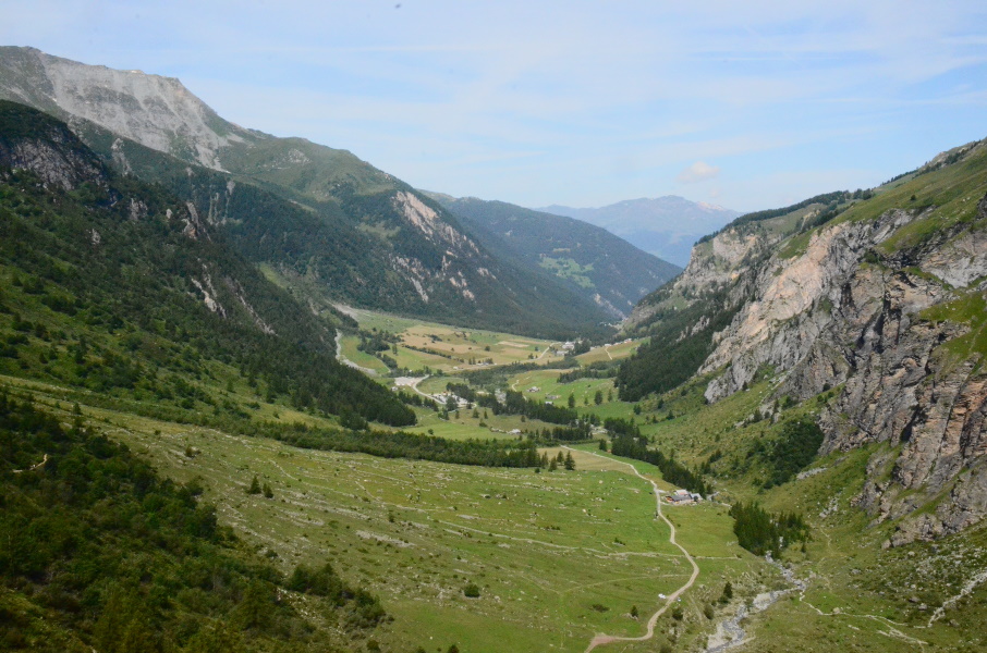
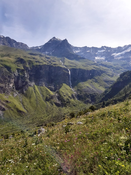
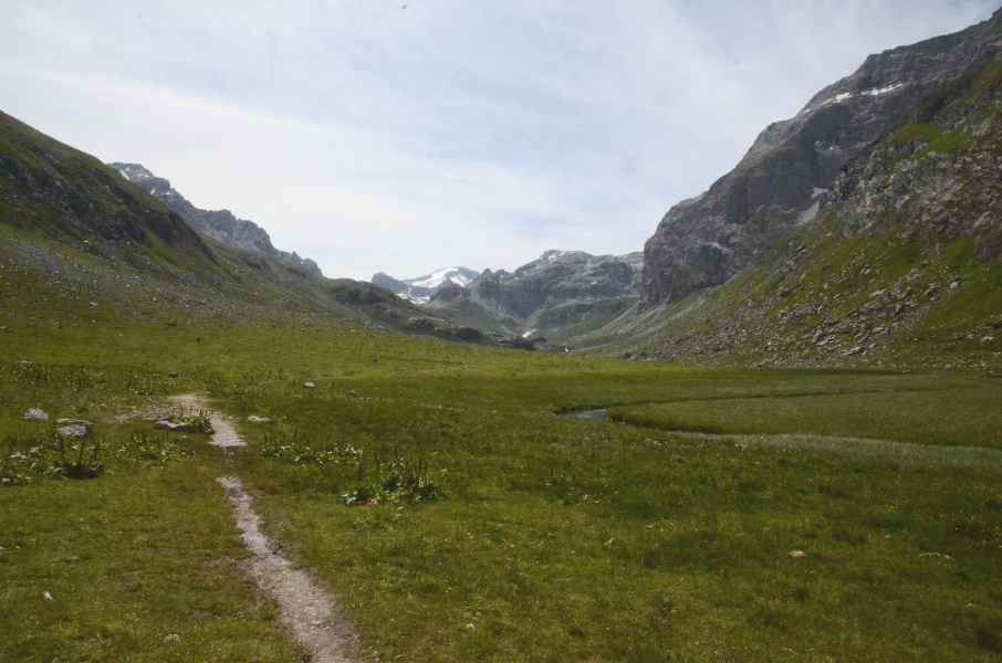
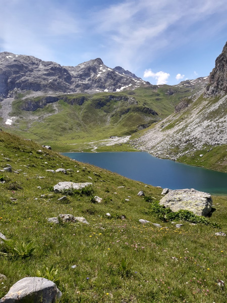
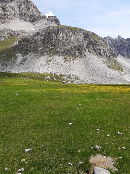
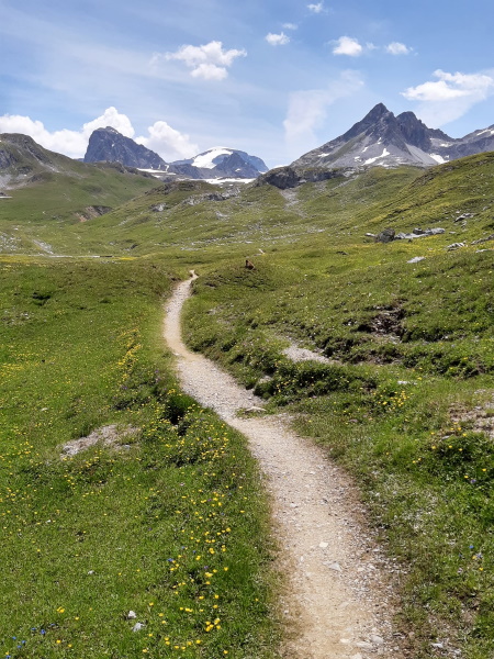
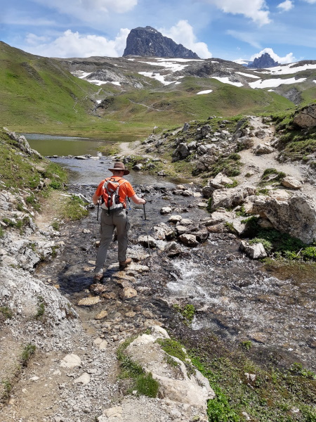
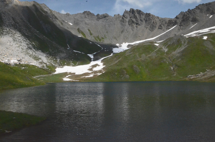
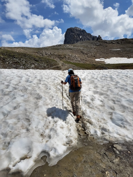
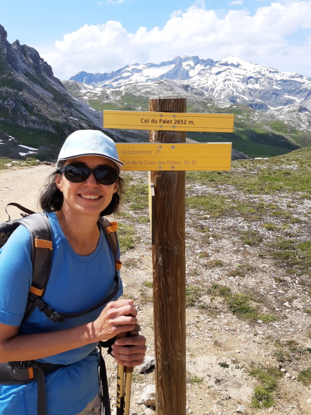
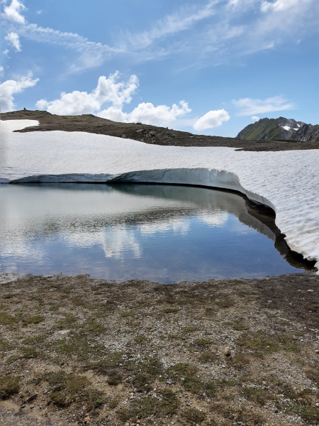
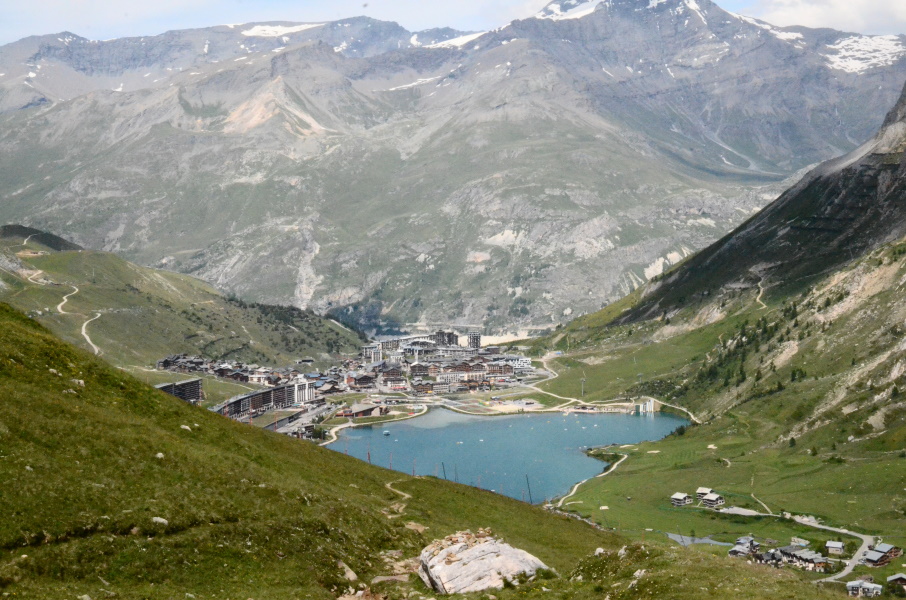
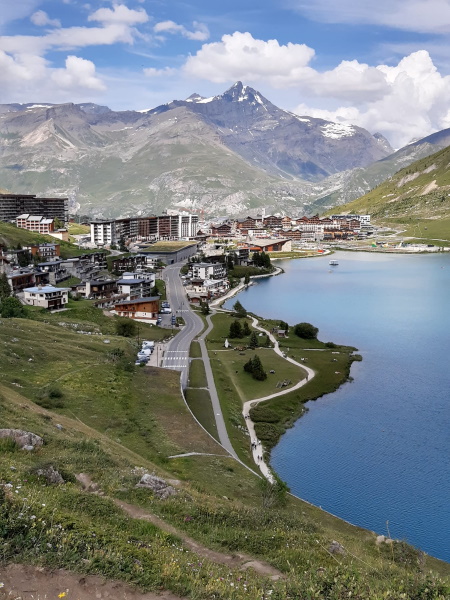
Today it's getting serious as we're going to reach the highest point of our walk so far. Probably that "record" will be broken again the next walking day, but still. The only problem is that the first bus to Rosuel won't pass until 9:45am so that we can't really start early. We do like sleeping without alarm clock, but we will have to see what time tonight we'll arrive. The bus is at least on time and so we make our first steps to Tignes at 10am. Around the refuge of Rosuel there are quite some walkers, but since the parking is pretty full we assume they are just walkers for the day. We almost immediately start climbing, though not so steep. The path passes some pastures and low bushes while gradually climbing. We slowly approach the rocks and there the path becomes narrower but in fact it keeps climbing gradually without getting very steep. On the left we have, already for a while, a good view over the Nant Putors waterfall and several small groups of walkers stop at different points to take pictures so that we continuously pass each other while enthusiastically greeting. It's all very relaxed. At the viewpoint of the waterfall we can have a last look at Rosuel down in the valley as the path here goes around the corner. We thought about having a first stop for a bite here, but it's rather busy so we decide to move on a bit more. Where the path leaves the forest there is a short tougher section through a narrow passage where rocks are layed out as stairs. At the top we look out over a boulder field where the river Ponturin goes briefly underground. Here, at the so-called Perte du Ponturin (the "loss" or "disappearance" of the Ponturin) the path splits. To the left is the GR5 to the Refuge du Col du Palet and straight ahead goes to La Plagne lake and the refuge there. It appears that 80% of the walkers go straight ahead to the lake and so it is suddenly very quiet. Along the flat and swampy Plan de la Plagne both trails are going in the same direction with the river in between. It's funny to see that the other trail is almost a parade of walkers going to the lake while on our side we're almost alone. The fun lasts until the Chalets de la Plagne, because here the GR5 starts climbing again and gains another 140m until the Cabane des Mindières where it shortly flattens before gaining another 100m to over 2300m altitude. Here a longer flat part starts along what once was a small lake (Lac de la Grassaz) but now is just a flat pasture full of flowers. It is also crowded with marmottes here, but it takes a while to get a good picture as they keep moving and we're just to slow grabbing our cell phones to take a photo. At the far end of the former lake the path again starts to rise: a long but not so steep climb to 2550m. But the altitude starts to become a factor and we notice we're easily ut of breath. And again we arrive at a lake: Lac du Grattaleu - and this one does have water. Especially with the patches of snow at the other side it is very beautiful here. From here a short but steep climb brings us to Refuge du Col du Palet at 2580m altitude, just under the pass. We stop again for a bite before we climb the last bit to the pass. Almost at the highest point we cross a small patch of snow; the first time in the GR5 for us. At the Col du Palet it's breathtakingly beautiful with among other things a small lake bordered with a kind of small cliff of snow and the mountains with quite some snow in the background. It's 3:30pm now so we're doing good and we can spare some time to make photos. But then we have to descend and descending is not our hobby. It always takes us a lot longer than what guides and signposts indicate. But this descent is rather easy and to our surprise 1.5 hours later we're at the shore of lake Tigne, exactly according to the guide. This must be the first time at the GR5.... In Tignes we pass along the promenade at the lake shore and it feels odd to have all those people here while less than 2 hours ago we were all alone on the pass. The tourist information is at the far end of the lake and so we pick up the car to drive 1.5 hours back to Nancroix. But the first real hiking day is a real success. |
              |
|||
|
|
||||
Download track RosTig.gpx