


Tuesday 1 August 2017
| Distance (km) | 23 kms | |||
| Distance (time) | 7 hrs | |||
| Climb / Descent | 600m / 1150m | |||
| Hard / Soft surface | 20% / 80% | |||
| Landscape |
|
|||
| Weather |
|
|||
|
|
||||
|
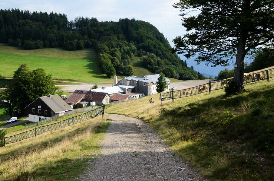
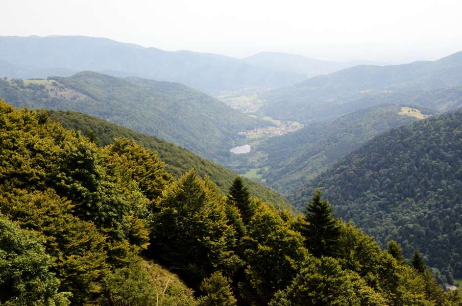
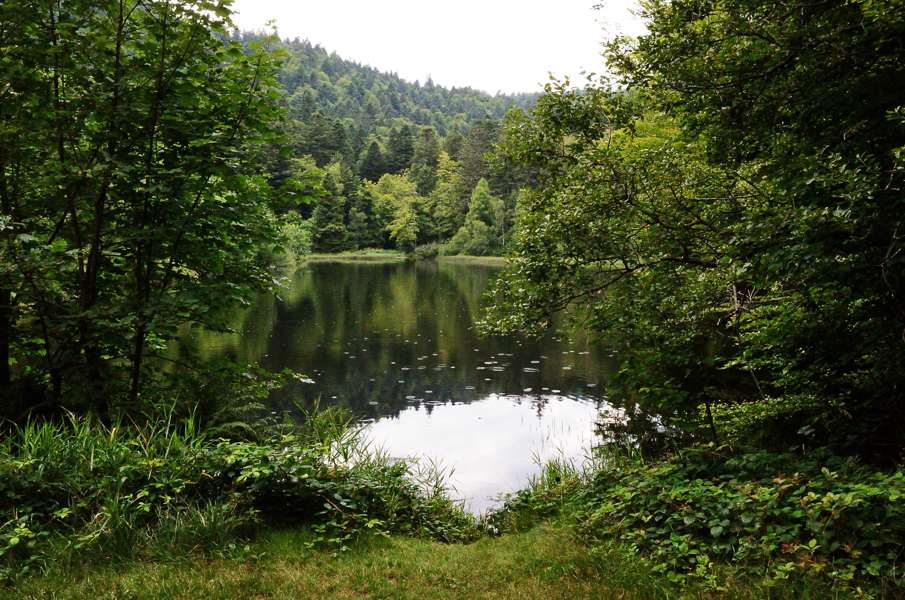
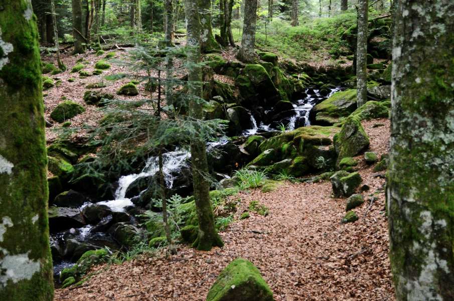
Next morning we get up pretty smoothly and we hurry for breakfast. That is not abundant but we eat as much as possible since toda will be a long day. We already decided not to retrace back to Col des Perches but shortcust somewhat as from Rouge Gazon there is a trail (signposted with vertical blue-white-blue markers) directly to Haut Bers where we can join the GR5 again. And so we climb steeply in between ski lifts just to enter the forest again at the highest point after which we descend to Haut Bers. And indeed, our trail crosses the GR5 there and so we're back on track. A track that goes up to 1100m and then descends again to below 1000m and just keeps rolling through the forest. We pass Col de Charbonnier, a rather meaningless crossing in the forest, to finally climb to Rundkopf: a low mountain summit with an open space. There is also a picknick table here, but unfortunately in the plain sun. A family already claimed the only bit of shadow on the ground and so we do use the picknick table in the sun to have something to eat. The sweat is flowing down our faces so it won't be a long break. A bit to the side of us there is a high summit, seriously higher than we are right now and Lupita asks me if that might be Ballon d'Alsace. Well, no, that should be.....it is in the wrong direction? Sure... We descend a bit from Rundkopf and the trail has a straight angle to the right....in the direction of the high summit. It isn't...yes it is Ballon d'Alsace. Ooph, that is going to be a climb! And climbing we do, with hands and fee on a steep rocky track until we finally reach the grassy summit. We pass underneath the highest point until the crossing where the GR5 gets white-red signs again! Since Col de l'Engin in August 2015 we have been following red triangles but now we get the real white-red flags back. From here it is less than 100m to the summit of Ballon d'Alsace which is far less impressive than Grand Ballon. We continue to the nameless secondary summit with the statue of Jeanne d'Arc and then to Col de Ballon d'Alsace. We spot a terrace and decide to have something to drink and hey, why not a slice of blueberry pie. And just like yesterday when we were in the open it doesn't stay dry: a sudden passing cloud drops some rain for a few minutes. As long as that's it there is no problem. At the other side of the road there is a tourist info centre and we're going to have a look if they can help us solving a public transport problem. In Belfort the local bus company is Optymo and the fun is that with Optymo it is not possible to buy tickets from the driver in the bus. The idea is that one buys an e-ticket by sending an SMS to a certain number and then receive the e-ticket. However....that only works if your cell phone provider is French, it doesn't work through roaming. Very tourist friendly! But for tourist there it the possibility to buy paper tickets from the ticket desk of Optymo in the downtown of Belfort or the ticket machine at the railway station. And how do you get there? By bus maybe? Anyway, we already had this problem yesterday and we will have it again in Giromagny catching the bus back to the camping. But to make a long story even longer: the tourist info centre at Col de Ballon d'Alsace doesn't sell bus tickets but they did tell us that the tabac/presse in downtown Giromagny sells tickets. However, they do close at 17:00. It's now 13:45 and according to the guide it's over 3.5 hours walking. So little chance we make it to buy a bus ticket before 17:00. We continue our way, into the forest. The path doesn't descend very steep and we like that. We are startled by a sudden thunder clap immediately followed by rain. But since we're in the forest we won't get wet immediately and in the end it doesn't rain long enough to get wet. Until the small Petit Haut lake the descent is gradual, but then the mess starts. A steep rocky path follows the Savoureuse (here still just a brook) down. Large steps of up to 50cm impose a heavy load on my knees and since the rocks are also very slippery here due to the rain we progress very slowly. It's a true suffering going down and after a while my knees start trembling from exhaustion. But we do get in one piece to Saut de la Truite and from here on it is supposed to be easier. Well, somewhat, but not much. Flat parts alternate with steep descending parts and by now we passed the 17:00 without being even close to Giromagny. We had hoped for the 17:50 bus but it is questionable whether that is feasible. After what seems a very long time we reach Malvaux and from here it will really be flat. We find some energy somewhere and we walk in 25 minutes to Lepuix (according to the guide that is a 35 min walk) and from there again considerably faster than the guide says to Giromagny. At the first bus stop we see we check the schedule and the bus to Belfort is supposed to pass at 17:52. It is now 17:58 so in principle we're too late.....and we have to wait for the 18:52 bus which is also the last bus. Lupita wants to walk to the downtown instead of staying here and at least have something to drink while waiting. Well....let's wait a bit, maybe the bus is late? And so we wait a bit more and we agree in waiting until max 18:10. And indeed, at 18:07 the bus comes around the corner. What a luck! We already sent SMS messages to get tickets (though we know that doesn't work on our cell phones) and show the driver that we really applied for a e-ticket but just didn't receive it. Ok, fine, just hop on In Valdoie we have to change busses to the bus to the camping so we again show our cell phones. But this driver knows and tells us that it doesn't work on foreign cell phones. Ah, oh, we pretend to be ignorant and it's ok, we can hop on again. And so we're reasonably on time at the camping site where we sink down in our chairs. Tomorrow a rest day....maybe we should get some bus tickets. |
    |
|||
|
|
||||