


Tuesday 1 September 2020
| Distance (km) | 16 kms | |||
| Distance (time) | 8.5 hrs | |||
| Climb / Descent | 1650m / 400m | |||
| Hard / Soft surface | 40% / 60% | |||
| Landscape |
|
|||
| Weather |
|
|||
|
|
||||
|
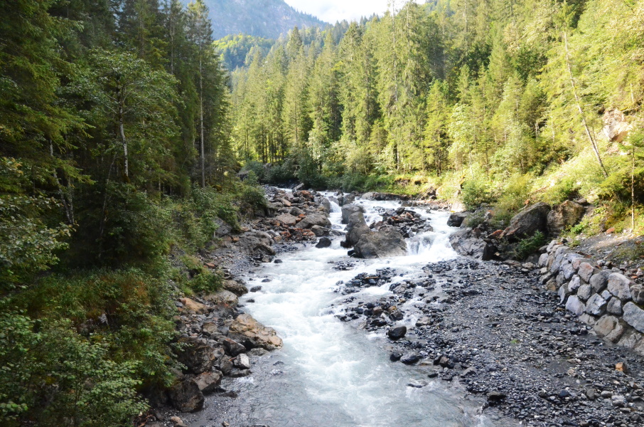
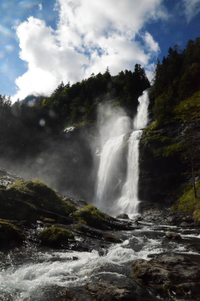
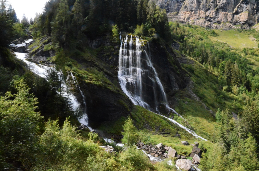
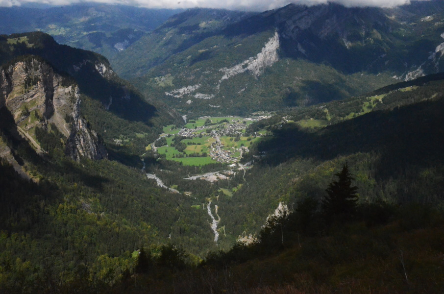
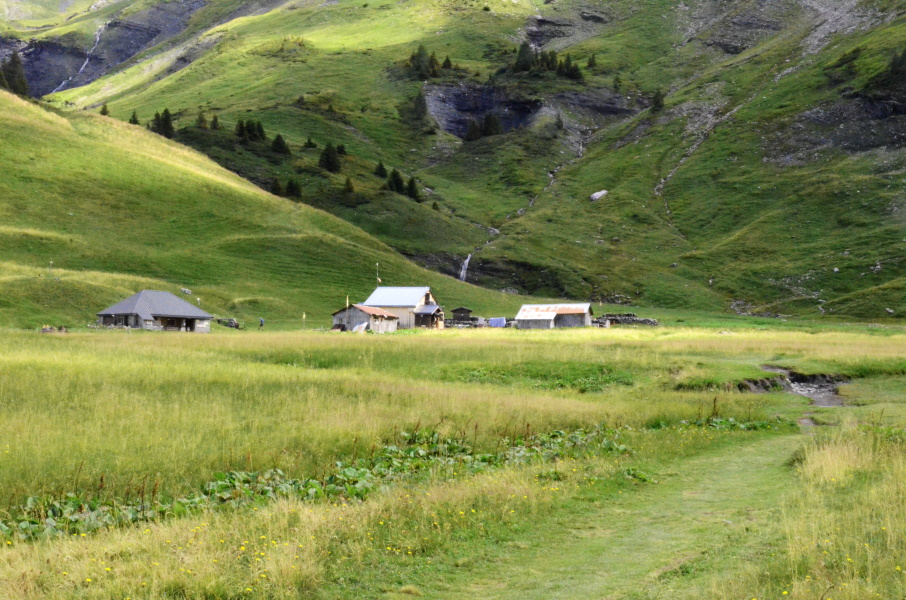
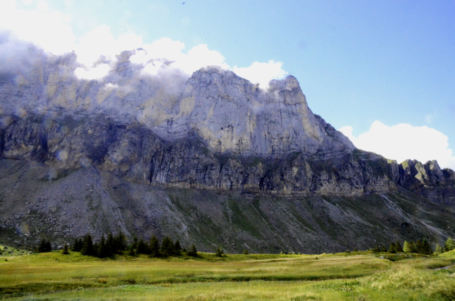
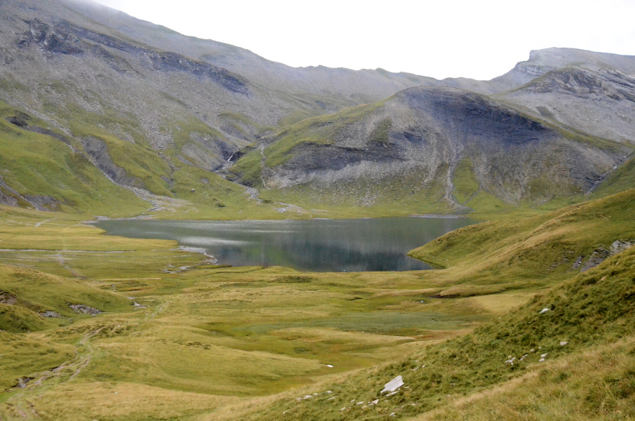
After yesterday's warming up today we will go for a real walk. First we have to get to the town centre to catch the bus (that is late) and then starting from Sixt we go up the mountain. We arrive in Sixt after 9:30 and apart from tightening the shoes we hop in the supermarket that's next to the bus station to get some snacks. But then we're really on our way. The first 10 minutes we walk back to Pont des Nants where we pick up the GR5 again. The first part gently climbs along the river following a wide gravel road. Just before Pont de Salles we arrive at the tarmac road that ends at the Lignon parking. We take some pictures standing on the bridge when we're almost bumped of the bridge by a passing car. The occupants, a young couple that we will meet again later today, demonstrates the typical annoying tourist behaviour as if they own the bridge and if others also want to take picture they just have bad luck. But ok, let's move on. From here both the walking trail and the tarmac road go to the Lignon parking, but the walking trail shortcuts most of the hairpins. That means that everytime we step off the tarmac we have a steep step and everytime we get on to the tarmac we have another 2-5 steep meters. We pass the Rouget waterfall that has a large amount of water coming down, the advantage of the rains of the last couple of days. For the rest the walk to Le Lignon is tiring with all those big steps on and off the tarmac, but in the end we do reach the parking where it's time for a snack break. It now continues over a rather wide gravel path and damn, it is a steep path without any relieve. We're for sure not the only ones going up here and both ahead and behind us people are struggling up, with and without a back pack. We finally get to the two waterfalls of the Pleureuse and Chauffaz and guess what, our "friends" from Pont de Salles are here too. The girl is standing at the very edge in all kinds of ridiculous poses that are meant to be funny and/or sexy with the waterfalls in the back and so nobody else can take a picture. It takes a while in which I wonder if she could maybe take one more tiny step back? Anyway, finally us mortals are granted some time to take a few pictures as well. Just beyond the waterfalls we have to turn left to Chalet d'Anterne and to our relieve we see that the annoying couple went straight ahead to Refuge de Salles. Whether that is a good idea in fashionable shoes and a dress is a good question, but not my problem to solve. We just regularly climb and apart from a steeper and slippier part with yellowish mud we reach the Collet d'Anterne without too much trouble. Time for a serious lunch break. After half an hour or so and also half a gingerbread it is time to move on. The path descends considerably before reaching a pasture full of sheep that keep running ahead of us. We have to cross a small stream here and we do so under the loud protest of the sheep population. Then it climbs again, gently, to a big pasture that we cross to reach Refuge d'Anterne or better known as Refuge Alfred Wills. Unfortunately this is not our end point yet and just after the refuge it starts to climb again. It is a quite steep and stoney climb to two nameless mountain passes of 2080 and 2085 meters high before we descend a bit to Lac d'Anterne. I'm not sure what I had imagined what the lake would look like, but now with the lowering clouds and it being a bit later in the afternoon (it's 16:30 now) it looks a bit mysterious and at the same time gloomy. Maybe some sunshine would have been better. We pass along the lake, cross some streams and start the final climb. The first piece is steep and since we're running out of steam we're happy to find out that in fact most of the climb is rather gentle. And so we arrive at 2257m altitude, a new record for us. The descent is not so gentle though, the first part is in fact very steep, and muddy, and slippery. It is supposed to be 30 minutes from the pass to the refuge and though we can see the refuge it still takes us over an hour to get there. It is here that Lupita overstretches here knee, which hurts a lot, and we have to take it slow. But by 18:15 we make it to the hut. We have a room reservation, but pity pity no shower. Due to covid the shower has been closed because otherwise they would have to desinfect it after every person taking a shower and they don't have the means to do so. On the otherhand at dinner we're with 20 people sitting should to shoulder crammed at 3 tables while 2/3 of the dining room is empty. That apparently is not a problem for covid. Strange fellows, those French. Anyway, we have to spunge bath ourselves at the tap. So we hijack a toilet with sink at the 2nd floor and block the door from the inside with a bench so that we can clean ourselves a bit. Diner is ok but not spectucular. Just like breakfast. |
       |
|||
|
|
||||
Download track SalMoe.gpx