


Saturday 16 May 2015
| Distance (km) | 17 kms | |||
| Distance (time) | 4 hrs | |||
| Climb / Descent | 585m / 570m | |||
| Hard / Soft surface | 45% / 55% | |||
| Landscape |
|
|||
| Weather |
|
|||
|
|
||||
|
Some days things don't go as planned and that typically happens on a day that that is extra inconvenient. Today is the last walking day and with some puzzling we decide that we want to park the car at the end point so that we're not depending on public transport at the end of the day. From Metz there is a but at 11:05 to Saulny, but exactly today there are no slow trains between Nancy and Metz due to works on the railroad and so there is no train from Ars to Metz today. Why today? But ok, the SNCF has replacement buses between Nancy and Metz (we have a lot of experience with how that works for the Dutch railroad, humz) and at 10:30 a bus should pass Ars that should be in 15 minutes in Metz. And so we are on time at the station in Ars for the bus....that doesn't arrive. Eventually the bus arrives 20 minutes late and full of people so that we have to squeeze ourselves in. And of course we miss the connection in Metz and we have to wait until 12:15 for the next bus to Saulny. Result: we start walking today at 12:45.
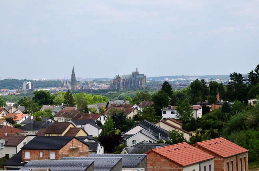
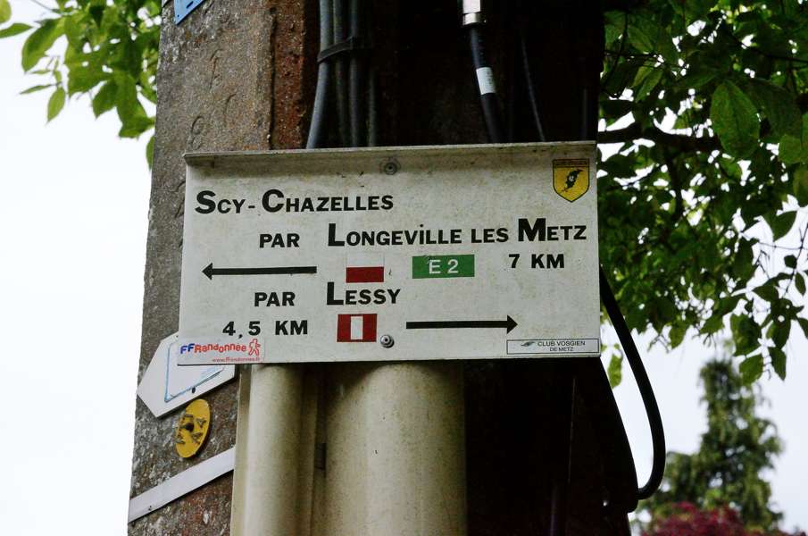
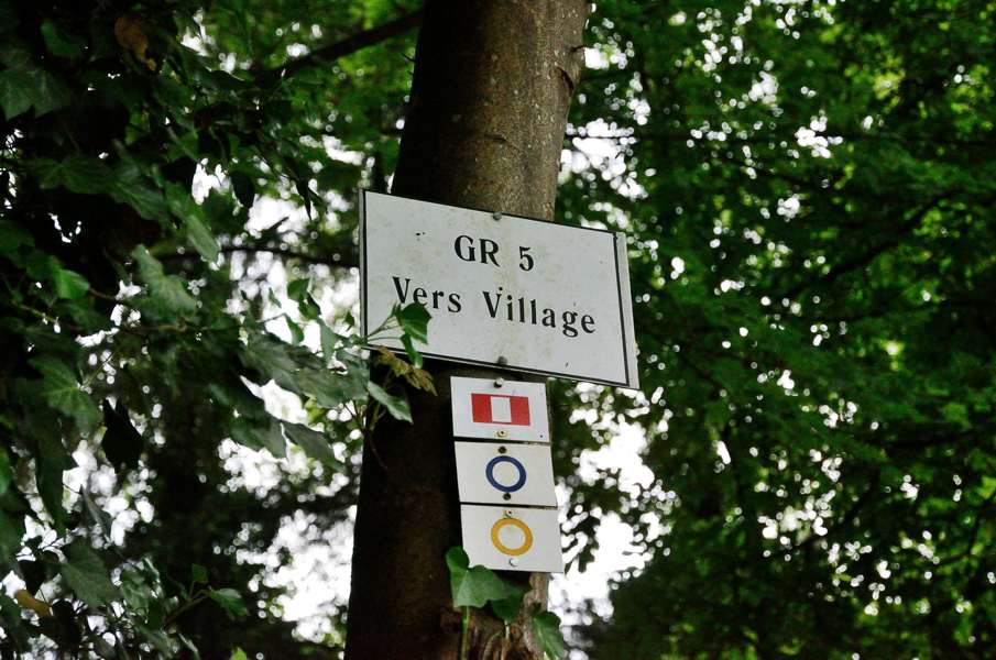
Anyway, from here on it goes fine and pretty fast we arrive in Plappeville. According to the guide we should pass the fortress, which we do not. Ok, can happen. After the fortress we should walk in the direction of Col de Lessy, but when we pass the town centre we reach the crossing of Avenue General de Gaulle and Rue de Petit Clos where the guide says we should turn right while the signs on the street indicate we have to turn left. Signs prefer over the guide (that is over 8 years old anyway) and so we follow the signs. We can see on the GPS that we are getting further and further away from the original route and we are now walking through ugly suburbs towards the Moselle. And it is there that things go wrong: first of all we have to pass underneath a little tunnel to get to the other side of the trunk road, but the underpass is closed. So we have to walk around and cross the road where cars pass with very high speed. Arriving at the other side of the underpass it is not getting better: there is a GR5 sign pointing into the underpass to Plappeville where we came from. A second sign points up the Moselle bridge to Metz (as indicated) and a third sign points north along the trunk road....so where do we go? To Metz? To the north? We're not on the route with respect to the guide, the map and the GPS so that is not going to help us and we have no idea what direction will bring us to Ars-sur-Moselle in the end. We take a radical decision: we will go back to Plappeville and see if we can follow the route according to the guide and the GPS. And so we find the closest bus stop and see that busses 11 and 15 go to Plappeville, the latter all the way to the downtown. Unfortunately neither of the two buses pass the stop where we are now and we have to walk to the next stop along the main road to get to a stop where we can at least take bus 11. Lucky for us the bus arrives within minutes and so we are 10 minutes later just outside Plappeville at the hospital. From here we can take bus 15 further to the town centre but bus 15 won't arrive for another 40 minutes and according to the GPS the town centre is only 800 meters from here so we decide to walk and get back to the crossing where we had been in doubt before. We now walk into Rue de Petit Clos where there are signs, but not GR5 signs. The signs in this direction are vertically red-white-red striped and due to the resemblance with the flag of Peru we decided to baptise this route the "Peruvian route". We follow the signs and keep a close eye on the GPS. We climb passing the church and over a forest path with some steps here and there towards Cold de Lessy, still on the Peruvian route. After Col de Lessy we follow a small tarmac road and at some point turn left onto another non-paved path. Here we can even see a washed out GR sign o the wall and nailed to a tree there is a sign "GR5 towards the village". This is/was for sure the GR5! Eventually we notice that the Peruvian route leads us completely over the old GR5 passing Lessy and Scy-Chazelles to Moulins-les-Metz where we spot regular GR5 signs again. Hence, the GR5 nowadays goes straight through Metz though it puzzles us why they did that. The Peruvian route is just the old GR5! In the meantime the weather didn't get any better: the sky is grey to dark grey and it is getting late. So what do we do? Try to find a but to where the car is? Lupita doesn't like the idea and actually neither do I. So we continue walking to Sainte Ruffine and Jussy. Then over a gravel track to Vaux. As an extra unpleasant suprise we still get another long climb out of Vaux through the forest before we finally descend to Ars. On the entrance of the town it starts to drizzle. So we are really just on time. Just before the railway station we hop in a bakery for some bread for next morning and we decide to go wild on a coffee eclair because we feel we deserved that. It is almost 19:00 when we step into the car. The plan to be back on time so that we can already start packing evaporated before we even started walking. To bad but that is the way it is, we won't be home early on Sunday. |
   |
|||
|
|
||||
Download track SauArs.gpx