


Saturday 31 May 2014
| Distance (km) | 16 kms | |||
| Distance (time) | 4.5 hrs | |||
| Climb / Descent | 408m / 416m | |||
| Hard / Soft surface | 25% / 75% | |||
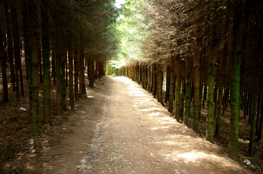
| Landscape |
|
|||
| Weather |
|
|||
|
|
||||
|
The next day the weather is great and hey, we have to pack our tent because today we will walk with full gear. That is new, at least for this year. It all fits perfectly in the backpack and it should be lighter than last year since we invested in ligher sleeping bags, matrasses, stove and pans....but it doesn't feel like that. According to Lupita her backpack is so nice and light, but mine feels the same as ever. I'm doing something wrong, clearly.
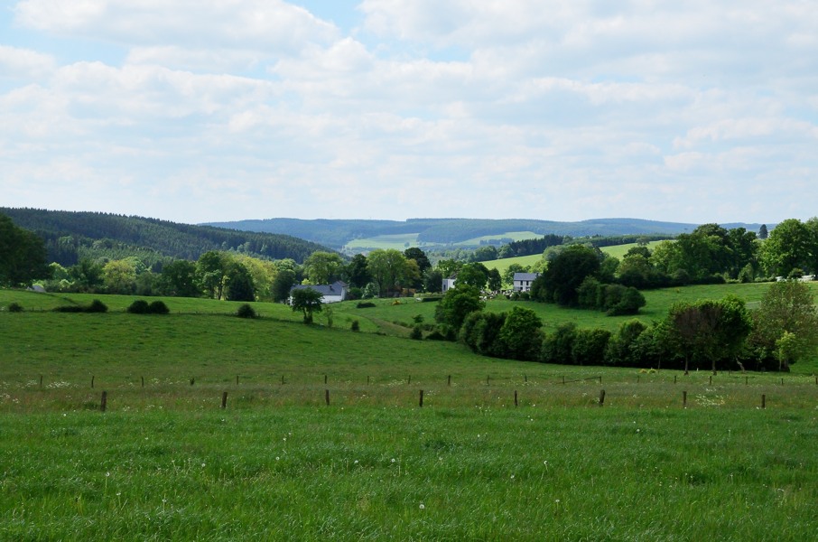
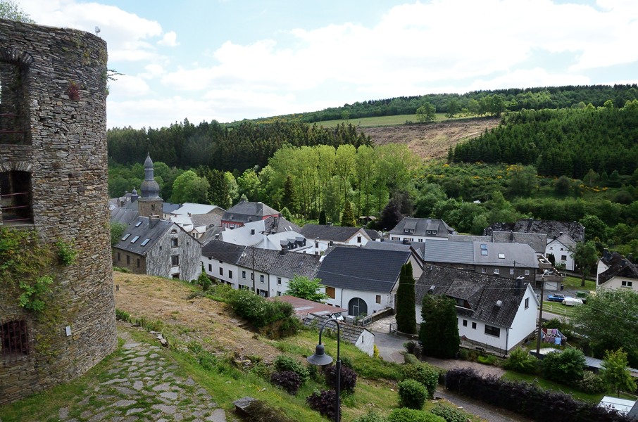
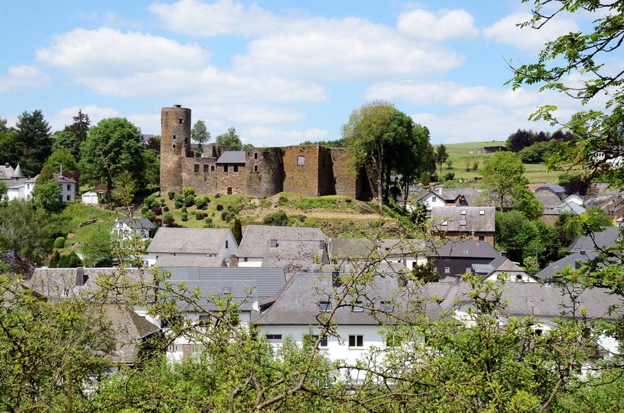
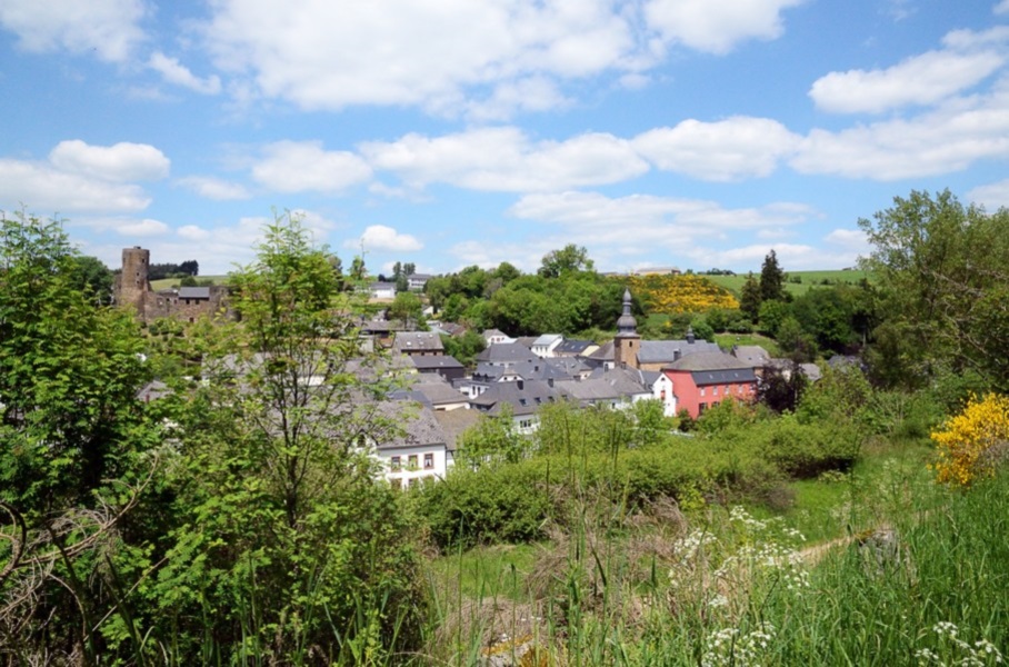
We leave the camping and now we have to cross the N62. That can take a while because it's one long queue of cars in the direction of Luxemburg. But the friendly driver of a garbage truck stops and waves we should cross. Good! So now we can climb through the pasture to the gravel road, pass the windmill and the barn and get back to the GR5. We walk narrow tarmac roads behind Grüfflingen and then enter the forest. Here comes a fierce little climb passing a house and through the forest over the hill. At the other side it descends gently just to end up on another narrow tarmac road that we have to follow for a while. There is a village where the road seems to had for, but that is Oudler and not Burg-Reuland. At the next split we have to turn left and the road rolls down, but still tarmac. Finally the road consistently goes down, and very steep too while we pass a hotel. Almost down in the village of Burg-Reuland the GR5 does not go to the main road but turns right steeply up. We struggle up to get to the old castle after which this village got its name. The GR5 now loops around the castle and back down. Here we mistake and end up making a larger loop than needed, but it is not that dramatic. We planned to have our lunch in Burg-Reuland but we can't find a simple bench to sit on. There was one at the hotel back up the hill, but once passed is passed. Hopefully we find one leaving the village. And so we pass underneath a gate house and cross a small stream after which it immediately goes up again to the old railroad track. There is indeed a bench here and the people currently using it are leaving. That's fortunate! My back is soaking wet and it feels soooo good to take the backpack off. We have a bite and watch the cyclists passing over the old railroad (now a cycle path). The route climbs a bit more following the little tarmac road before turning right following the old railroad track but just a bit higher. We have a nice view over Burg-Reuland until the route goes left and up. Now we know that from mathematical point of view the shortest connection between 2 points is a straight line, but they really didn't have to make the path this straight up the hill. It is mega steep and walking sticks are useless. In fact, hands and feet are more practical. The blister on my left heel for sure is not so amused. A bit further up we get onto a forest track and the inclination drops from ridiculously steep to just normal bloody steep. The track has two more steep parts before we arrive on another little tarmac road at the top that we cross onto another narrow tarmac road. We continue until a tarmac road to the left. At this point there is also a track to the right and we know from the GPS track that we should go right here following the track. But there is no marking to be found. We take the track anyway and it's good to see that 50m further on there is another GR marking. The track descends throguh the forest and starts following a stream, though considerably higher than the stream. We keep dropping and finally we end up at a gravel road that we take to the right. We now follow another stream, this time upstream. It's really beautiful here and it feels like discovering a forgotten piece of the Ardennes.....until I have a near miss from 2 mountainbikers. Ring a bell next time? Or just shout "ring-ring" when approaching? Ok, it's still beautiful here. We follow the stream until a house where we cross and climb into the forest. This climb is supposingly not as steep as the one getting out of Burg-Reuland and that is kind of right, on average at least. The first part entering the forest is serious but it eases once in the forest. Coming out of the forest is again short but steep going up and easing again. Then a long steep S-curve follows that seems to bring you onto a ridge. However, getting up there is appears that the highest point is still considerably further close to a shelter that can be seen far in advance. So another piece climbing. Maybe less steep but now unprotected in the sun all the way to the shelter. We're now on a crossing with a narrow tarmac road that enters Luxemburg to the right. Here ends our GR5 adventure for now because we have to leave the route to walk into Luxemburg as the first village (Leithum) has a bus to Troisvierges. And we cannot linger because the bus goes once an hour at :05 with exception of 17:05 when there is no bus. It's now 15:45 and so we either catch the 16:05 bus or we have to wait for the 18:05 bus. So we walk pretty fast into the village and arrive at the bus stop at 15:55 where we see that the bus leaves at 16:15 and not 16:05. Ok, so there was no reason to hurry then. But we hardly sit down for 30 seconds when the bus arrives from the direction Troisvierges. It passes the bus stop, turns around and immediately comes back. Lupita sticks out her and to make sure it stops. We're the only passengers all the way to Troisvierges and for 4 euros we're back at the car. So lucky we were on time at the bus stop! Back at Troisvierges we're happy to have our car back and so we drive to the camping site in Troisvierges where we flush away the day with a nice hot shower. In the evening we walk to restaurant Lamy, about 1 km uphill (ouch) where we had such a great dinner after our wedding in 2009 when we took a weekend break in Luxemburg. And today is the same: 4 course menu, bottle of wine.....and then walk back to the camping site. Can't wait for the next walking week in August. |
     |
|||
|
|
||||
Download track SchLei.gpx