


Sunday 13 August 2017
| Distance (km) | 25 kms | |||
| Distance (time) | 6.5 hrs | |||
| Climb / Descent | 990m / 870m | |||
| Hard / Soft surface | 10% / 90% | |||
| Landscape |
|
|||
| Weather |
|
|||
|
|
||||
|
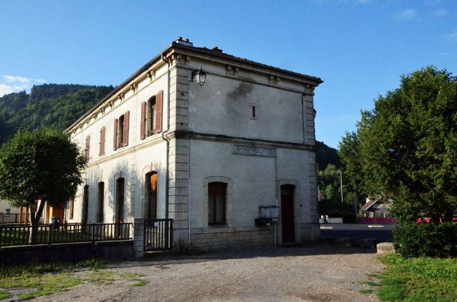
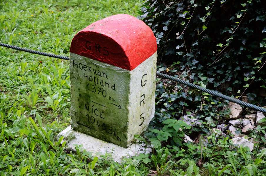
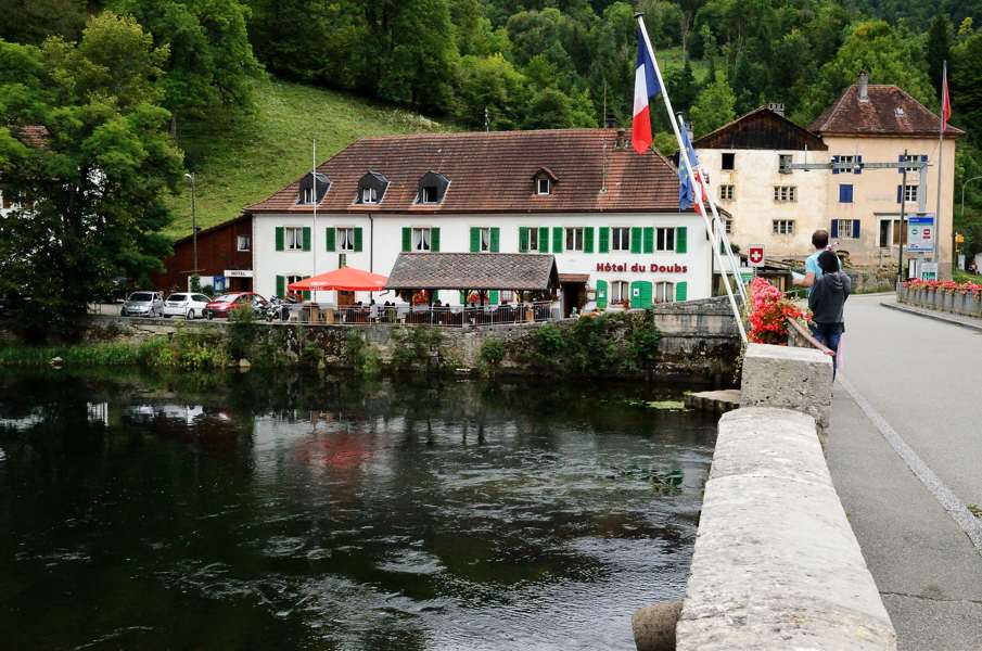
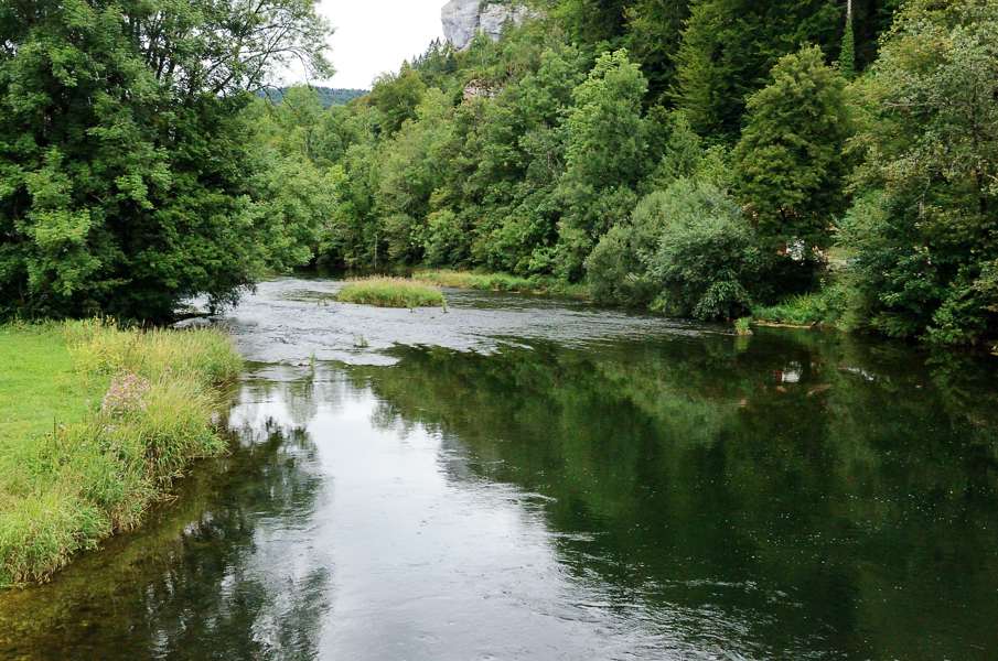
We took a few days off from walking and in the meantime I bought a role of tape to be able to strap my knee. And that seems to work, so we're going to try again. From Morteau we take the bus to St.Hippolyte and since it's Sunday there is only 1 bus: at 7:30 in the morning arriving at 8:20 in St.Hippolyte. However, we do have a time limit: there are 2 buses going out of Goumois in the afternoon, but only the first bus at 15:56 is a sensible option as it will bring us back at a reasonable time. If we would take the 17:12 bus we won't be back in Morteau until 22:00 in the evening because we would have to wait almost 4 hours in La-Chaux-de-Fonds. Hence, we have 7.5 hours for a hike that according to the guide should take us 7 hours. We have to keep moving! From the bus stop in St.Hippolyte we pass the old train station again to join the GR5. We immediately go wrong because we follow the tarmac road and about 50m further we realize we should have gone up a track before the first house. This is for sure not the first time we walk in the wrong direction within the first meters. Anyway, we pass behind the houses and for the next few kilometers it gently climbs until we reach a farmhouse that seems to be abandonned. We have to turn right here (though that is not so clear) to Soulce-Cernay. The first couple of houses in the valley appear not to be the village yet but some hamlet La Saunerie. A bit further on is the "real" village though it's hardly bigger. At the bridge we have a mini-break to eat something after which we immediately move on. The nice flattish path is gone now: we have to get out of the valley and so we will get some serious climbing. First to the D134 that we then have to follow to the left. It's funny to see that with the lack of poles to put markings on the white-red markings are just painted on the asphalt. According to the GPS track we should veer left in the hairpin, but we can't seen any possibility to do so. So we walk on a bit more but start getting doubts and partially walk back to the hairpin. No, we truly don't see how it would be possible to go left here so we walk on again. And indeed, after a slight curve to the left a track goes steeply up to the left. Taking this track we shortcut another long loop of the D134 and we get back to the road again a bit higher up. Again we're supposed to turn left in the upcoming hairpin and now there actually is a path. A bit later this path ends at a narrow tar sealed track that goes up brutally steep. Unfortunately this is our route and so we snail our way up on this rather straight track until we leave the forest behind us at a large farmhouse. While the family is having lunch outside we pass the farmhouse and enter a pasture. This is just gently going up, nice! At the other end of the pasture we arrive at a falling-apart barn that we have to go around and to our surprise the track becomes a narrow tarmac road again that we have to follow further up. Above us we can see a classical mountain pass, a saddle, that we have to get over. And that happens in a equally classic way: with a couple of hairpins. However, the pass it not the highest point as the road climbs a bit more bore descending into the village of Courtefontaine, considerably sooner than we had expected. We walk around the church and cross the D134 once more before passing behind the village. This got to be the sleepiest village in France, even the dogs are slow in barking when we pass. At the end of the village we get back to the....indeed, D134. Along this tarmac road we climb gently and just after the highest point we have to go right and cross a pasture. Fine, we can do that. In the distance we can see the fence along the D201 at the end of the pasture so we know where to go. However, just before getting there we have to cross another fence. Not a problem, but on the other side of the fence a young bull is staring at us. Great....so what do we do? We approach the fence and the only thing the bull does is staring at us, that's it. We wait a bit but decide to just corss the fence and walk away from the bull fast but without running. He's not moving, but we're happy to reach the final fence to get us to the D201. Instead of following the D201 we have to cross it and take a narrow tarmac road that gently climbs. We pass a couple of farmhouses and at one of them a small-size St.Bernard comes running onto the straight loudly barking. From inside the farmhouse somebody is calling him back but he completely ignores that and the owners of the dogs are clearly to lazy to check what is going on. So we wait a bit and after half a minute or so the dog stops barking, gets distracted by a butterfly or so and we just quietly pass him with him paying any attention to us. He makes such a great guardian dog.... The road just keeps on climbing until we leave the forest again at the last farmhouse. The tarmac road becomes a dirt track that we have to leave to the left a bit further on. We cross some fields and again reach a farmhouse where another narrow tarmac road starts. This road slowly descends and right in front of us we see a village glued to the hill side. That can't be Fessevillers? If it is we'll have to climb considerably while right now we're just descending. And we keep descending. At the lowest point we veer right again following a slightly climbing track. After 200-300m it starts to climb more but in reality the steeper part of the track is very short and we can see the first houses of Fessevillers through the trees. That was fast! From down in the valley it looked considerably worse than it is in reality. It's high time to have something to eat again, but in Fessevillers we don't see anything like a picknick table or a bench. So we continue walking and leave the village again and agree that if we reach the little summit straight in front of us without finding a picknick site, we'll just sit along the side of the road. And so we end up sitting on the side of the road .... It continues to climb and when the little tarmac road enters the forest there is an ugly little steep part with an s-curve. But finally we reach the highest point in the Bois de la Joux, so we can go down again! Well....no. We do descend a bit, just to end up on another tarmac forest road that stays level again. Towards Urtière it even climbs a bit, but after the small chapel we now really go down. At a farmhouse we have to turn left and it feels like we're falling of a ledge into the valley. It goes down steeply over a wide but very stoney path. So very gently, but my knee is not so happy with this descent. It doesn't really hurt but it is at least sensitive. Finally we arrive at another farmhouse and we can already see Goumois. Nevertheless we have to descend a bit more to get to the D437b road just above the village. It looks like we're almost there but there is still a considerable amount of descending to do through the village and it is all very steep. But ok, we do arrive in the village and pass over the bridge over the river Doubs to get to the Swiss side where the bus stop is. We have 10 minutes to spare before the bus arrives, perfect timing. Returning by public transport is a bit of a hustle. The bus is on schedule and drops us on time at the station in Saignelegier where we have 2 minutes to catch the train to La-Chaux-de-Fonds. But due to maintenance works on the track the train only goes until La Cibourg where we have to change to a bus, another tight transfer. And then in La-Chaux-de-Fonds we have to run because we have 6 minutes for the train to Morteau and the bus stops completely at the far end of the square. But we make it... |
      |
|||
|
|
||||