


Tuesday 11 August 2015
| Distance (km) | 20 kms | |||
| Distance (time) | 7 hrs | |||
| Climb / Descent | 850m / 415m | |||
| Hard / Soft surface | 0% / 100% | |||
| Landscape |
|
|||
| Weather |
|
|||
|
|
||||
|
Today we're going to shortcut a bit. We checked the map several times for the loop in the GR5 to pass Abreschviller without it being very clear why the GR5 has such a loop. Maybe it has to do with the headoffice of the Club Vosgien being in Abreschviller? Anyway, we could park the car there and leave it overnight for a day (we will go to Schirmeck in 2 stages with an overnight stay in Hotel du Donon) but why should we? We'd rather leave the car with the tent at the camping site in St.Quirin, and that is what we will do.
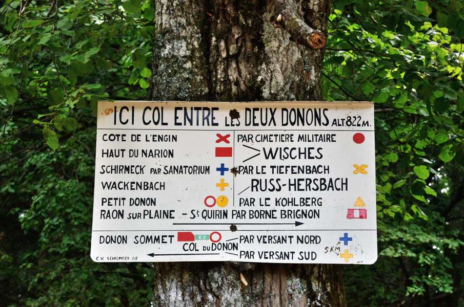
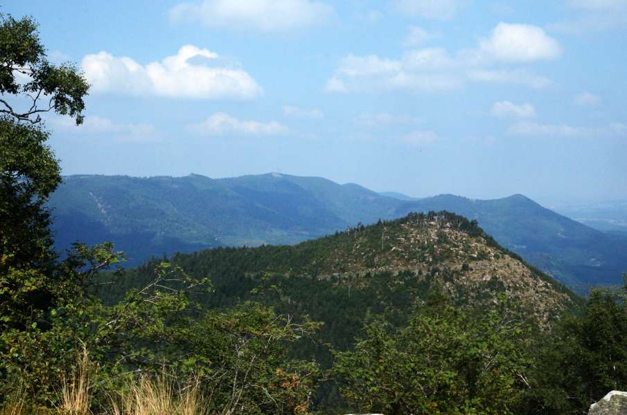
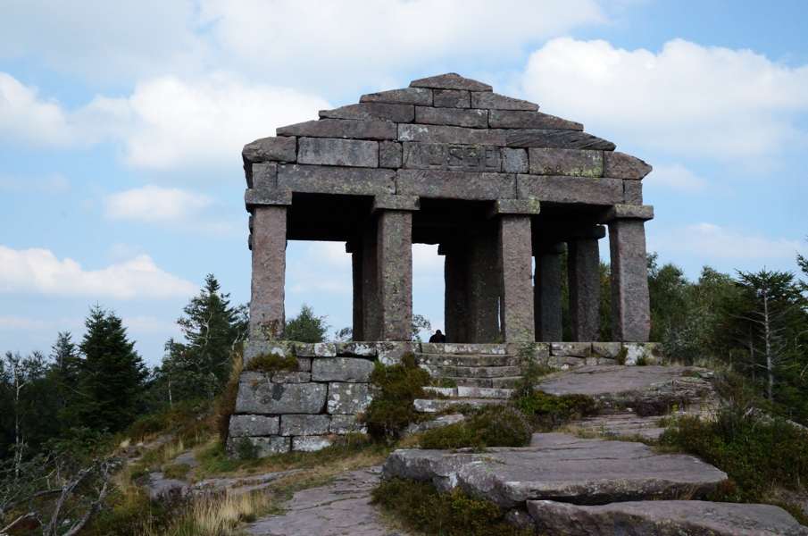
We leave in the morning just before 10 just walking from the camping site following the GR5 into the woods. But where the GR5 turns left to Abreschviller we go straight ahead follow the route of the blue circles. The car track continues until some kind of crossing where we go straight ahead again following a narrow forest path that slowly climbs. It is a nice climb and not much later we are at the crossing of forest tracks called "Quatre Chemin" where we rejoin the GR5 again but now on the section from Abreschviller to the Donon. The first climb is registered: where we were at 290m altitude at the camping site, we are now at 440m altitude. From here it is basically just following the track to the south and do not descend. It's well signposted though occasionally the distance between the signs is so large that we start doubting whether we missed a side road or so. And that does indeed happen, because after Col de Lendenstein we apparently had to go left somewhere to get to the viewpoint of Belle Roche, but we miss it completely. We just continue over the forest track and see few markings. A quick look at the map learns that we're heading in the right direction and to our surprise a little bit further the GR5 joins us from the left. We completely skipped Belle Roche, but then we don't feel like walking back for it either. Just before the peak Tête de Calice there is another long section without signposting but here we are on the right track. Along Pierre St.Quirin (a disappointing piece of rock) the route is a narrow forest path that later becomes a track again. After the shelter it becomes a more serious climb to Borne Brignon and a little beyond after which it gets flatter again to Croix Simon. Here starts a seriously steep climb to just before Col de l'Engin where the route crosses the D145. Time for a break to have something to eat and we sit down on a couple of logs. A couple of minutes later we have company of 2 Dutch who started in Abreschviller in the morning and want to reach Schirmeck today. But they can stop any time they like and simply call the family at the camping site to be picked up, so they explain. That is easy, but we don't have that luxury. The youngest of the two tells that he started in Hoek van Holland in 2009 and we tell him we started in 2013. If he managed to walk from Abreschviller to here in half a day we wonder why he needs 4 years to get from Holland to here. But ok, maybe he just has less days per year to walk. We leave the Dutch to their lunch and continue gently climbing to Col Entre les Deux Donons (822m) where the real climb starts. At first it is a wide track but soon enough it is only a narrow path that goes up zigzagging with some climbing over large rocks here and there. I feel it is not that bad but behind me I here Lupita wondering whether we are really going to make it to the summit. Just below the summit we pass a shelter from the 1st world war and here we loose track. Correct, because we shouldn't have passed the shelter: just before the route goes further up and then we are at the summit within a few minutes. It is busy at the summit, both with tourists and wasps. Nevertheless we manage to take a picture of the temple without tourists before we're fed up with the wasps and start our descent. It is a wide path, a bit eroded in places, but basically without difficulties. Only the very last piece we have some problems at a peculiar split where both branches have a GR5 marking. The only difference is that the right marking has the additional remark "parking". We decide to take the left path and arrive just below the Hotel Le Velleda at the D392 main road. We have a reservation at Hotel du Donon so we have to walk along the road up until 200m beyond Hotel Le Velleda that we considered far to expensive. At the Hotel du Donon there is sign saying that guests for the hotel should report at Hotel Le Velleda. We're still grumbling that we just passed the other hotel when a French couple arrives. They explain that the hotel is taken over by the other hotel and here there are only rooms: reception and restaurant are in Hotel Le Velleda. Nice, so we have to go up-and-down more today. And so we walk back to Hotel Le Velleda where we check in....and get a room in Hotel Le Velleda. Very nice and convenient, because we have the restaurant close by now. After a great shower and and even better dinner with a bottle of wine we sleep like babies. |
   |
|||
|
|
||||
Download track StQDon.gpx