


Thursday 29 July 2021
| Distance (km) | 19 kms | |||
| Distance (time) | 7 hrs | |||
| Climb / Descent | 880m / 800m | |||
| Hard / Soft surface | 10% / 90% | |||
| Landscape |
|
|||
| Weather |
|
|||
|
|
||||
|
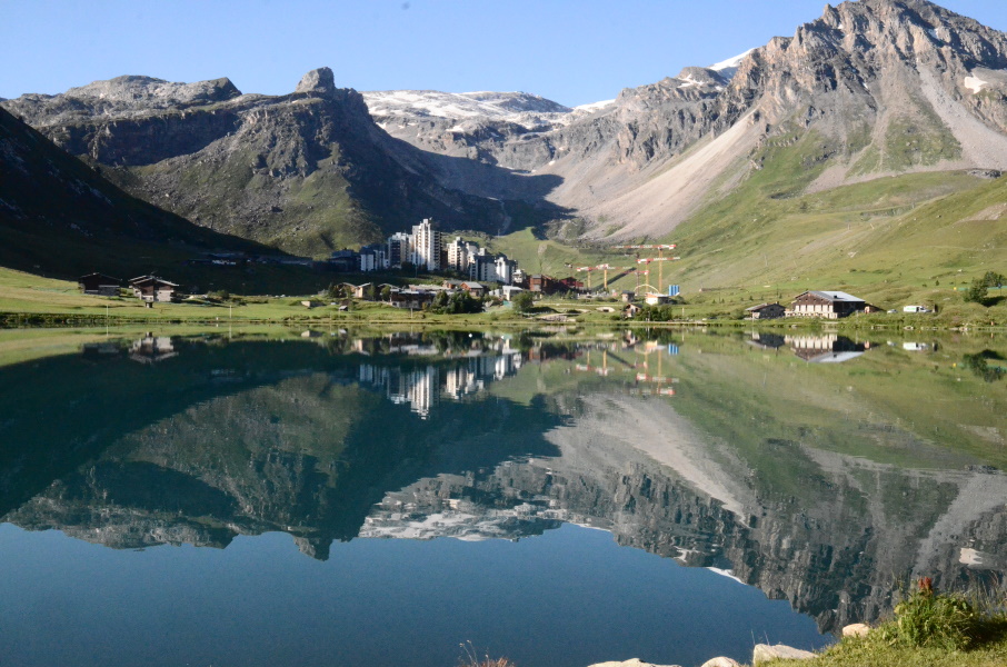
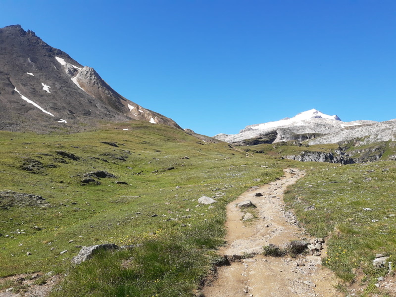
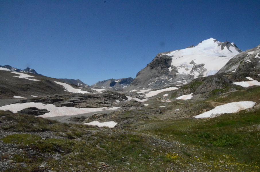
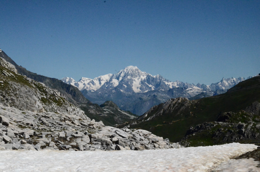
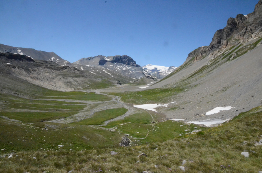
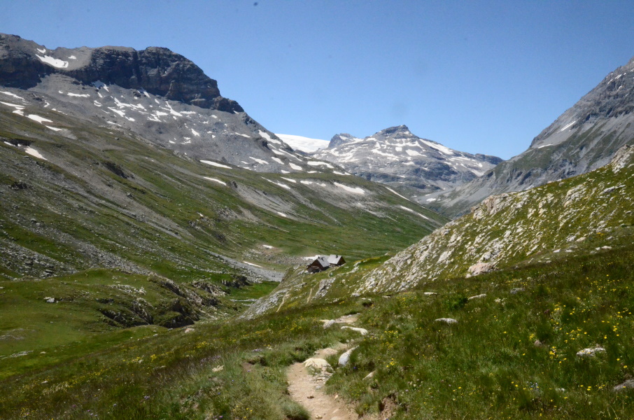
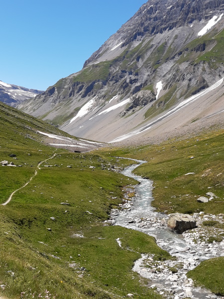
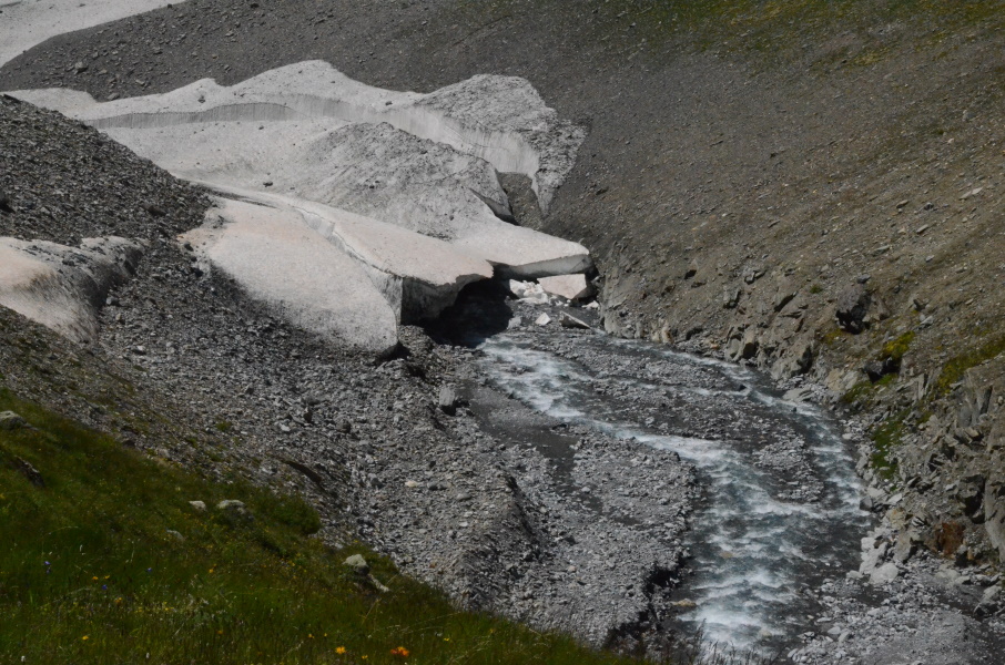
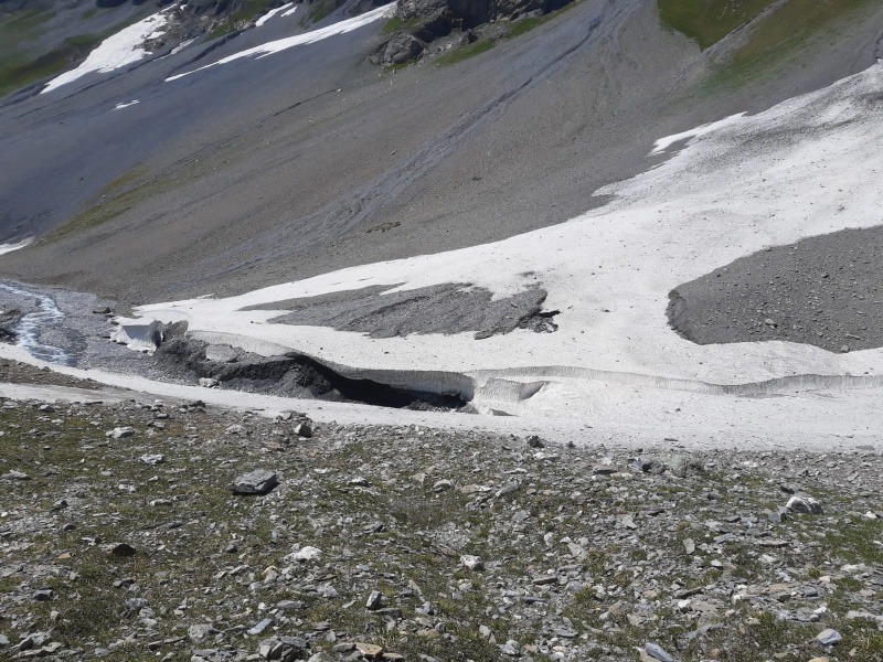
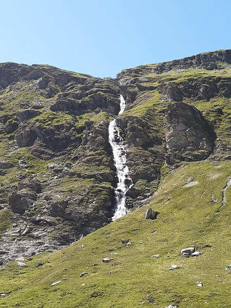
On Tuesday morning the alarm went off to continue our walk from Bessans to the Refuge du Vallonbrun for which we had already made the reservation. But when the alarm went off we both didn't feel much motivation to get up and we wondered why. Are we tired or so? So with some discussion we concluded that we both found the part from Pont de la Lenta to Bessans disappointing and uninteresting so that we're both worried about the upcoming piece to Bellecombe through Vallonbrun, and even further. This will all be mostly balcony tracks where we just stare at the same valley the whole day. Do we really want that? And the conclusion is ... no, we don't. So now what? We could walk the GR5E (Chemin de Petit Bonheur) through the valley, but if that valley is already not so exciting from above, how interesting will it be to actually walk it, parallel to the main road? And there is a second alternative: the GR55. We decide to now walk that Tuesday (which in the end was better as the weather was unexpectedly not so good that day with heavy showers and rain on Wednesday in the morning) and make a new planning following the GR55. The first problem is that the GR55 starts in Tignes-le-Lac and we just passed that. But with some searching on the internet we come to a planning that on Wednesday we travel to Tignes while our base camp stays in Termignon (hence, bus to Modane, train to Chambéry and change trains in St.Pierr d'Albigny to the train to Bourg-Saint-Maurice and from there the by now well-known bus to Tignes-le-Lac). That is over 6 hours of travelling, so in Tignes we find ourselves an Airbnb so that we can start walking on Thursday morning. It is possible to walk in a single day to Entre Deux Eaux from where we can then take the shuttle bus down to Termignon. The second problem is that the GR55 twice goes over 2700m altitude and Lupita doesn't like high altitude. But she's willing to endure it just because it seems a better solution than to continue the GR5. We will see how things will develop with headache and so. And so we decided: GR55, here we come... And so now it's Thursday morning in Tignes-le-Lac and after a good night's sleep and equal breakfast we are ready to leave. We didn't expect to return to Tignes, so it feels a bit strange to suddenly be here again. We walk around the lake to Val Claret that we pass along the outskirts while slowly climbing. And directly after the ski resort it starts to climb more seriously, and we also see marmottes again. And that is what we wanted (not specifically the marmottes obviously): nice tracks and impressive mountains. The first part is following more or less a skilift but at 2400m altitude we leave that behind us as the GR55 turns south towards the Col de la Leisse (2761m). A couple of times it looks like we're almost there, but then it appears to be a bit further again. But it's not a difficult climb so we'll get there. The last bit is almost busy when we arrive with 7-8 people almost at the same time at the paass. Among them a Danish/English young couple that is trying to walk in 2 months from Thonon-les-Bains to Menton. That's some serious walking, but then, they over 20 years younger than we are. At the pass it's almost serene, but too bad that in the background one can hear the sound of the skilifts to the Grande Motte glacier high above. One one hand it's impressive to see the skiers so high above us as little dots coming down, but on the other hand it's ridiculous (we think) that they have to ski in summer and therefore polute a precious glacier. But apart from all that, the view is great. We have a bite and start the descent. The first part is very easy and hardly descending and a bit further even climbing a bit. But then the path kind of falls over the edge and there is some serious descending to Lac des Nettes. Around this lake it's flat again, after which a second descent follows to Plan des Nettes: a flat part that once was an artificial lake that just naturally filled up with rocks and stones after which the dam became useless. The dam was demolished again, but the small plain remained. Around the Plan des Nettes it may be flat, but not easy. It runs along the bottom of a rock slide and the track is hard to follow: we're stumbling through the debris rather than walking. A bit further there is another piece like that, but here the debris is more large blocks so we're stepping from block to block. But in the end we reach the other side of the plain where the dam once was and the track starts descending again to Refuge de la Leisse. Just before the refuge the GR55 turns left and makes a loop and a few hairpins to descend even further to what is in fact the beginning of the Leisse valley. High time again for a break and a bite. From here on it's a lot easier: the path descends but not very steep anymore. We do have to cross some snow fields and some of them are quite impressive. At 2 locations the river just disappears under the snow and reappears further on. We making good progress like this, but at the one of the last snow fields Lupita slips and hurts her ankle. The damage seems to be small and we can continue. At the Croé-Vie bridge the GR55 goes up again to the Col de la Vanoise, but that will be be for the next time. We are heading to Refuge Entre Deux Eaux, about 20 minutes of the GR55. There is a shuttle bus from a stop with the same name to Termignon and that is what we want to do. The path to the refuge is very wet and muddy in the first part, but apart from that not very difficult. At the refuge we only see a steep 4x4 track and so it's clear that the bus doesn't stop here. We ask and it appears that we have to follow the track down until we hit the tarmac road and there is the bus stop. We are assured we can't miss it (famous last words?). So we walk down for 10 minutes or so and we can already see the tarmac road. And indeed, we can't miss it because there are already at least 30 people at the bus stop and after us more and more people join. A frenchman behind us in the queue is getting nervous becaus the bus only has about 30 seats and will thus not be big enough. But apparently they knew, because 20 minutes later not one but two busses arrive and everybody has a seat. That is ... for now. Because at the next stop there is a group of 20 children with accompanying adults and they want to take the bus as well. So everybody is squeezed in and at the next stop (Refuge du Plan du Lac) we just pass without stopping as we can't take anybody on board anymore. And so we arrive with two busses full up to the roof at the parking of Bellecombe. People get off the bus, but we have to go to Termignon so we stay. Until somebody tells us that if we stay we will go back to Entre Deux Eaux. To go to Termignon we have to step out and take the bigger bus down the parking. We get out and run to the other bus....and to our surprise in this bigger bus there are hardly 10 people including us going to Termignon. And so we descend in a way to large touring car over a narrow winding road to Termignon, back to our base camp. Back at the camping we are happy we changed our plans. Today was a beautiful walk with high mountains, snow fields, marmottes, waterfalls and fast flowing streams. This is how we pictured the Vanoise. |
              |
|||
|
|
||||
Download track TigEau.gpx