


Friday 23 July 2021
| Distance (km) | 16 kms | |||
| Distance (time) | 7 hrs | |||
| Climb / Descent | 1290m / 530m | |||
| Hard / Soft surface | 20% / 80% | |||
| Landscape |
|
|||
| Weather |
|
|||
|
|
||||
|
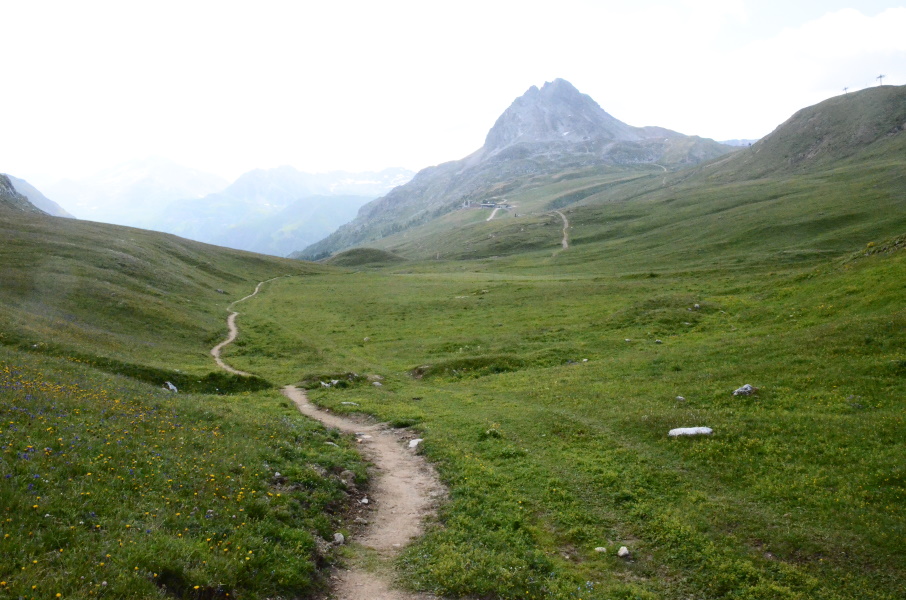
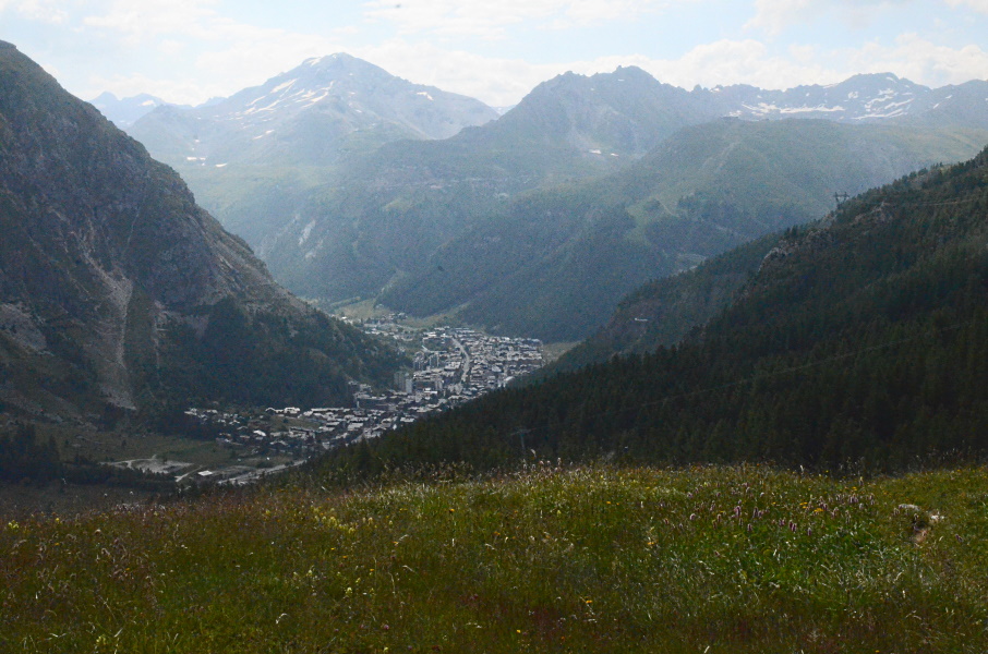
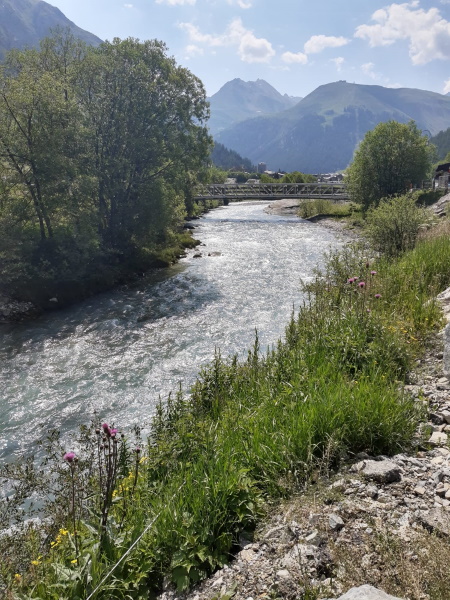
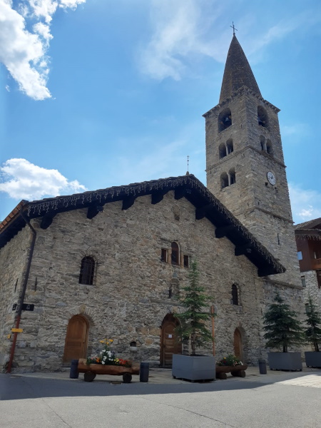
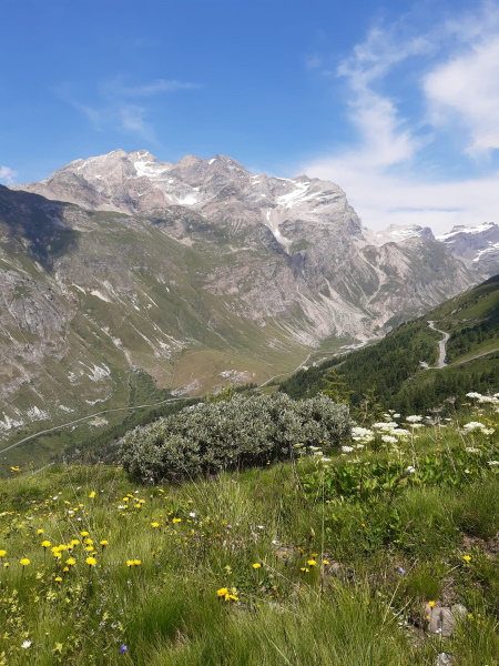
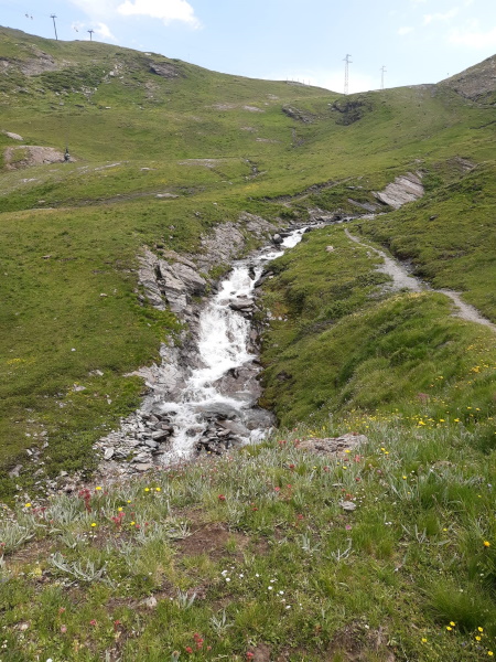
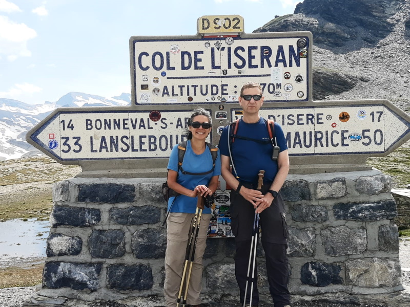
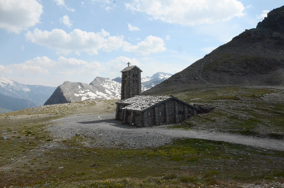
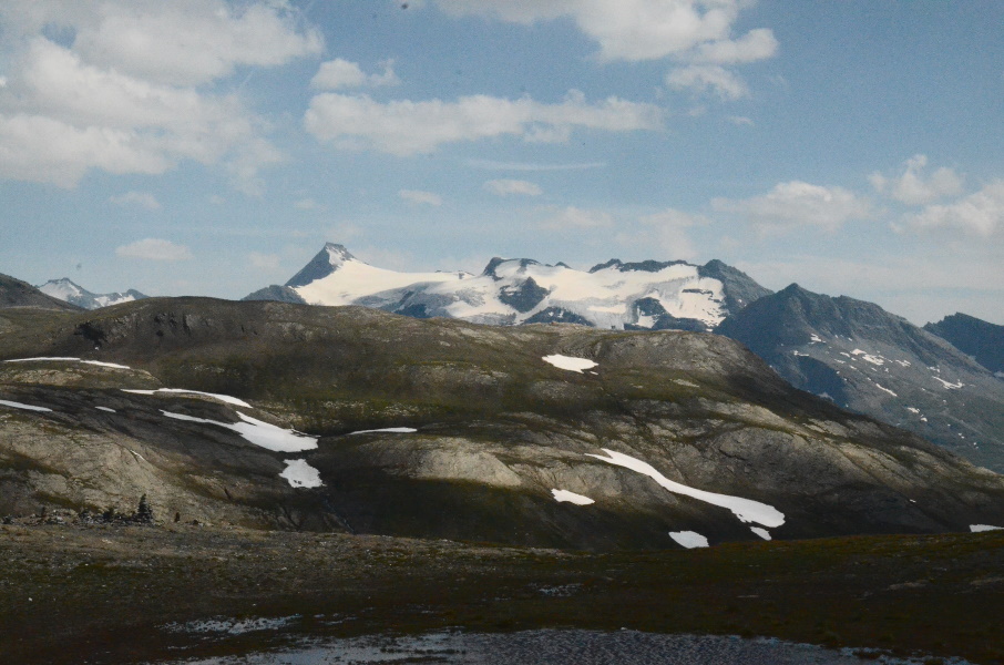
We already had a hard time getting up when we had to park the car in Tignes, but today we have to put the alarm even an hour earlier. So it's hardly light when the alarm goes off at 5:30am and we have a quick breakfast in order to leave at 6:30 towards Val d'Isère. We will take the same bus today as we when we parked the car in Tignes, but now from Val d'Isère. We arrive before 8am and have plenty of time to park the car and walk to the bus station. Peculiarly almost all bus tickets can be bought online, but not the piece from Val d'Isère to Tignes - it's just not available - so we have to buy it from the driver: 7 euro per person. Not cheap for a trip of under 30 minutes, but compared to the 13.5 Euro per person from Tignes to Bourg-Saint-Maurice it's maybe not that bad. Just before quarter to 9 we're in Tignes at the tourist office and we can hit the road, well, the trail. A short part is still through Tignes and then it almost immediately starts climbing. And that is off course where it goes wrong already, because pretty much on the path there is some kind of pony rental thing and one can pass it along the left or along the right side. The sign clearly points to the left ... which is wrong. So back again and now passing along the other side and up. We only have to gain 150m but in the early morning (for us at least, we're not morning people) it is not that easy. The climb is very stony but not too steep. The jackets are taken off and not much later we're on Pas de la Tovière. It's more like a wide pasture from which the path now gently descends again. Several other walkers pass us, but at the split a bit further on they all go straight ahead to the summit of the Tovière while we go left to La Daille. The GR5 descends gently through a shallow little valley and it's so quiet here one would almost forget this is a busy winter sports area. The last part to La Daille is then steep again and unfortunately the ugly skilifts are back again as well. Down in the valley along the river we have a short break to have something to eat before we head for the downtown of Val d'Isère. We want to stop by the tourist info because their website claims there is a shuttle bus to Col de l'Iseran, but apart from that remark there is no information whatsoever. Another website gave some times, but I would rather have those confirmed. And so we queue for the tourist info desk, just to get told that the shuttle bus indeed exists, but only on Thursdays. And today, of course, is a Friday.... We're disappointed and leave the tourist info to sit outside and discuss what to do. The car is really close by and basically we're done for today because continuing to the col de l'Iseran makes little sense if we can't come back. Unless we're willing to take the risk to hitchhike. Lupita suggests to ask what a pickup from the pass by a taxi might cost us...maybe that's an option? So we head back in to queue and we ask the lady of the tourist info if she can help us contacting a taxi. She can, and it is possible to have us picked up from the Col de l'Iseran at a price of 50 euro. I look to my left to see what Lupita thinks about that price, but she already confirmed that's ok and so we arrange that we will be picked up at 5pm from the Col de l'Iseran to be brought back to Val d'Isère. It's now close to 1pm, so we have 4 hours to do what according to our GR5 guide book is a 3h10 walk. Hence, we do not have much time to lose. And so we walk out of Val d'Isère. The path gently climbs towards the forest, but once there the gentle part is gone as the track becomes seriously steep. On top of that they're not very generous with signs and though I do have the track on my GPS at some we're quite far off as the GR5 is supposed to be to our right and considerably higher. We start doubting and decide to walk back to the point where we left the GPS track. But before reaching that point we encounter the last sign we saw, and that sign is really pointing in the direction we just already walked (though we know from earlier pony experience that signs do not always accurately point in the correct direction). So we head again in the direction we just did, which means climbing again. If we would only have walked on 20m more when we got doubts we would have seen that the path takes a hairpin to the right and climbs towards what according to the GPS should be the GR5. And indeed, a bit higher we encounter another T-crossing where we turn right and now we're back on the GPS track of the GR5. We now climb along a ski slope and it's ridiculously steep here. Occasionally it makes a zigzag and the slope is better, but other parts are just straight up. We need to stop regularly (what we call "mini-breaks") to let the respiration and heart rate get back to normal values. Finally we leave the forest and thus we get some wind, making it less warm and humid. It's not less steep though and finally we reach the D902 road. We need a break here, have a bite and a sip. This was tough and looking at the map we did only a quarter to a third of the distance. On the other hand, the altimeter learns us that we're above 2300m altitude so in terms of altitude gain we're about halfway and we're only walking for 1.5 hours now. That gives us some hope that we will make it on time. We have to walk along the road for some 100 meters and then continue on the track accross the road. The trails is indeed less steep now, but on the other hand the altitude becomes noticeable. A small bridge brings us across the Ruisseau de l'Iseran and we decide to wash our faces with some cold water from the stream to cool down. That helps and refreshed we continue to climb. A bit further on (after the steepest part) there is a strange pyramid-like structure or column. No idea what it is and it's also not along the road or so - it's just there. From here the path climbs only gently, but by now we're at 2550m altitude so we're not getting any faster. A the next skilift (Téléski du Col) I need some energy again so we have another break to eat 2 granola bars. This little break really helps and from here we actually walk to the pass without further breaks. We're slow because of the altitude, and especially at the last hairpin it takes hands and feet to get back on the road. But then we can see the pass and with a small loop over the parking we walk to sign indicating the pass. Of course we need to take a picture for which we have to queue among cyclists and motor bikers. A friendly cyclist offers to take a picture of the both of us in exchange of us taking a picture of him, which we gladly accept. Result is that we immediately get a queue of cyclists asking us to take a picture of them ... well, ok then. I take some pictures of cyclists and then we sneak out to the terrace of the bar for a cold coke and a piece of pie. It's 16:15 now and so we have plenty of time for the taxi. And we did the climb in hardly more time than what the guide indicates. Great! At 10 to 5 the taxi arrives and at easy pace he gets us back down while giving some information on what to see around here. When we see deep down the tiny looking houses of Val d'Isère we can hardly believe that we climb all that. And so, 30 minutes later, we're back at the car ready to drive back to Nancroix. Tomorrow we will move our basecamp from Nancroix to Termignon (Val-Cenis). |
         |
|||
|
|
||||
Download track TigIse.gpx