


Thursday 6 August 2015
| Distance (km) | 24 kms | |||
| Distance (time) | 6 hrs | |||
| Climb / Descent | 270m / 230m | |||
| Hard / Soft surface | 70% / 30% | |||
| Landscape |
|
|||
| Weather |
|
|||
|
|
||||
|
Public transport has its limitation and especially in a rural area like Lorraine. And so the next 45 kms we have the problem that there simply isn't any public transport. But fortunately there is a B&B almost exactly halfway and so we can turn this into a 2-days walk with luxury overnight stay. However, we would first have to park the car at the end point and that is an around-the-world trip already. On Wednesday the 5th we drive in the morning to Gondrexange and we park the car there just outside the camping site after which we walk to the bus stop at the other side of the canal. Just before 8:30 the bus of the SNCF (French railroad) passes to bring us to Sarrebourg. Well, bus, it's more like a small taxi van. In Sarrebourg we have 20 minutes to buy tickets and jump into the train to Nancy. The train is announced to be about 10 minutes late so we have all the time we need. And so we are in Nancy at 10:30. From here we have 2 options: the bus to Vic at 12:30 or at 17:30. In fact we would like to see the city since we're here now anyway and so we aim for the 17:30 bus. After extensively strolling around the city, having lunch and an extra coffee we walk to the bus stop Division de Fer for the bus to Vic that drops us in Vic at 18:15.
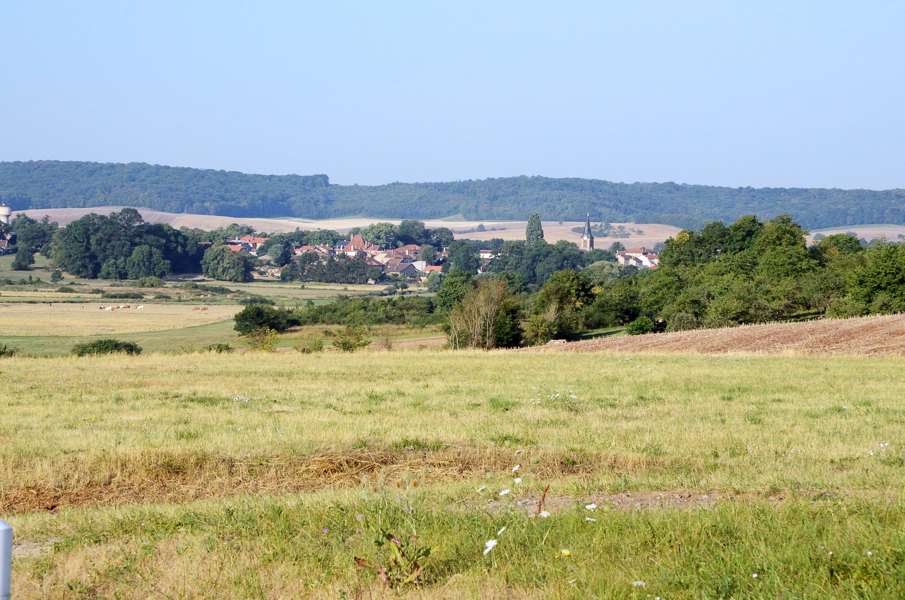
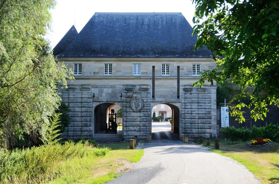
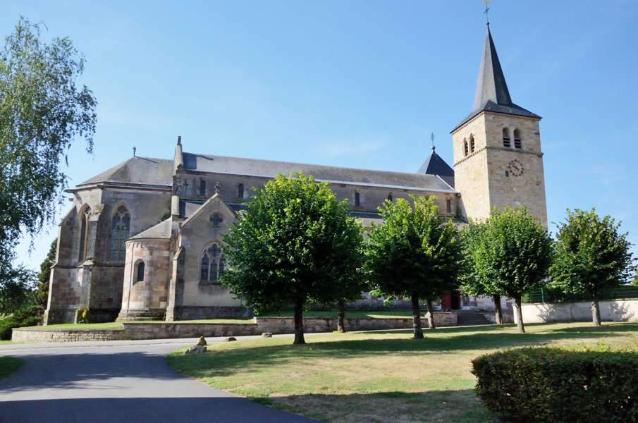
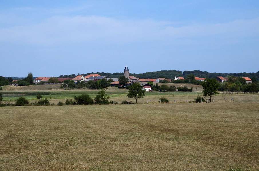
Because we put all our stuff in the car (we only have the matrasses and sleeping bags in te tent in Vic because we do not completely trust the camping site) we cannot cook. But no problem: Vic has several restaurants....or at least we thought so. The first 2 restaurants are both not open on Wednesdays....and today is Wednesday. Restaurant number 3 is open but can't serve dinner because the owner/cook has hurt his hand and can't cook. So we head to the pizzeria, but the pizzeria is closed due to "extraordinary family circumstances". As a last resort we go to the kebap place which opens at 18:30. And so we sit like 2 hungry cats outside the kebab place that seriously doesn't open at 18:30? And so we run to the grocery store that closes at 19:00 to buy some stuff: olives, some ham, lettuce, bread and yoghurt. That will get us through the night, and we walk back to the camping site. So much for our evening out for dinner in Vic... Anyway, on Thursday, today, we will walk to Tarquimpol. It is said to get very warm today and so we get up early and leave the camping site walking before 7 o'clock. We first have to walk 1.5 kms through Vic to get to the GR5. We ignore the new loop around Vic and just follow the "old" route over the D155z. It is a tarmac road but there is no living soul on the street and so we walk in all tranquility to the busy D955. Here we have to go straight across into a narrow path and that is well indicated. We walk along a meadow and at the other side we cross a ditch over a concrete plate serving as a bridge. Here we can go left or straight ahead, but there is no sign. According to the map it should be straight ahead and so we do. It climbs and after the steepest part we end up in the curve of a cart track where we can go right or straight ahead. Again without sign and again the map helps: straigh ahead. Now we're descending again to the busy D38. A short walk along this road brings us to the side road to Marsal that we have to take. Underneath the apple trees we walk along the road through an interesting gate into the village. It really still is a fortified village with old defense walls and an impressively large church. We take a short break for a snack and a sip of something as the heat is seriously building up. From here it is a looong stretch of tarmac without much shadow to Blanche-Eglise (that, by the way, in spite of its name does not have a white church). Our guide claims there should be something there to buy something to drink, but Blanche-Eglise is just a collection of farmhouses and that's it. We stop anyway to eat something and take our shoes of to let dry our feet and socks. We leave Blanche-Eglise along the D22a and briefly climb into the forest. A forest that doesn't give much shadow on the road until we have to turn right onto a rather overgrown forest track. Now we do walk in the shadow! We end up at the D22 and according to the map we should go straight ahead here, but according to the signs we should turn left. As always we follow the signs over the map (if we can find the signs) and so we turn left. We walk a few 100m along the road when the forest on our right stops and we see a sign attached to a large tree. It points to the right, which is nice, but like 10m later that track splits in left and right.....and here there is no sign. And since we are already walking different compared to the map the map is not really helping. We split up, Lupita to the left and I to the right and we agree to be back here in 4 minutes. My track to the right goes back parallel to the D22 and it is unlikely that that is the way we should go. So go back to the large tree and Lupita arrives there as well claiming that on her side there was no sign either. Nevertheless that should be the correct direction and we decide to go that way. Along the track there is a wooden fence....how hard can it be to attach a sign? We continue on the track with a small lake on our right (Étang des Essarts) and no sign. At the end of the path at a gravel road there is finally a sign point leftish and so we now follow the gravel path with a restricted military area on our left. At the end of this gravel path we can go left or right. And in neither direction we find a sign. Grrrrr!!! We check the map again and decide we're fed up playing boyscout. To the right there are 2 tracks: an old railroad and some other path. If we take the other path we will end up on the "old" GR5 that is indicated on the map and that is what we will do. We walk through the forest until we reach the tarmac Chemin Noir and turn left here. At the busy D999 we have to turn right and follow the main road for 900m. With all the heavy traffic I guess that is the reason the route has been changed, but then they do have to properly signpost it! We're happy when we can turn left into the forest again and eventually we reach a cart track with a view over the Lindre reservoir (Étang de Lindre). And hey, we see GR5 signs here again. So the route comes from the left here (later we hear that at the end of the military area we should have turned left passing Dieuze and Lindre-BAsse - in total 3 kms longer than the old route). We now turn right and after a short while we reach the D199f that will become the D199g after the side road to Tarquimpol. It is seriously warm now and walking along a tarmac road through the fields is tough. Lupita has a hard time and we're so happy to reach Alteville where we will stay overnight. We are received so friendly in this beautifull fortified farmhouse. It is nice and cool inside and with the decoration we feel like we are the lord and lady of the castle. We meet the other guests, have an aperitif, a 3-course dinner and a great night's sleep. |
    |
|||
|
|
||||
Download track VicTar.gpx