


Sunday 25 May 2014
| Distance (km) | 23 kms | |||
| Distance (time) | 5.5 hrs | |||
| Climb / Descent | 523m / 411m | |||
| Hard / Soft surface | 50% / 50% | |||
| Landscape |
|
|||
| Weather |
|
|||
|
|
||||
|
It's beautiful weather and it seems it will be a nice but warm day. Though we don't have to travel far we still manage to be late, also because we wake up just before 9 o'clock. Fast breakfast and then leave to Soumagne to park the car at Domaine de Wegimont. From there we take the 11:10 bus 69 to Liege to step out in Jupille and change to bus 140 to Visé. Monday to Friday this is a pretty good connection but of course on Sundays it's not. Bus 69 arrives in Jupille about 3 minutes after bus 140 left for Visé and so we have to wait 57 minutes in between sad abandonned factory buildings. The few stores in this street are all closed and so the only thing we can do is to sit in the sun and wait, and wait. No wonder we won't be in Visé until almost 13:00....actually simply too late to start a 23 kms stage.
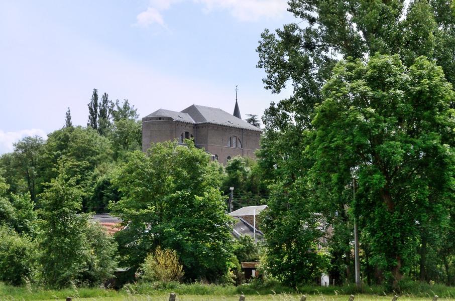
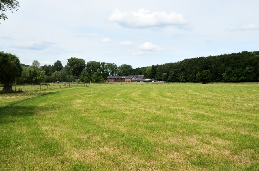
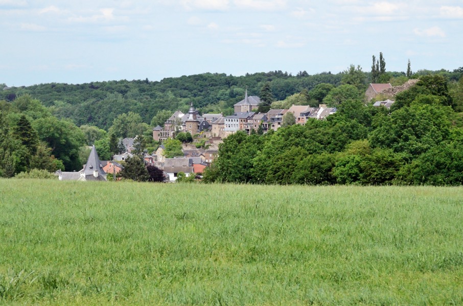
We pass through Visé and still in town it already climbs significantly through a long set of stairs. We are walking in the shadow, which is nice. From the cementary we enter the fields before descending to Dalhem. The route passes in between some large villas and here we have to search for our route again. Just before the small bridge over the Berwinne stream there is a marking saying we should turn right. There is some sort of a path in between the house just before the Berwinnen and the stream itself, but it is not convincing. Just after the bridge there is a house with an electricity pole on its area with a GR5 marking on it, but very worn off. Do we have to go over the private property then? Directly after the house there is the entrance to a pasture, but that is closed off with a fence and a bit further along the road there is another GR sign but that doesn't match the earlier sign that we should turn right. Unless there are multiple GR routes here and there is a mixup of signs. So let's first try the path in between the house and the stream: a dead end after 100m or so, so have to go back. We have another close look. The entrance to the pasture maybe? We check again and actually there is a very faded GR5 sign on the fence. So we struggle along the barb wire and walk onto the pasture and guess what....another GR5 sign. So why the GR signs going straight ahead after the bridge over the Berwinne? It must be another GR route.....we guess. So now we walk over a pasture with some cows lying around chewing. Lupita doesn't like cows but they look at us very sleepy and we pass them without a problem. It is a beautiful part here through the pasture next to the Berwinne with woods on either side and the church of Dalhem sticking out high above. Just to make the picture complete a kingfisher flies away just before our feet when we approach the Berwinne again. In the village centre of Dalhem we're going touristic. First we have to climb a steep cobblestone side road and then turn right through a small gate down the stairs to get back to the main road. Then behind some houses we enter an abandonned railroad track. We follow this track for quite a while, gently climbing, after which we turn right onto a gravel road with a great view over Dalhem. But here the muddling starts again. At the Y-crossing we have to keep left (says the marking on the pole) but then the next GR5 marking is behind barb wire. It looks like the GR5 used a small passage between two barb wire fences here but with the replacement of the fence this has become inaccessible? Well, then let's see if we can continue our current road bit more. And so we do, entering a farm yard. We sneak onto the yard (seriously aware of dogs) because we notice on the GPS the GR5 track is still closeby. So we walk around the corner of the farmhouse to see if we can leave the yard on the other side when a dog comes running to us, barking. Lupita freezes, but it's a labrador and it looks friendly. So no harm done. We see GR5 markings again, but in the opposite direction? We look around and see a very narrow track glued against the wall of the farmhouse going around, literally passing underneath the kitchen window. Who makes up this kind of nonsense?? We pass the track and walk inbetween two wooded banks, suddenly ending up in the village Feneur. Time for a snack break.... Feneur is disappointingly small and we walk in and out of the village. We now follow the stream Bolland until St.Remy where we have to climb steeply next to the church towards the main road. At the other side of the main road it just goes on climbing until we're between the fields again and again arrive at a tarmac road. Another very narrow track follows, this time in between two gardens, but this time well signposted. After crossing yet another tarmac road we enter a forest and start descending. Finally we end on a wide gravel road following a nameless little stream. This is very nice and cool in the shadow and almost flat. Not a surprise we're not the only walkers here. Finally this leads to the motorway E40 that we have to underpass using a small tunnel. Directly after the underpass we turn left and a steep climbs starts, through the forest over a narrow little track. The calfs suffer and we're happy to at the top at some houses along the N642 main road. Following good traditions we decide to change loads here: I get the camera and Lupita takes the day pack. From here it's mostly tarmac to Saive. The GR5 goes around the village but actually we would like something cool to drink as we're soaking wet from sweating. So we enter Saive towards the church and there seems to be....nothing. We decide not to walk back and pick up the GR5 where we left it, but pass next to the church and join the GR5 leaving the village. Good choice, as there is a snackbar along this road. Two cans of soda almost evaporate and we continue. First down to get back to the GR5 and then along a holloway seriously climbing to end up at a farmhouse high above the village. And here we get back onto the tarmac again. A long sections follows, first a bit winding and then very very straight. Not very interesting but for sure very warm walkig in the sun like this. Funny enough the highest point of today's stage is here. At again an abandonned railroad where several GRs meet we stop one more time for a final sip before very gently descending in the direction of Soumagne. We finally make it to the bus stop where we left this morning. The car is still there (of course) and with the airco set to 18 degrees we drive back to the camping in Spa. |
   |
|||
|
|
||||
Download track VisWeg.gpx