


Saturday 29 June 2013
| Distance (km) | 22 kms | |||
| Distance (time) | 5.5 hrs | |||
| Hard / Soft surface | 25% / 75% | |||
| Landscape |
|
|||
| Weather |
|
|||
|
|
||||
|
Slowly but surely we're getting so far away from home that is actually to far to drive to our starting point on Saturday morning. So we're considering driving there on Friday evening to pitch our tent on the local camping site in Zoerle-Parwijs. The weather decides differently: for Friday evening and the following night the forecast is lots of rain and so we decided to travel on Saturday morning anyway. A good plan because indeed on Friday evening around 8 it starts bucketing and we should have had to pitch our tent in the rain.
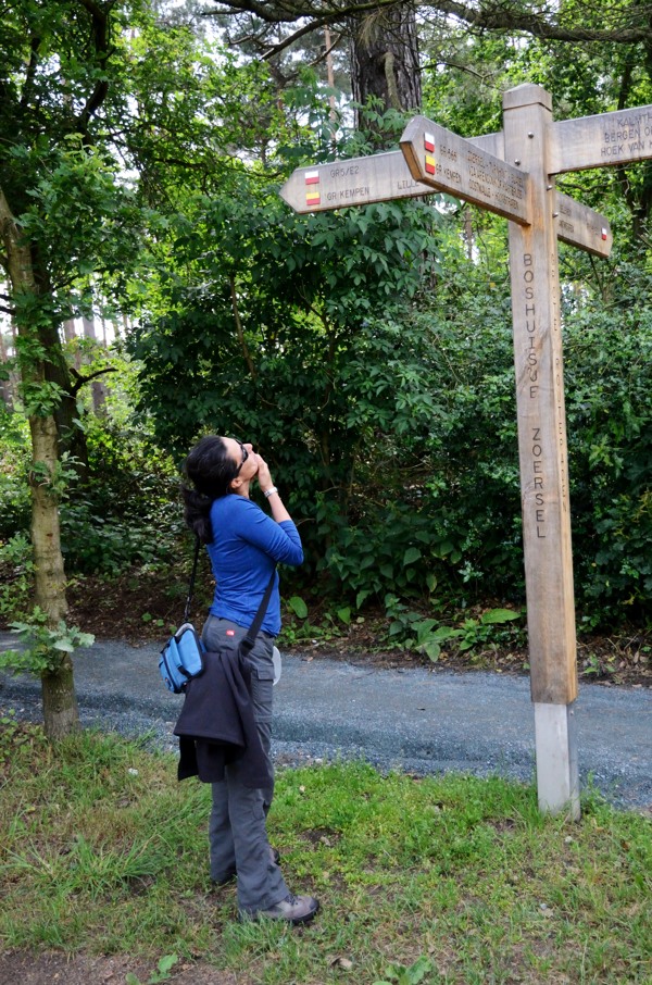
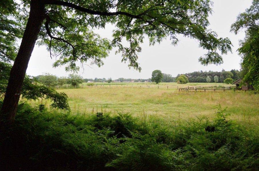
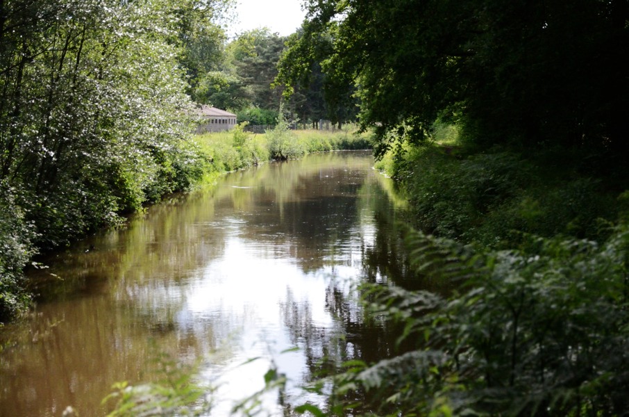
We leave Saturday morning at 9:15 to Herentals to park the car at the railway station and take the bus just before 11:00. We would have made it, but a few kilometres before Herentals in the village of Lille traffic is stuck due to local festivities and so we miss the bus with 5 minutes and have to wait 55 minutes for the next one. The railway station in Herentals is not so exciting so we're happy if the bus finally arrives. We ask for 2 persons to bus stop �Westmalle Zandstraat� and the bus driver confirms this by repeating it. We pass Lille again (and fast now) through Oostmalle to Westmalle. I've set the GPS to the bus stop so that I know when we're close and have to tell the bus to stop. About 300m before our bus stop we pass another bus stop and I press the button that we want to get out at the next stop. But while doing so I look back (we're waiting for a traffic light) and I see that the bus stop we just passed is in fact Westmalle Zandstraat. Apparently it's not located where Google maps thinks it is. At that moment the traffic light changes to green and the bus moves. We're toast and have to step out at the next stop�..hopefully it's not too far away. But we're not that lucky: 1.5 km further and it happens to be outside the village in the middle of nowhere. We say some nasty things about the bus driver who knew where we had to get out but didn't bother to stop for us. We check the bus stop sign if there is a bus going back any time soon, but the next one is in 45 minutes and so walking back will be faster. We walk with serious pace and at maybe 200m before the bus stop we should have gone out of the bus we're being passed by a bus. Where does that come from? We could have taken it. In the end we decide to walk even one bus stop further as we have missed our connection anyway. Fortunately the bus goes every 30 minutes, even in the weekend, en not once per hour as many other busses. So with another half an hour delay we finally make it to the abbey. So instead of at 11:45 we start walking at 13:15 today. And it will be a long stage: the GPS track claims it will be 25 kms (in the end it's not that bad). We wave goodbye to the abbey and start walking. The first 3-4 kms follow the usual endless areas of large houses in the woods but when we enter the Zoersel forest it is finally nice and quiet. We end up at caf&eacut;/restaurant Het Boshuisje but in spite of the delicious smell of roast meat we decide not to let is seduce us: it's still a long way and we started late. So we cross the motorway and later the N14 main road before passing behind some houses. There is a bench blinking at us and since we have walked 2 hours now we give in and have a short break with a sip and a bite. We walked 8.1 kms now, which for us is quite an average speed. It goes on through farming fields and mostly along quiet tarmac roads until we head back into the forest walking along the Pulderdijk. This patch of forest is called "Konijnenbos" (Rabbit forest) though we haven't spotted a single rabbit. At the end of the Pulderdijk we have to turn right over the wide Heirbaan. We walk another 200m when I do the regular check on the GPS and notice we're no longer on track. Where we entered the Heirbaan we should have immediately turned left though we didn't see any markings. We walk back to the path we should have taken and indeed there is no GR sign. There is a sign of a local route, but since we didn't see any sign straight ahead on the Heirbaan either we decide to follow the GPS track. So far that has always worked out fine as the GPS track was provided by the organisation in charge of signposting the GR5. And indeed, about 100m further there is a sign again proofing we're on the right track. Apparently another change in the route that has not completely been implemented yet in the field though alraeady included in the GPS track. We leave the forest and encounter two runners who, based on their facial expressions, clearly have a hard time. We can imagine: it's overcast and quite sticky with a high humidity. We're just walking and already sweating, let alone when one would run. After a short piece along some corn fields we pass the local beer house and walk into the next patch of forest: the Molenbos. It's really a nice and alternating route today! We cross the Molenbos and walk through the most outer residential area of Vorselaar before ending up at a larger and busier road. We have to follow this road for a short while until the water mill along the Kleine Nete river. Directly after the bridge over the river there is a picknick bench and since we have again walked about 2 hours it's time for another stop. Besides "we only have to" follow the Kleine Nete to Herentals and we're there...right? Well, it's not that easy. The first section after our stop is another narrow tarmac road without any possibility to walk next to the tarmac which is rather unpleasant for the feet. It looks as a short piece on the map, but in the end it's 3 kms tarmac before our feet can enjoy another soft trail. If it is indeed 25 kms to Herentals then we should walk another 6 kms along the river Kleine Nete meaning that we would be close to 19:30 at the car. Not much we can do about that but keep on walking. After following the river for a short while the GR5 suddenly turns left away from the river just to return to the river a bit furter on. We don't see why this would be necessary unless something interesting is to bee seen somewhere to our left. However, the detour implies going down the steep embankment and jump over the water filled ditch at the foot and actually we don't really feel like doing so. So we decide to keep following the river and leave the detour. Earlier than expected we arrive at the bridge over the river and cross this bridge to end up on a tarmac road. This can't be Herentals already? The road continues along an old railroad track and we see more and more houses. So indeed, we're almost there! At 18:45 we arrive at the car, earlier than expected. But then today's stage is 3 kms shorter than expected. By car we drive to Zoerle-Parwijs where we will pitch the tent for a night on camping site Dennewoud. The camping site is hopelessly outdates, but clean. Nevertheless, toilets where almost all tiles came off and showers that appear to be the showers of the sports field behind the camping (for which we have to pick up the key in the bar with the very friendly owner). The camping site is for sale and considering the state of maintenance combined with the fact we only pay 8 euros for a night we get the suspicion that this camping site may exist much longer. At night we decided we're too lazy to cook and we drive to Olen - a village of 3 times nothing but with an impressive amount of restaurant. In restaurant De Ketel van Keizer Karel (The Kettle of Emperor Charles - weird name for a restaurant) we enjoy a large pasta dish with a Belgian beer for a price so low it's not even worth cooking yourself. So good we had the car with us to come here... |
   |
|||
|
|
||||
Download track WesHer.gpx